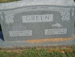
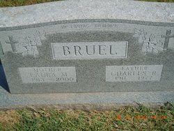
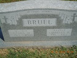
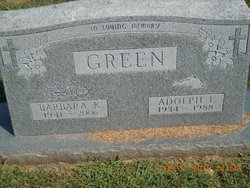
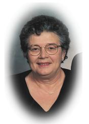
Barbara Kay Bruel Green
| Birth | : | 3 Apr 1941 Atchison, Atchison County, Kansas, USA |
| Death | : | 18 Aug 2006 Holton, Jackson County, Kansas, USA |
| Burial | : | Saint Johns Lutheran Cemetery, Millwood, Leavenworth County, USA |
| Coordinate | : | 39.4042015, -95.1386032 |
| Description | : | Barbara Green of Eureka, died on August 18, 2006, at Holton Manor Nursing Home in Holton, at the age of 65. She was born April 3, 1941, to Charles Robert and Laura Marie (Gore) Bruel in Atchison. She graduated from Trinity Lutheran Grade School and Mount Saint Scholastica High School in Atchison. On August 29, 1970, Barbara was united in marriage to Adolph Green. They made their home in Eureka. Barbara worked in local nursing homes and hospital as a nurse’s aid until retirement. Adolph preceded her in death in 1988. She was a member of Christ... Read More |
frequently asked questions (FAQ):
-
Where is Barbara Kay Bruel Green's memorial?
Barbara Kay Bruel Green's memorial is located at: Saint Johns Lutheran Cemetery, Millwood, Leavenworth County, USA.
-
When did Barbara Kay Bruel Green death?
Barbara Kay Bruel Green death on 18 Aug 2006 in Holton, Jackson County, Kansas, USA
-
Where are the coordinates of the Barbara Kay Bruel Green's memorial?
Latitude: 39.4042015
Longitude: -95.1386032
Family Members:
Parent
Spouse
Siblings
Flowers:
Nearby Cemetories:
1. Saint Johns Lutheran Cemetery
Millwood, Leavenworth County, USA
Coordinate: 39.4042015, -95.1386032
2. Evergreen Cemetery
Millwood, Leavenworth County, USA
Coordinate: 39.3833008, -95.1333008
3. Fairview Cemetery
Potter, Atchison County, USA
Coordinate: 39.4239006, -95.1613998
4. Oak Hill Cemetery
Millwood, Leavenworth County, USA
Coordinate: 39.3833008, -95.0943985
5. Langley Cemetery
Easton, Leavenworth County, USA
Coordinate: 39.3616982, -95.1611023
6. Old Young Cemetery
Potter, Atchison County, USA
Coordinate: 39.4480782, -95.1176071
7. Mount Pleasant Cemetery
Potter, Atchison County, USA
Coordinate: 39.4520187, -95.1412964
8. Round Prairie Cemetery
Lowemont, Leavenworth County, USA
Coordinate: 39.4122009, -95.0738983
9. Hays Cemetery
Oak Mills, Atchison County, USA
Coordinate: 39.4370300, -95.0883700
10. Springhill Cemetery
Potter, Atchison County, USA
Coordinate: 39.4303589, -95.2025375
11. Saint Lawrence Cemetery
Easton, Leavenworth County, USA
Coordinate: 39.3443985, -95.1335983
12. Easton Cemetery
Easton, Leavenworth County, USA
Coordinate: 39.3395882, -95.1237793
13. Saint Patrick Cemetery
Saint Pats, Atchison County, USA
Coordinate: 39.4689713, -95.1242523
14. Ashcraft Cemetery
Saint Pats, Atchison County, USA
Coordinate: 39.4695396, -95.1479034
15. Round Mound Cemetery
Cummings, Atchison County, USA
Coordinate: 39.4646988, -95.1908035
16. Mount Gillin Cemetery
Port Williams, Atchison County, USA
Coordinate: 39.4598618, -95.0670776
17. Corpus Christi Cemetery
Winchester, Jefferson County, USA
Coordinate: 39.3908005, -95.2394028
18. Pleasant Ridge Cemetery
Lowemont, Leavenworth County, USA
Coordinate: 39.3792000, -95.0344009
19. Sacks Family Cemetery
Oak Mills, Atchison County, USA
Coordinate: 39.4216800, -95.0316000
20. Stranger Creek Cemetery
Easton, Leavenworth County, USA
Coordinate: 39.3211100, -95.1016700
21. Mount Olivet Cemetery
Easton, Leavenworth County, USA
Coordinate: 39.3385010, -95.0582962
22. Hull Grove Cemetery
Winchester, Jefferson County, USA
Coordinate: 39.3630981, -95.2435989
23. Hightower and Cook Cemetery
Port Williams, Atchison County, USA
Coordinate: 39.4573100, -95.0421900
24. DeWeese Cemetery (Defunct)
Port Williams, Atchison County, USA
Coordinate: 39.4627500, -95.0473400

