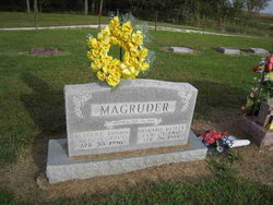
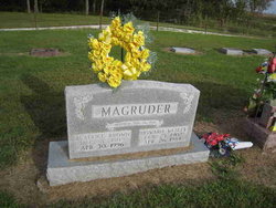
Beatrice Eloise Brown Magruder
| Birth | : | 3 Dec 1909 Shelby County, Missouri, USA |
| Death | : | 30 Apr 1996 Kirksville, Adair County, Missouri, USA |
| Burial | : | Dripping Springs Cemetery, Dripping Springs, Crawford County, USA |
| Coordinate | : | 35.5258000, -94.3896000 |
| Description | : | Clarence Courier, Clarence, Shelby, Missouri, May 1, 1996 Mrs. Beatrice Magruder, age 86, of Shelbina, died Tuesday, April 30, 1996 in Grim-Smith Hospital at Kirksville. She was born at home in Shelby County on December 3, 1909, the daughter of the late John and Clara Isabelle Morrey Brown Jr. On August 16, 1934, she was united in marriage to Howard Wesley Magruder in New London, MO. He preceded her in death on April 26, 1984. She is survived by five daughters, Dorothy Shoemyer of Shelbina, Doris Jernigan of Palmdale, CA, Virginia Douglass of Shelbyville, Nancy Jo Moore of Fort Atkins, WI, Joyce Ellen... Read More |
frequently asked questions (FAQ):
-
Where is Beatrice Eloise Brown Magruder's memorial?
Beatrice Eloise Brown Magruder's memorial is located at: Dripping Springs Cemetery, Dripping Springs, Crawford County, USA.
-
When did Beatrice Eloise Brown Magruder death?
Beatrice Eloise Brown Magruder death on 30 Apr 1996 in Kirksville, Adair County, Missouri, USA
-
Where are the coordinates of the Beatrice Eloise Brown Magruder's memorial?
Latitude: 35.5258000
Longitude: -94.3896000
Family Members:
Parent
Spouse
Siblings
Children
Flowers:
Nearby Cemetories:
1. Dripping Springs Cemetery
Dripping Springs, Crawford County, USA
Coordinate: 35.5258000, -94.3896000
2. Sarah Grove Cemetery
Van Buren, Crawford County, USA
Coordinate: 35.5421982, -94.3719025
3. Thompson Cemetery
Crawford County, USA
Coordinate: 35.5372009, -94.4281006
4. Woods Cemetery
Crawford County, USA
Coordinate: 35.5278015, -94.4328003
5. Speir Cemetery
Crawford County, USA
Coordinate: 35.5475006, -94.4291992
6. Bodine Cemetery
Crawford County, USA
Coordinate: 35.4867250, -94.4116100
7. Peevyhouse Cemetery
Van Buren, Crawford County, USA
Coordinate: 35.4799995, -94.3925018
8. Macedonia Cemetery
Uniontown, Crawford County, USA
Coordinate: 35.5573170, -94.4355000
9. Foster Cemetery
Van Buren, Crawford County, USA
Coordinate: 35.4755710, -94.3731370
10. Allison Cemetery
Sequoyah County, USA
Coordinate: 35.5181007, -94.4569016
11. Oliver Springs Cemetery
Rudy, Crawford County, USA
Coordinate: 35.5280991, -94.3163986
12. Salem Cemetery
Cedarville, Crawford County, USA
Coordinate: 35.5881004, -94.3788986
13. Antioch Cemetery
Van Buren, Crawford County, USA
Coordinate: 35.4771996, -94.3368988
14. Pixley Cemetery
Rudy, Crawford County, USA
Coordinate: 35.5512720, -94.3161810
15. Uniontown Cemetery
Uniontown, Crawford County, USA
Coordinate: 35.5851000, -94.4434000
16. Stevenson Cemetery
Van Buren, Crawford County, USA
Coordinate: 35.4702988, -94.3221970
17. Kenner Chapel Cemetery
Rudy, Crawford County, USA
Coordinate: 35.5554530, -94.2975360
18. Czarnikow Cemetery
Roland, Sequoyah County, USA
Coordinate: 35.4883000, -94.4775000
19. Johnson Cemetery
Rudy, Crawford County, USA
Coordinate: 35.5306015, -94.2893982
20. Trinity Columbarium
Van Buren, Crawford County, USA
Coordinate: 35.4484650, -94.3496980
21. Dora Cemetery
Van Buren, Crawford County, USA
Coordinate: 35.4493350, -94.4394630
22. Fairview Cemetery
Van Buren, Crawford County, USA
Coordinate: 35.4411011, -94.3503036
23. Mount McCurry Cemetery
Rudy, Crawford County, USA
Coordinate: 35.5381012, -94.2771988
24. Winfrey Cemetery
Rudy, Crawford County, USA
Coordinate: 35.5349998, -94.2750015


