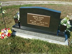
Bernard G “Bernie” Gilner
| Birth | : | 8 Sep 1948 Garnett, Anderson County, Kansas, USA |
| Death | : | 18 Nov 2010 La Crosse, Rush County, Kansas, USA |
| Burial | : | Fish Cemetery, Pemberville, Wood County, USA |
| Coordinate | : | 41.3699989, -83.5038986 |
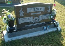
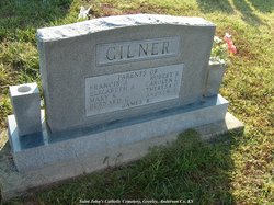
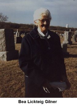
| Description | : | Bernard G. Bernie Gilner, 62 Paola, died Thursday Nov 18, 2010 as the result of a vehicle wreck near La Crosse Services will be 10 am Monday at St. John's Catholic Church, Greeley with burial following in St. John's Cemetery Greeley He was born on Sept 8, 1948 at Garnett, to James and Beatrice ( Lickteig) Gilner He served in the US Army, he worked as a laborer. He married Barbara Lanzrath Oct 18, 1975 at St.John's Catholic Church Greeley. She survives of the home Other survivers include daughters Dena Lawhear, Becky Stroman, Tammy Daulton, and Tracy Bryant, eight grandchildren and brothers Frank,... Read More |
frequently asked questions (FAQ):
-
Where is Bernard G “Bernie” Gilner's memorial?
Bernard G “Bernie” Gilner's memorial is located at: Fish Cemetery, Pemberville, Wood County, USA.
-
When did Bernard G “Bernie” Gilner death?
Bernard G “Bernie” Gilner death on 18 Nov 2010 in La Crosse, Rush County, Kansas, USA
-
Where are the coordinates of the Bernard G “Bernie” Gilner's memorial?
Latitude: 41.3699989
Longitude: -83.5038986
Family Members:
Parent
Siblings
Flowers:
Nearby Cemetories:
1. Fish Cemetery
Pemberville, Wood County, USA
Coordinate: 41.3699989, -83.5038986
2. Myers Cemetery
New Rochester, Wood County, USA
Coordinate: 41.3621708, -83.5034170
3. Brandeberry Cemetery
Freedom Township, Wood County, USA
Coordinate: 41.3838997, -83.5017014
4. Pemberville Cemetery
Pemberville, Wood County, USA
Coordinate: 41.3958015, -83.4914017
5. Webster Township Cemetery
Scotch Ridge, Wood County, USA
Coordinate: 41.4075429, -83.5305762
6. Eisenhour Cemetery
Pemberville, Wood County, USA
Coordinate: 41.3866997, -83.4347000
7. Bradner Cemetery
Bradner, Wood County, USA
Coordinate: 41.3267403, -83.4177170
8. Chestnut Grove Cemetery
Scott Township, Sandusky County, USA
Coordinate: 41.3268590, -83.4171130
9. Troy Township Cemetery
Luckey, Wood County, USA
Coordinate: 41.4533300, -83.4772000
10. Graham Cemetery
Wayne, Wood County, USA
Coordinate: 41.2882996, -83.4655991
11. Wood County Home Cemetery
Center Township, Wood County, USA
Coordinate: 41.3493980, -83.6192870
12. Salem Church Cemetery
Luckey, Wood County, USA
Coordinate: 41.4438300, -83.4344900
13. Pember Farm Cemetery
Rollersville, Sandusky County, USA
Coordinate: 41.3341904, -83.3812103
14. Oak Grove Cemetery
Bowling Green, Wood County, USA
Coordinate: 41.3792000, -83.6380997
15. Wood County Mausoleum (Defunct)
Bowling Green, Wood County, USA
Coordinate: 41.3784760, -83.6406650
16. Mount Zion Cemetery
Wayne, Wood County, USA
Coordinate: 41.2668300, -83.5445600
17. Portage Cemetery
Portage, Wood County, USA
Coordinate: 41.3292007, -83.6371994
18. Old Oak Grove Cemetery
Bowling Green, Wood County, USA
Coordinate: 41.3786100, -83.6475000
19. Quinshan Cemetery
Gibsonburg, Sandusky County, USA
Coordinate: 41.3539009, -83.3602982
20. Mennonite Cemetery
Perry Township, Wood County, USA
Coordinate: 41.2531100, -83.5279800
21. Westwood Cemetery
Woodville, Sandusky County, USA
Coordinate: 41.4510994, -83.3861008
22. Old Belleville Ridge Cemetery
Dowling, Wood County, USA
Coordinate: 41.4776700, -83.5895600
23. West Union Cemetery
Gibsonburg, Sandusky County, USA
Coordinate: 41.3842010, -83.3377991
24. Sargent Cemetery
Rudolph, Wood County, USA
Coordinate: 41.3342018, -83.6643982

