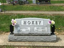
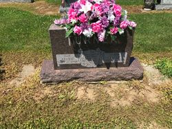
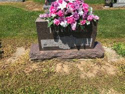
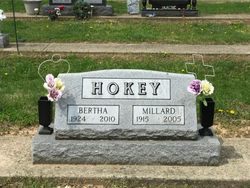
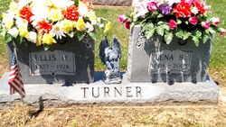
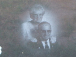
Bertha Turner Hokey
| Birth | : | 24 May 1924 Kentucky, USA |
| Death | : | 13 Jan 2010 Brookville, Franklin County, Indiana, USA |
| Burial | : | Featherston Cemetery, Featherston, South Wairarapa District, New Zealand |
| Coordinate | : | -41.1217800, 175.3144160 |
| Description | : | Bertha Hokey, 85, of Brookville, Indiana died Wednesday, January 13, 2010 at her residence. She was born May 24, 1924 in Kentucky to Lloyd Turner and Lillie Halcomb. She married Millard David Hokey who preceded her in death on May 12, 2005. She worked as a Homemaker and she, along with family members, developed and managed the Spring Hill Campgrounds in Brookville for a number of years. She was a member of Oak Forest Church of Christ in Brookville. Survivors include her Daughter, Deborah Simmons of Connersville, Son and Daughter-in-law, David and Joyce Hokey of Brookville, five Grandchildren, Jason... Read More |
frequently asked questions (FAQ):
-
Where is Bertha Turner Hokey's memorial?
Bertha Turner Hokey's memorial is located at: Featherston Cemetery, Featherston, South Wairarapa District, New Zealand.
-
When did Bertha Turner Hokey death?
Bertha Turner Hokey death on 13 Jan 2010 in Brookville, Franklin County, Indiana, USA
-
Where are the coordinates of the Bertha Turner Hokey's memorial?
Latitude: -41.1217800
Longitude: 175.3144160
Family Members:
Parent
Spouse
Siblings
Flowers:
Nearby Cemetories:
1. Featherston Cemetery
Featherston, South Wairarapa District, New Zealand
Coordinate: -41.1217800, 175.3144160
2. Featherston Soldiers Cemetery
Featherston, South Wairarapa District, New Zealand
Coordinate: -41.1212630, 175.3147170
3. Greytown Cemetery
Greytown, South Wairarapa District, New Zealand
Coordinate: -41.0920470, 175.4401160
4. Pukio Cemetery
Kahutara, South Wairarapa District, New Zealand
Coordinate: -41.2460220, 175.3603000
5. Papawai Urupā
Greytown, South Wairarapa District, New Zealand
Coordinate: -41.0985090, 175.4892270
6. Waihenga Cemetery
Martinborough, South Wairarapa District, New Zealand
Coordinate: -41.2176230, 175.4528540
7. Te Uru o Tane Urupā
Greytown, South Wairarapa District, New Zealand
Coordinate: -41.0570790, 175.4947740
8. Martinborough Cemetery
Martinborough, South Wairarapa District, New Zealand
Coordinate: -41.2158720, 175.4722330
9. Akatarawa Cemetery
Upper Hutt City, New Zealand
Coordinate: -41.0876320, 175.1025870
10. Waiorongomai Cemetery
South Wairarapa District, New Zealand
Coordinate: -41.2535785, 175.1567108
11. Wallaceville Cemetery
Wallaceville, Upper Hutt City, New Zealand
Coordinate: -41.1359900, 175.0743300
12. St. Joseph's Church Cemetery
Upper Hutt, Upper Hutt City, New Zealand
Coordinate: -41.1243380, 175.0686570
13. St. John's Anglican Churchyard Cemetery
Trentham, Upper Hutt City, New Zealand
Coordinate: -41.1303100, 175.0443500
14. Oates Family Cemetery
Carterton, Carterton District, New Zealand
Coordinate: -41.0453670, 175.5683580
15. Burnside Cemetery
Pirinoa, South Wairarapa District, New Zealand
Coordinate: -41.3277100, 175.2391400
16. Clareville Cemetery
Clareville, Carterton District, New Zealand
Coordinate: -40.9981070, 175.5459540
17. Kohunui Urupā
Featherston, South Wairarapa District, New Zealand
Coordinate: -41.3286030, 175.2199000
18. Hurunui-o-rangi
Masterton, Masterton District, New Zealand
Coordinate: -41.0709670, 175.6200720
19. Gladstone Church Cemetery
Gladstone, Carterton District, New Zealand
Coordinate: -41.0883600, 175.6432100
20. Waipopo Urupā
Masterton, Masterton District, New Zealand
Coordinate: -41.0696370, 175.6604430
21. Waipoapoa Urupa
Hastings, Hastings District, New Zealand
Coordinate: -41.0696050, 175.6604650
22. Christ Church Anglican Cemetery
Taita, Lower Hutt City, New Zealand
Coordinate: -41.1820960, 174.9600920
23. Hamuera Urupā
Masterton District, New Zealand
Coordinate: -41.0374980, 175.6611940
24. Taita Lawn Cemetery
Naenae, Lower Hutt City, New Zealand
Coordinate: -41.1968900, 174.9634900

