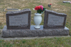
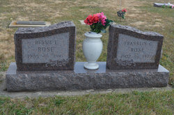
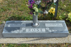
Bessie Irene McMichael Rose
| Birth | : | 6 Oct 1905 Muscatine County, Iowa, USA |
| Death | : | 10 Aug 1987 Des Moines, Polk County, Iowa, USA |
| Burial | : | Leverington Cemetery, Roxborough, Philadelphia County, USA |
| Coordinate | : | 40.0335999, -75.2118988 |
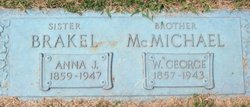
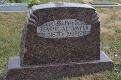
| Description | : | Boone News Republican August 11, 1987 ROSE STRATFORD - Bessie I. Rose, 81, died Aug. 10, 1987 at the Mercy Medical Center in Des Moines. She was born Oct. 6, 1906 in Muscatine County the daughter of George and Tempie Corbin McMichael. She married Franklin C. Rose Nov. 6, 1926 in Des Moines. Rose was a graduate of Drake University. She was a teacher in elementary schools in the Central Webster School District and retired in 1966. She was a member of Calvary United Methodist Church, Order of Eastern Star, Avon Chapter 504 and the Boone White Shrine and Beauceant. She was preceded in death... Read More |
frequently asked questions (FAQ):
-
Where is Bessie Irene McMichael Rose's memorial?
Bessie Irene McMichael Rose's memorial is located at: Leverington Cemetery, Roxborough, Philadelphia County, USA.
-
When did Bessie Irene McMichael Rose death?
Bessie Irene McMichael Rose death on 10 Aug 1987 in Des Moines, Polk County, Iowa, USA
-
Where are the coordinates of the Bessie Irene McMichael Rose's memorial?
Latitude: 40.0335999
Longitude: -75.2118988
Family Members:
Parent
Spouse
Siblings
Children
Flowers:
Nearby Cemetories:
1. Leverington Cemetery
Roxborough, Philadelphia County, USA
Coordinate: 40.0335999, -75.2118988
2. Bethany German Lutheran Cemetery
Manayunk, Philadelphia County, USA
Coordinate: 40.0301208, -75.2170715
3. Saint Timothys Episcopal Church Cemetery
Roxborough, Philadelphia County, USA
Coordinate: 40.0275230, -75.2107315
4. Fourth Reformed Churchyard (Defunct)
Philadelphia, Philadelphia County, USA
Coordinate: 40.0262720, -75.2213970
5. Saint John the Baptist Catholic Church Cemetery
Manayunk, Philadelphia County, USA
Coordinate: 40.0250282, -75.2195282
6. Saint Mary of the Assumption Cemetery
Roxborough, Philadelphia County, USA
Coordinate: 40.0382996, -75.2268982
7. Kelphius Memorial
Germantown, Philadelphia County, USA
Coordinate: 40.0237730, -75.2015340
8. Saint Davids Protestant Episcopal Churchyard
Manayunk, Philadelphia County, USA
Coordinate: 40.0288467, -75.2272415
9. Church of Saint Alban Memorial Garden
Roxborough, Philadelphia County, USA
Coordinate: 40.0423160, -75.2247540
10. First Presbyterian Church Grounds
Manayunk, Philadelphia County, USA
Coordinate: 40.0283430, -75.2280010
11. Westminster Cemetery
Bala Cynwyd, Montgomery County, USA
Coordinate: 40.0219002, -75.2285995
12. West Laurel Hill Cemetery
Bala Cynwyd, Montgomery County, USA
Coordinate: 40.0140170, -75.2277120
13. Upper Burial Grounds
Germantown, Philadelphia County, USA
Coordinate: 40.0440000, -75.1811000
14. Germantown Mennonite Cemetery
Germantown, Philadelphia County, USA
Coordinate: 40.0413971, -75.1789932
15. Germantown Church of the Brethren Cemetery
Germantown, Philadelphia County, USA
Coordinate: 40.0496101, -75.1840820
16. Saint Michaels Lutheran Churchyard
Germantown, Philadelphia County, USA
Coordinate: 40.0517044, -75.1850204
17. Haines Street Methodist Cemetery
Germantown, Philadelphia County, USA
Coordinate: 40.0393370, -75.1763230
18. Polite Temple Baptist Churchyard
Philadelphia County, USA
Coordinate: 40.0373198, -75.1745654
19. Saint Vincent de Paul Catholic Church Grounds
Germantown, Philadelphia County, USA
Coordinate: 40.0378854, -75.1743803
20. Merion Memorial Park
Bala Cynwyd, Montgomery County, USA
Coordinate: 40.0167694, -75.2428818
21. Germantown Potter's Field
Germantown, Philadelphia County, USA
Coordinate: 40.0263188, -75.1747099
22. Germantown Preparatory Meeting of Friends Cemetery
Germantown, Philadelphia County, USA
Coordinate: 40.0319672, -75.1722794
23. Market Square Presbyterian Church Cemetery
Germantown, Philadelphia County, USA
Coordinate: 40.0340700, -75.1722200
24. Saint Luke's Episcopal Churchyard
Germantown, Philadelphia County, USA
Coordinate: 40.0336533, -75.1709671

