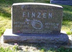
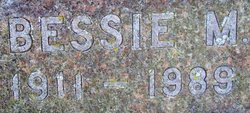
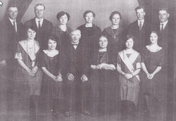
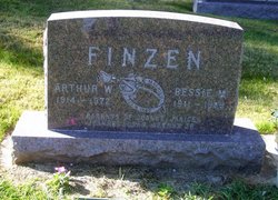
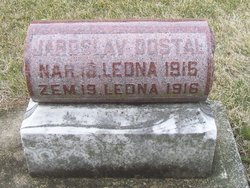
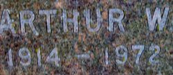
Bessie Maxine Dostal Finzen
| Birth | : | 1914 Elberon, Tama County, Iowa, USA |
| Death | : | 1972 Iowa, USA |
| Burial | : | Shepherd Memorial Park, Naples, Henderson County, USA |
| Coordinate | : | 35.3835351, -82.5067129 |
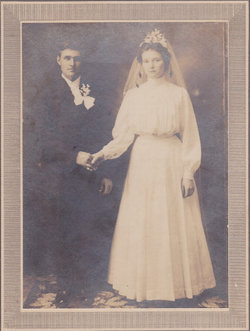
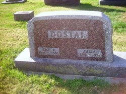
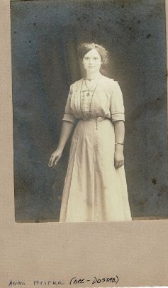
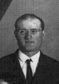
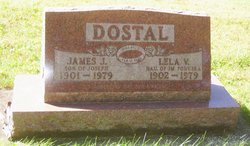
| Description | : | Services for Bessie Maxine Finzen, 78, Dysart, were Monday, Aug. 14, at the Dysart United Methodist Church with the Rev. Carroll Robinson in charge of the the service. Burial was in National Cemetery at Vining. She died Thursday, Aug. 10, at her home. Bessie Maxine Dostal was born July 28, 1911, at Elberon, one of 12 children of Joseph and Anna (Pavlicek) Dostal. She received her education in country school. She married Arthur Finzen, October 8, 1940, at Davenport, and they farmed until 1949. They then moved to the Geneseo area, and he went to work at John... Read More |
frequently asked questions (FAQ):
-
Where is Bessie Maxine Dostal Finzen's memorial?
Bessie Maxine Dostal Finzen's memorial is located at: Shepherd Memorial Park, Naples, Henderson County, USA.
-
When did Bessie Maxine Dostal Finzen death?
Bessie Maxine Dostal Finzen death on 1972 in Iowa, USA
-
Where are the coordinates of the Bessie Maxine Dostal Finzen's memorial?
Latitude: 35.3835351
Longitude: -82.5067129
Family Members:
Parent
Spouse
Siblings
Children
Flowers:
Nearby Cemetories:
1. Shepherd Memorial Park
Naples, Henderson County, USA
Coordinate: 35.3835351, -82.5067129
2. Mill Pond Cemetery
Rugby, Henderson County, USA
Coordinate: 35.3666992, -82.5239029
3. Saint Matthews Cemetery
Hillgirt, Henderson County, USA
Coordinate: 35.3683014, -82.4792023
4. Brickton Missionary Baptist Church Cemetery
Fletcher, Henderson County, USA
Coordinate: 35.4126850, -82.5032530
5. Henderson County Home Cemetery
Henderson County, USA
Coordinate: 35.3535480, -82.4986540
6. Fletcher Family Cemetery
Fletcher, Henderson County, USA
Coordinate: 35.4149600, -82.4985300
7. Jones Cemetery
Mills River, Henderson County, USA
Coordinate: 35.3988991, -82.5456009
8. Patty's Chapel Cemetery
Fletcher, Henderson County, USA
Coordinate: 35.4160995, -82.4882965
9. Hutchinson
Hoopers Creek, Henderson County, USA
Coordinate: 35.4050416, -82.4713800
10. Old French Broad Baptist Church
Rugby, Henderson County, USA
Coordinate: 35.3588340, -82.5418500
11. McCarson Cemetery
Henderson County, USA
Coordinate: 35.3442001, -82.5021973
12. Featherstone Family Cemetery
Henderson County, USA
Coordinate: 35.3817100, -82.4573500
13. Featherstone Slave Cemetery
Henderson County, USA
Coordinate: 35.3839389, -82.4571000
14. Shaws Creek Methodist Campground Cemetery
Horse Shoe, Henderson County, USA
Coordinate: 35.3437996, -82.5345001
15. Jeremiah Osborne Cemetery
Horse Shoe, Henderson County, USA
Coordinate: 35.3527400, -82.5551720
16. McCrary Family Cemetery
Henderson County, USA
Coordinate: 35.3366776, -82.4810562
17. Boiling Springs Baptist Church
Fletcher, Henderson County, USA
Coordinate: 35.4320297, -82.5294037
18. Saint John Baptist Church Cemetery
Fletcher, Henderson County, USA
Coordinate: 35.4356600, -82.5086700
19. Drake Family Cemetery
Henderson County, USA
Coordinate: 35.4025000, -82.4458060
20. Mills River Presbyterian Church Cemetery
Mills River, Henderson County, USA
Coordinate: 35.3777733, -82.5728073
21. Old Salem Cemetery
Fletcher, Henderson County, USA
Coordinate: 35.4380810, -82.4980550
22. Mills River United Methodist Church
Mills River, Henderson County, USA
Coordinate: 35.3843620, -82.5770620
23. Carolina Memorial Sanctuary
Mills River, Henderson County, USA
Coordinate: 35.4202480, -82.5632190
24. Calvary Episcopal Church Cemetery
Fletcher, Henderson County, USA
Coordinate: 35.4434013, -82.5062027


