
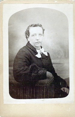
| Birth | : | 20 Mar 1832 Pennsylvania, USA |
| Death | : | 11 May 1925 Sacramento, Sacramento County, California, USA |
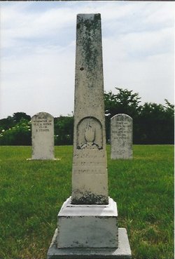
| Burial | : | Masonic Lawn Cemetery, Sacramento, Sacramento County, USA |
| Coordinate | : | 38.5604720, -121.5032600 |
| Description | : | Caleb married Frances Nixon on 9 Dec 1855 in Pottawattamie County, Iowa. After her death, he married Adella Sharp, daughter of Joseph and Loretta (Whitson) Sharp, on 22 Dec 1893 in Council Bluffs, Pottawattamie, Iowa. Second wife: Adella (Sharp) Kimball 2 Aug 1874, Penn, Osborne, Kansas 7 Jan 1911, Garner, Pottawattamie, Iowa. |
frequently asked questions (FAQ):
-
Where is Caleb Kimball's memorial?
Caleb Kimball's memorial is located at: Masonic Lawn Cemetery, Sacramento, Sacramento County, USA.
-
When did Caleb Kimball death?
Caleb Kimball death on 11 May 1925 in Sacramento, Sacramento County, California, USA
-
Where are the coordinates of the Caleb Kimball's memorial?
Latitude: 38.5604720
Longitude: -121.5032600
Family Members:
Children

Flowers:


Nearby Cemetories:
1. Masonic Lawn Cemetery
Sacramento, Sacramento County, USA
Coordinate: 38.5604720, -121.5032600
2. Sunset Hill Cemetery
Sacramento, Sacramento County, USA
Coordinate: 38.5608000, -121.5037300
3. Odd Fellows Lawn Cemetery and Mausoleum
Sacramento, Sacramento County, USA
Coordinate: 38.5585000, -121.5011000
4. Sacramento City Cemetery
Sacramento, Sacramento County, USA
Coordinate: 38.5636864, -121.5009537
5. Buddhist Church of Sacramento Nokotsudo
Sacramento, Sacramento County, USA
Coordinate: 38.5639300, -121.4978400
6. National Shrine of Our Lady of Guadalupe Crypt
Sacramento, Sacramento County, USA
Coordinate: 38.5704800, -121.5014400
7. Saint Joseph Cemetery
Sacramento, Sacramento County, USA
Coordinate: 38.5574989, -121.4835968
8. California State Capitol
Sacramento, Sacramento County, USA
Coordinate: 38.5760994, -121.4931488
9. Holy Ascension Russian Orthodox Cemetery
Sacramento, Sacramento County, USA
Coordinate: 38.5846212, -121.4936736
10. Trinity Episcopal Cathedral Columbarium
Sacramento, Sacramento County, USA
Coordinate: 38.5705500, -121.4723770
11. New Helvetia Cemetery (Defunct)
Sacramento, Sacramento County, USA
Coordinate: 38.5731600, -121.4639900
12. Pho Minh Temple Columbarium
Sacramento, Sacramento County, USA
Coordinate: 38.5340100, -121.4769000
13. East Lawn Memorial Park
Sacramento, Sacramento County, USA
Coordinate: 38.5612960, -121.4492760
14. Saint Rose Cemetery (Defunct)
Sacramento, Sacramento County, USA
Coordinate: 38.5208015, -121.4672012
15. Saint Mary's Catholic Cemetery and Mausoleum
Sacramento, Sacramento County, USA
Coordinate: 38.5298900, -121.4261200
16. Sacramento Memorial Lawn Cemetery
Sacramento, Sacramento County, USA
Coordinate: 38.5146484, -121.4380341
17. Home of Peace Cemetery
Sacramento, Sacramento County, USA
Coordinate: 38.5137558, -121.4382782
18. Sacramento County Hospital Cemetery
Sacramento, Sacramento County, USA
Coordinate: 38.5289300, -121.4239100
19. Russian Orthodox Cemetery
Sacramento, Sacramento County, USA
Coordinate: 38.5268800, -121.4244300
20. Sacramento County Cemetery
Sacramento County, USA
Coordinate: 38.5267900, -121.4233700
21. Sacramento County Veterans Memorial Cemetery
Sacramento, Sacramento County, USA
Coordinate: 38.5252838, -121.4239120
22. Tinh Xa Ngoc An Temple Columbarium
Sacramento, Sacramento County, USA
Coordinate: 38.5190200, -121.4159500
23. Elder Creek Cemetery
Florin, Sacramento County, USA
Coordinate: 38.5111008, -121.4169006
24. Kim Quang Temple Columbarium
Sacramento, Sacramento County, USA
Coordinate: 38.5996600, -121.3904700