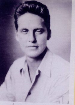
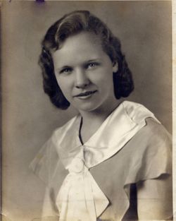
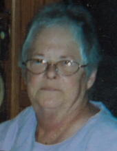
Calvin Duane “Cal” Specht
| Birth | : | 24 Jul 1943 Marshalltown, Marshall County, Iowa, USA |
| Death | : | 28 Jun 2003 Marshalltown, Marshall County, Iowa, USA |
| Burial | : | Waikopua Cemetery, Whitford, Auckland Council, New Zealand |
| Coordinate | : | -36.9274400, 174.9998900 |
| Description | : | Calvin "Cal" Duane Specht was the second of two children born to Ida Lucille Stevens and Charles Benjamin Specht Jr. The majority of his youth was spent in Marshalltown and he graduated from Marshalltown High School in 1961 then entered the U.S. Navy serving three years active service. He met Carla White and loved her so much he married her twice; once in July of 1968 and again in August of 1981. Their marriage produced three children; Danielle, Tyson, and Brandy. Unfortunately they decided to go their separate ways and divorced in 1992. |
frequently asked questions (FAQ):
-
Where is Calvin Duane “Cal” Specht's memorial?
Calvin Duane “Cal” Specht's memorial is located at: Waikopua Cemetery, Whitford, Auckland Council, New Zealand.
-
When did Calvin Duane “Cal” Specht death?
Calvin Duane “Cal” Specht death on 28 Jun 2003 in Marshalltown, Marshall County, Iowa, USA
-
Where are the coordinates of the Calvin Duane “Cal” Specht's memorial?
Latitude: -36.9274400
Longitude: 174.9998900
Family Members:
Parent
Siblings
Flowers:
Nearby Cemetories:
1. Waikopua Cemetery
Whitford, Auckland Council, New Zealand
Coordinate: -36.9274400, 174.9998900
2. Howick Cemetery
Howick, Auckland Council, New Zealand
Coordinate: -36.9040400, 174.9380500
3. All Saints Cemetery
Howick, Auckland Council, New Zealand
Coordinate: -36.8954260, 174.9337600
4. Our Lady Star of the Sea Parish Cemetery
Howick, Auckland Council, New Zealand
Coordinate: -36.8932940, 174.9307940
5. Clevedon Cemetery All Souls Church
Clevedon, Auckland Council, New Zealand
Coordinate: -36.9862400, 175.0418100
6. St. Andrew Presbyterian Cemetery
Howick, Auckland Council, New Zealand
Coordinate: -36.8989900, 174.9201600
7. St Andrews Presbyterian Cemetery
Clevedon, Auckland Council, New Zealand
Coordinate: -36.9921320, 175.0371370
8. Flat Bush Cemetery
East Tamaki, Auckland Council, New Zealand
Coordinate: -36.9563500, 174.9097100
9. Howick Historical Village
Pakuranga, Auckland Council, New Zealand
Coordinate: -36.9067680, 174.9027080
10. St. Paul's Anglican Cemetery
East Tamaki, Auckland Council, New Zealand
Coordinate: -36.9615200, 174.9082000
11. St. John's Church Cemetery
East Tamaki, Auckland Council, New Zealand
Coordinate: -36.9522250, 174.8964540
12. Pakuranga Methodist Cemetery
Pakuranga, Auckland Council, New Zealand
Coordinate: -36.9054000, 174.8914900
13. Alfriston Cemetery
Auckland Council, New Zealand
Coordinate: -37.0133660, 174.9479400
14. St James Churchyard Ardmore
Auckland Council, New Zealand
Coordinate: -37.0364180, 174.9992160
15. Woodside Methodist Cemetery
Manukau, Auckland Council, New Zealand
Coordinate: -36.9929680, 174.8837860
16. St Matthias Churchyard
Panmure, Auckland Council, New Zealand
Coordinate: -36.9053300, 174.8577200
17. St. David's Anglican Churchyard
Wiri, Auckland Council, New Zealand
Coordinate: -37.0025400, 174.8886150
18. St. Patrick's Roman Catholic Church Cemetery
Panmure, Auckland Council, New Zealand
Coordinate: -36.9029680, 174.8564960
19. St. John's Presbyterian Church Cemetery
Papatoetoe, Auckland Council, New Zealand
Coordinate: -36.9674185, 174.8598178
20. Point England Presbyterian Cemetery
Point England, Auckland Council, New Zealand
Coordinate: -36.8823420, 174.8601550
21. St. Joseph and St. Joachim Catholic Cemetery
Ōtāhūhū, Auckland Council, New Zealand
Coordinate: -36.9436100, 174.8490100
22. Holy Trinity Memorial Park
Ōtāhūhū, Auckland Council, New Zealand
Coordinate: -36.9374510, 174.8448580
23. Otahuhu Public Cemetery
Ōtāhūhū, Auckland Council, New Zealand
Coordinate: -36.9377500, 174.8432390
24. Nixon Memorial
Ōtāhūhū, Auckland Council, New Zealand
Coordinate: -36.9499366, 174.8449909


