
| Memorials | : | 62 |
| Location | : | Howick, Auckland Council, New Zealand |
| Coordinate | : | -36.8989900, 174.9201600 |
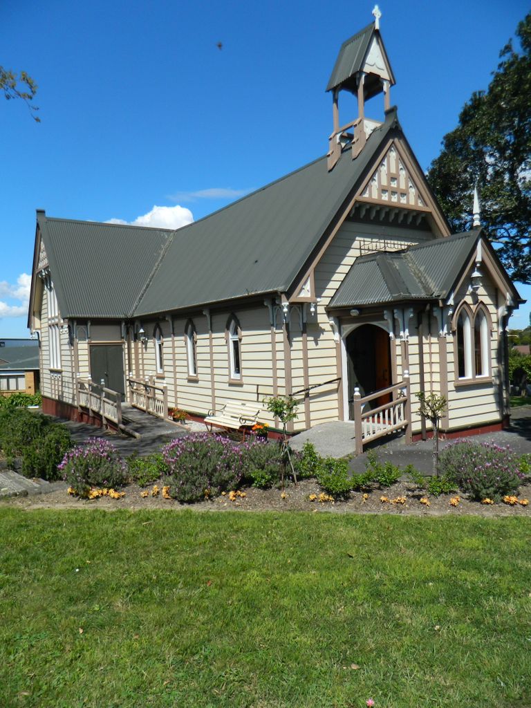
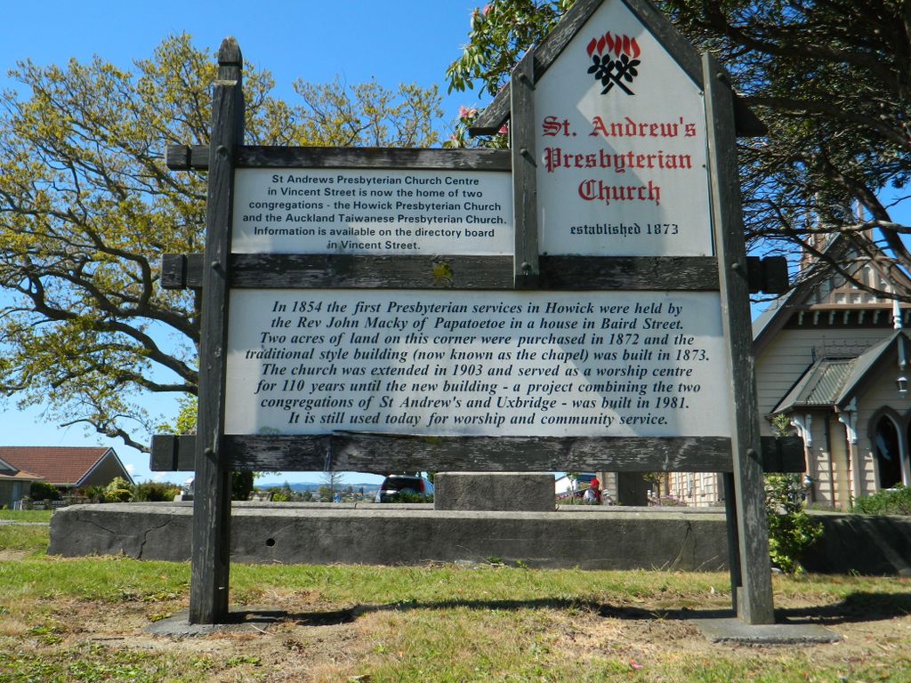
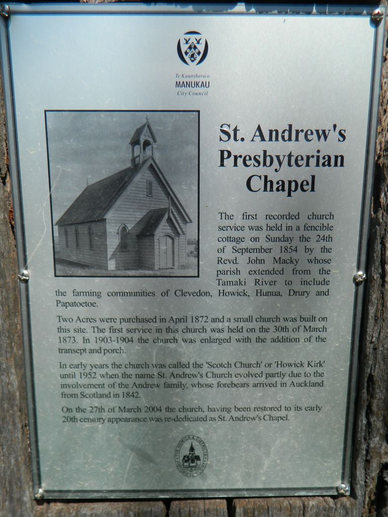
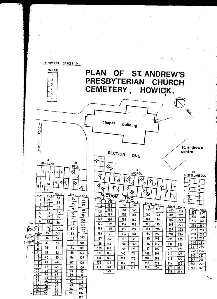
| Description | : | St Andrew's Presbyterian Church is also known as St Andrew's Presbyterian Chapel. The small cemetery is on the grounds of the church. |
frequently asked questions (FAQ):
-
Where is St. Andrew Presbyterian Cemetery?
St. Andrew Presbyterian Cemetery is located at Vincent Street Howick, Auckland Council ,Auckland ,New Zealand.
-
St. Andrew Presbyterian Cemetery cemetery's updated grave count on graveviews.com?
62 memorials
-
Where are the coordinates of the St. Andrew Presbyterian Cemetery?
Latitude: -36.8989900
Longitude: 174.9201600
Nearby Cemetories:
1. Our Lady Star of the Sea Parish Cemetery
Howick, Auckland Council, New Zealand
Coordinate: -36.8932940, 174.9307940
2. All Saints Cemetery
Howick, Auckland Council, New Zealand
Coordinate: -36.8954260, 174.9337600
3. Howick Cemetery
Howick, Auckland Council, New Zealand
Coordinate: -36.9040400, 174.9380500
4. Howick Historical Village
Pakuranga, Auckland Council, New Zealand
Coordinate: -36.9067680, 174.9027080
5. Pakuranga Methodist Cemetery
Pakuranga, Auckland Council, New Zealand
Coordinate: -36.9054000, 174.8914900
6. St Matthias Churchyard
Panmure, Auckland Council, New Zealand
Coordinate: -36.9053300, 174.8577200
7. Point England Presbyterian Cemetery
Point England, Auckland Council, New Zealand
Coordinate: -36.8823420, 174.8601550
8. St. Patrick's Roman Catholic Church Cemetery
Panmure, Auckland Council, New Zealand
Coordinate: -36.9029680, 174.8564960
9. St. John's Church Cemetery
East Tamaki, Auckland Council, New Zealand
Coordinate: -36.9522250, 174.8964540
10. Flat Bush Cemetery
East Tamaki, Auckland Council, New Zealand
Coordinate: -36.9563500, 174.9097100
11. St. Paul's Anglican Cemetery
East Tamaki, Auckland Council, New Zealand
Coordinate: -36.9615200, 174.9082000
12. St. Thomas Churchyard
Tamaki, Auckland Council, New Zealand
Coordinate: -36.8675590, 174.8460560
13. St. John’s College Graveyard
Saint Johns, Auckland Council, New Zealand
Coordinate: -36.8738169, 174.8416826
14. Waikopua Cemetery
Whitford, Auckland Council, New Zealand
Coordinate: -36.9274400, 174.9998900
15. Holy Trinity Memorial Park
Ōtāhūhū, Auckland Council, New Zealand
Coordinate: -36.9374510, 174.8448580
16. St. Joseph and St. Joachim Catholic Cemetery
Ōtāhūhū, Auckland Council, New Zealand
Coordinate: -36.9436100, 174.8490100
17. Otahuhu Public Cemetery
Ōtāhūhū, Auckland Council, New Zealand
Coordinate: -36.9377500, 174.8432390
18. Nixon Memorial
Ōtāhūhū, Auckland Council, New Zealand
Coordinate: -36.9499366, 174.8449909
19. Purewa Cemetery
Meadowbank, Auckland Council, New Zealand
Coordinate: -36.8674300, 174.8297900
20. St. John's Presbyterian Church Cemetery
Papatoetoe, Auckland Council, New Zealand
Coordinate: -36.9674185, 174.8598178
21. Ōrākei (Rautara St) Urupā
Orakei, Auckland Council, New Zealand
Coordinate: -36.8610770, 174.8188960
22. Savage Memorial
Auckland, Auckland Council, New Zealand
Coordinate: -36.8462500, 174.8259300
23. Woodside Methodist Cemetery
Manukau, Auckland Council, New Zealand
Coordinate: -36.9929680, 174.8837860
24. Motuihe Island Cemetery
Auckland Council, New Zealand
Coordinate: -36.8000400, 174.9363920