
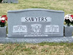
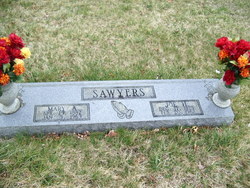
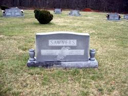
Canus Kenneth Sawyers
| Birth | : | 20 Jun 1927 Patrick County, Virginia, USA |
| Death | : | 21 Jan 2002 Surry County, North Carolina, USA |
| Burial | : | Holy Trinity Churchyard, Loddon, South Norfolk District, England |
| Coordinate | : | 52.5350430, 1.4832560 |
| Description | : | Canus Kenneth Sawyers, 74, of Mount Airy, N.C., died Monday, January 21, 2002, at his home. He was born on June 20, 1927 in Patrick County and was a son of the late Joe Henry and Mary Agnes Hall Sawyers. He was retired from Adams-Millis Hosiery and was a member of Doe Run Baptist Church. Surviving are his wife, Cassie Reva Bowman Sawyers of the home; one son, Danny Sawyers of Westfield, N.C.; two sisters, Nellie Bowman and Mattie Smith, both of Ararat; one brother, Hoover Sawyers of Mount Airy; three grandchildren and several nieces and nephews. The funeral was held Friday at... Read More |
frequently asked questions (FAQ):
-
Where is Canus Kenneth Sawyers's memorial?
Canus Kenneth Sawyers's memorial is located at: Holy Trinity Churchyard, Loddon, South Norfolk District, England.
-
When did Canus Kenneth Sawyers death?
Canus Kenneth Sawyers death on 21 Jan 2002 in Surry County, North Carolina, USA
-
Where are the coordinates of the Canus Kenneth Sawyers's memorial?
Latitude: 52.5350430
Longitude: 1.4832560
Family Members:
Parent

Siblings

Flowers:


Nearby Cemetories:
1. Holy Trinity Churchyard
Loddon, South Norfolk District, England
Coordinate: 52.5350430, 1.4832560
2. All Saints Churchyard
Chedgrave, South Norfolk District, England
Coordinate: 52.5409130, 1.4831200
3. St Gregory Churchyard
Heckingham, South Norfolk District, England
Coordinate: 52.5350940, 1.5144710
4. St. Michaels's Church Cemetery
Langley with Hardley, South Norfolk District, England
Coordinate: 52.5552220, 1.4727530
5. Hardley Methodist Chapel
Langley with Hardley, South Norfolk District, England
Coordinate: 52.5577290, 1.4957960
6. St Margaret's Churchyard
Hardley Street, South Norfolk District, England
Coordinate: 52.5522980, 1.5170630
7. St Margaret Churchyard
Hales, South Norfolk District, England
Coordinate: 52.5109380, 1.5110840
8. St Peter's Churchyard
Mundham, South Norfolk District, England
Coordinate: 52.5303890, 1.4260120
9. Langley Abbey
Langley with Hardley, South Norfolk District, England
Coordinate: 52.5719000, 1.4875700
10. St Andrews Churchyard
Raveningham, South Norfolk District, England
Coordinate: 52.5126430, 1.5323570
11. St Peter's Churchyard
Carleton St Peter, South Norfolk District, England
Coordinate: 52.5680520, 1.4514100
12. St Margaret and St Remigius Churchyard
Seething, South Norfolk District, England
Coordinate: 52.5303390, 1.4185000
13. Ss Mary and Margaret Churchyard
Norton Subcourse, North Norfolk District, England
Coordinate: 52.5324780, 1.5483860
14. All Saints Churchyard
Kirby Cane, South Norfolk District, England
Coordinate: 52.4937500, 1.4952820
15. St Mary's Parish Churchyard
Ashby St Mary, South Norfolk District, England
Coordinate: 52.5679100, 1.4354760
16. Methodist Churchyard
Norton Subcourse, North Norfolk District, England
Coordinate: 52.5317630, 1.5557020
17. St. Peter and St. Paul Churchyard
Bergh Apton, South Norfolk District, England
Coordinate: 52.5480290, 1.4060870
18. St. Margaret Churchyard
Cantley, Broadland District, England
Coordinate: 52.5826600, 1.5137200
19. St Andrews
Claxton, South Norfolk District, England
Coordinate: 52.5769660, 1.4340060
20. St Michael's Churchyard
Broome, South Norfolk District, England
Coordinate: 52.4860360, 1.4547410
21. St. Botolph's Churchyard
Limpenhoe, Broadland District, England
Coordinate: 52.5811500, 1.5340800
22. St. John the Baptist Churchyard
Hellington, South Norfolk District, England
Coordinate: 52.5761440, 1.4132050
23. St Margaret's Churchyard
Kirstead, South Norfolk District, England
Coordinate: 52.5358860, 1.3840860
24. St Mary's Churchyard
Ellingham, South Norfolk District, England
Coordinate: 52.4739393, 1.4827976