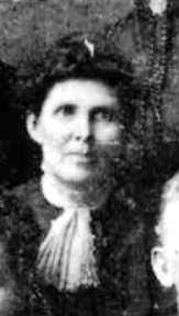
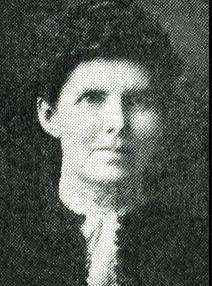
Cara M. Rice Bamford
| Birth | : | 1859 Castle Rock, Dakota County, Minnesota, USA |
| Death | : | 13 Jan 1937 Fargo, Cass County, North Dakota, USA |
| Burial | : | St Andrew Churchyard, Kildwick, Craven District, England |
| Coordinate | : | 53.9091560, -1.9839700 |
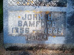
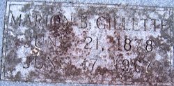
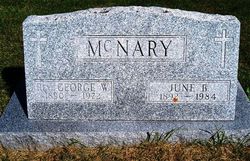
| Description | : | wife of John Bamford, mother of June Bamford McNary, John Rice Bamford and Freddie Bamford. And was a member of the Congregational Church of Mitchell. Mitchell Woman Who Succumbed on Visit Buried; Rites Held MITCHELL, IOWA - Funeral services for Mrs. J. H. Bamford, 77, who died from pneumonia followed by a heart attack at the home of her daughter, and husband, Mr. and Mrs. H. W. Gillette at Fargo, North Dakota, where she and Mr. Bamford had gone to spend the winter, were held Saturday afternoon at the Bamford home. Her son-in-law, the Rev. George McNary, a former pastor of... Read More |
frequently asked questions (FAQ):
-
Where is Cara M. Rice Bamford's memorial?
Cara M. Rice Bamford's memorial is located at: St Andrew Churchyard, Kildwick, Craven District, England.
-
When did Cara M. Rice Bamford death?
Cara M. Rice Bamford death on 13 Jan 1937 in Fargo, Cass County, North Dakota, USA
-
Where are the coordinates of the Cara M. Rice Bamford's memorial?
Latitude: 53.9091560
Longitude: -1.9839700
Family Members:
Parent
Spouse
Children
Flowers:
Nearby Cemetories:
1. St Andrew Churchyard
Kildwick, Craven District, England
Coordinate: 53.9091560, -1.9839700
2. St. Thomas's Churchyard
Sutton-in-Craven, Craven District, England
Coordinate: 53.8937020, -1.9906290
3. Bradley Cemetery
Bradleys Both, Craven District, England
Coordinate: 53.9306747, -1.9907120
4. St. Stephen Churchyard
Steeton, Metropolitan Borough of Bradford, England
Coordinate: 53.8968600, -1.9499600
5. St. John's Churchyard
Cononley, Craven District, England
Coordinate: 53.9187890, -2.0212930
6. St James Churchyard
Silsden, Metropolitan Borough of Bradford, England
Coordinate: 53.9139070, -1.9390650
7. Silsden Cemetery
Silsden, Metropolitan Borough of Bradford, England
Coordinate: 53.9106500, -1.9267000
8. Cowling Hill Baptist Cemetery
Cowling, Craven District, England
Coordinate: 53.8961550, -2.0536900
9. Christ Churchyard
Lothersdale, Craven District, England
Coordinate: 53.9097000, -2.0578600
10. St Andrew Methodist Cemetery
Cowling, Craven District, England
Coordinate: 53.8830940, -2.0465580
11. Cowling Holy Trinity Churchyard
Cowling, Craven District, England
Coordinate: 53.8836542, -2.0473431
12. Holy Trinity Churchyard
Cowling, Craven District, England
Coordinate: 53.8836930, -2.0502720
13. Holy Trinity Churchyard
Cowling, Craven District, England
Coordinate: 53.8837150, -2.0503150
14. Laycock Wesleyan Methodist Cemetery
Laycock, Metropolitan Borough of Bradford, England
Coordinate: 53.8651200, -1.9527500
15. Waltonwrays Cemetery and Skipton Crematorium
Skipton, Craven District, England
Coordinate: 53.9505500, -2.0272300
16. St Mary the Virgin Churchyard
Carleton, Craven District, England
Coordinate: 53.9442300, -2.0417800
17. Utley Cemetery
Keighley, Metropolitan Borough of Bradford, England
Coordinate: 53.8809160, -1.9141230
18. Christ Churchyard
Skipton, Craven District, England
Coordinate: 53.9581200, -2.0188910
19. Bethel Chapel Cemetery
Lothersdale, Craven District, England
Coordinate: 53.9102184, -2.0749640
20. Friends Burial Ground at Skipton
Skipton, Craven District, England
Coordinate: 53.9599220, -2.0148630
21. St. Andrew's Churchyard
Skipton, Craven District, England
Coordinate: 53.9609959, -2.0140994
22. Skipton War Memorial
Skipton, Craven District, England
Coordinate: 53.9627100, -2.0161680
23. Holy Trinity Churchyard
Skipton, Craven District, England
Coordinate: 53.9633250, -2.0161180
24. Friends Burial Ground at Calversike Hill
Kildwick, Craven District, England
Coordinate: 53.8661050, -1.9195670

