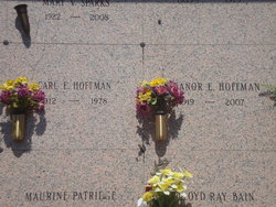
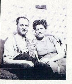
Carl Everett Hoffman
| Birth | : | 14 Oct 1912 Plymouth County, Iowa, USA |
| Death | : | 29 Sep 1978 Seattle, King County, Washington, USA |
| Burial | : | Saint Pauls Evangelical Lutheran Cemetery, Loganton, Clinton County, USA |
| Coordinate | : | 41.0337000, -77.3065000 |
| Plot | : | GRDN LOT 12BC SITE 406 |
| Description | : | Carl Everett Hoffman, was born in Portland Township, Plymouth County, Iowa, son of Charles William Hoffman and Mae Irene McKillips. Carl married Eleanor Esther Hallett on 27 Aug.1937 in Dakota City, Dakota County, Nebraska, later on 6 Dec 1940, they had their marriage blessed at St. Michael Catholic Church, by Rev. L. N. Llein, witness by Robert Campbell and Catherine Williams.Carl and Eleanor were blessed with six daughters, Lois, Sharon, Patricia, Sharon, Sandra, Clara and Koren. Sharon and Lois have passed and are with them now. |
frequently asked questions (FAQ):
-
Where is Carl Everett Hoffman's memorial?
Carl Everett Hoffman's memorial is located at: Saint Pauls Evangelical Lutheran Cemetery, Loganton, Clinton County, USA.
-
When did Carl Everett Hoffman death?
Carl Everett Hoffman death on 29 Sep 1978 in Seattle, King County, Washington, USA
-
Where are the coordinates of the Carl Everett Hoffman's memorial?
Latitude: 41.0337000
Longitude: -77.3065000
Family Members:
Parent
Spouse
Siblings
Children
Flowers:
Nearby Cemetories:
1. Saint Pauls Evangelical Lutheran Cemetery
Loganton, Clinton County, USA
Coordinate: 41.0337000, -77.3065000
2. Fairview Evangelical Cemetery
Loganton, Clinton County, USA
Coordinate: 41.0363998, -77.2983017
3. Esh Sugar Valley Cemetery
Loganton, Clinton County, USA
Coordinate: 41.0157090, -77.3021390
4. Old Schracktown Cemetery
Loganton, Clinton County, USA
Coordinate: 41.0219002, -77.3336029
5. Mount Pleasant Cemetery
Rosecrans, Clinton County, USA
Coordinate: 41.0612900, -77.3327900
6. Saint Matthew Evangelical Lutheran Cemetery
Clinton County, USA
Coordinate: 41.0413000, -77.2611000
7. Saint Johns Evangelical Lutheran Cemetery
Booneville, Clinton County, USA
Coordinate: 41.0200000, -77.3590000
8. Esher Cemetery
Clinton County, USA
Coordinate: 41.0191000, -77.3595000
9. Emanuel Reformed Cemetery
Greenburr, Clinton County, USA
Coordinate: 41.0065000, -77.3530000
10. Trinity United Methodist Cemetery
Greenburr, Clinton County, USA
Coordinate: 41.0075000, -77.3543000
11. Price Cemetery
Clinton County, USA
Coordinate: 41.0435982, -77.2427979
12. Livonia Cemetery
Livonia, Centre County, USA
Coordinate: 40.9803000, -77.2983000
13. Green Grove Cemetery
Carroll, Clinton County, USA
Coordinate: 41.0645000, -77.2411000
14. Mount Zion Cemetery
Loganton, Clinton County, USA
Coordinate: 41.0914000, -77.2955000
15. Church of Brethren Cemetery
Eastville, Clinton County, USA
Coordinate: 41.0350494, -77.2251740
16. Saint Paul EUB Cemetery
Logan Mills, Clinton County, USA
Coordinate: 41.0023000, -77.3767000
17. Brungart Cemetery
Centre County, USA
Coordinate: 40.9707000, -77.3445000
18. Mount Union Cemetery
Carroll, Clinton County, USA
Coordinate: 41.0684000, -77.2210000
19. Snyder Cemetery
Mill Hall, Clinton County, USA
Coordinate: 41.0951000, -77.3840000
20. Old Wolf's Store Cemetery
Wolfs Store, Centre County, USA
Coordinate: 40.9606660, -77.3828290
21. East End Amish Cemetery
Clinton County, USA
Coordinate: 41.0701000, -77.4281000
22. Tylersville Lutheran and Reformed Cemetery
Tylersville, Clinton County, USA
Coordinate: 40.9910000, -77.4258000
23. Tylersville Evangelical Cemetery
Tylersville, Clinton County, USA
Coordinate: 40.9913000, -77.4272000
24. Tylersville Reformed Cemetery
Tylersville, Clinton County, USA
Coordinate: 40.9897003, -77.4347000


