| Birth | : | 18 Apr 1937 Fox, Grayson County, Virginia, USA |
| Death | : | 25 Apr 2009 Mouth of Wilson, Grayson County, Virginia, USA |
| Burial | : | Rose Hill Burial Park, Springfield, Clark County, USA |
| Coordinate | : | 39.8903008, -83.7192001 |
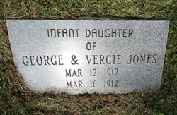
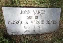
| Description | : | Carol J. Richardson, 72, of Mouth of Wilson, in the Pine Branch community, died Saturday, April 25, 2009 at her residence. She was born April 18, 1937 at Fox to George and Vergie Sparks Jones. Survivors include her husband, Jim R. Richardson of the home; a son, Ebby Richardson of the home; two sisters and spouse, Leola and Roy James and Faye West, all of Mouth of Wilson; a sister-in-law, Cora Jones of Independence; and several nieces and nephews. A funeral will be held today, Wednesday, at 2 p.m., in the Pine Branch Baptist Church at Mouth of Wilson with burial in the... Read More |
frequently asked questions (FAQ):
-
Where is Carol Jones Richardson's memorial?
Carol Jones Richardson's memorial is located at: Rose Hill Burial Park, Springfield, Clark County, USA.
-
When did Carol Jones Richardson death?
Carol Jones Richardson death on 25 Apr 2009 in Mouth of Wilson, Grayson County, Virginia, USA
-
Where are the coordinates of the Carol Jones Richardson's memorial?
Latitude: 39.8903008
Longitude: -83.7192001
Family Members:
Parent
Spouse
Siblings
Children
Flowers:
Nearby Cemetories:
1. Rose Hill Burial Park
Springfield, Clark County, USA
Coordinate: 39.8903008, -83.7192001
2. Fletcher Chapel Cemetery
Harmony, Clark County, USA
Coordinate: 39.8936005, -83.6956024
3. Calvary Cemetery
Springfield, Clark County, USA
Coordinate: 39.8843994, -83.7585983
4. Yale Cemetery
Clark County, USA
Coordinate: 39.9258003, -83.7257996
5. Yale Cemetery
Springfield, Clark County, USA
Coordinate: 39.9258935, -83.7257592
6. Titus Cemetery
Clark County, USA
Coordinate: 39.9155998, -83.6836014
7. Laybourn Cemetery
Clark County, USA
Coordinate: 39.9157740, -83.6832810
8. Sinking Creek Cemetery
Clark County, USA
Coordinate: 39.9290000, -83.7250000
9. Wraggs Cemetery
Clark County, USA
Coordinate: 39.9028015, -83.6667023
10. Tuttle Cemetery
Clark County, USA
Coordinate: 39.9331017, -83.7213974
11. Steele Cemetery
Springfield, Clark County, USA
Coordinate: 39.8702510, -83.7698680
12. Pleasant Grove Baptist Cemetery
Clark County, USA
Coordinate: 39.8457200, -83.7292900
13. Garlough Cemetery
Pitchin, Clark County, USA
Coordinate: 39.8563995, -83.7592010
14. Hinkle Cemetery
Springfield, Clark County, USA
Coordinate: 39.8817177, -83.7870636
15. Buffenbarger Cemetery
Pitchin, Clark County, USA
Coordinate: 39.8372002, -83.7121964
16. Goodfellow Cemetery
Harmony, Clark County, USA
Coordinate: 39.9146620, -83.6556300
17. Pitchin Methodist Church Cemetery
Pitchin, Clark County, USA
Coordinate: 39.8408160, -83.7591690
18. Greenmount Cemetery
Springfield, Clark County, USA
Coordinate: 39.9211006, -83.7889023
19. Saint Raphael's Cemetery
Springfield, Clark County, USA
Coordinate: 39.9305992, -83.7869034
20. Lisbon Cemetery
Lisbon, Clark County, USA
Coordinate: 39.8591995, -83.6393967
21. Newcomers Cemetery
Springfield, Clark County, USA
Coordinate: 39.9500008, -83.7668991
22. Graybill Cemetery
Clark County, USA
Coordinate: 39.9574550, -83.7468100
23. Christ Episcopal Church Columbarium
Springfield, Clark County, USA
Coordinate: 39.9226150, -83.8037060
24. Columbia Street Cemetery
Springfield, Clark County, USA
Coordinate: 39.9263992, -83.8131027


