


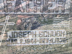
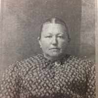
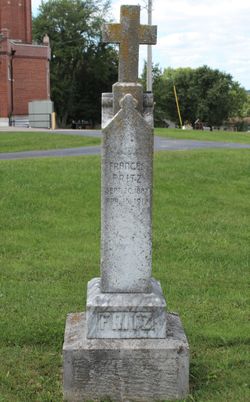
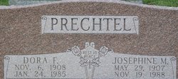
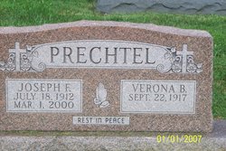
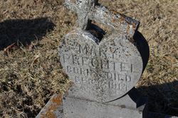
Caroline M “Carrie” Schuch Prechtel
| Birth | : | 24 Oct 1884 |
| Death | : | 26 Dec 1934 Dubois County, Indiana, USA |
| Burial | : | St. James' Churchyard, Cameley, Bath and North East Somerset Unitary Authority, England |
| Coordinate | : | 51.3158560, -2.5606190 |
frequently asked questions (FAQ):
-
Where is Caroline M “Carrie” Schuch Prechtel's memorial?
Caroline M “Carrie” Schuch Prechtel's memorial is located at: St. James' Churchyard, Cameley, Bath and North East Somerset Unitary Authority, England.
-
When did Caroline M “Carrie” Schuch Prechtel death?
Caroline M “Carrie” Schuch Prechtel death on 26 Dec 1934 in Dubois County, Indiana, USA
-
Where are the coordinates of the Caroline M “Carrie” Schuch Prechtel's memorial?
Latitude: 51.3158560
Longitude: -2.5606190
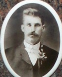
Family Members:
Parent
Spouse
Siblings
Children

Flowers:


Nearby Cemetories:
1. St. James' Churchyard
Cameley, Bath and North East Somerset Unitary Authority, England
Coordinate: 51.3158560, -2.5606190
2. St Margarets Churchyard
Hinton Blewett, Bath and North East Somerset Unitary Authority, England
Coordinate: 51.3104000, -2.5834000
3. Saint Augustine of Hippo
Clutton, Bath and North East Somerset Unitary Authority, England
Coordinate: 51.3281990, -2.5430220
4. St Nicholas & the Blessed Virgin Mary
Stowey Sutton, Bath and North East Somerset Unitary Authority, England
Coordinate: 51.3329190, -2.5764850
5. St. John the Baptist Churchyard
Farrington Gurney, Bath and North East Somerset Unitary Authority, England
Coordinate: 51.2993710, -2.5248000
6. Bishop's Sutton Holy Trinity Churchyard
Bath and North East Somerset Unitary Authority, England
Coordinate: 51.3341900, -2.5958300
7. Saint Mary the Virgin Churchyard
Litton, Mendip District, England
Coordinate: 51.2899860, -2.5838440
8. Holy Trinity Churchyard
High Littleton, Bath and North East Somerset Unitary Authority, England
Coordinate: 51.3195810, -2.5115860
9. Church of the Holy Trinity
Paulton, Bath and North East Somerset Unitary Authority, England
Coordinate: 51.3074740, -2.5033500
10. Saint Mary the Virgin Church
Ston Easton, Mendip District, England
Coordinate: 51.2789610, -2.5407720
11. Paulton Cemetery
Paulton, Bath and North East Somerset Unitary Authority, England
Coordinate: 51.3095671, -2.4988841
12. St Mary The Virgin Churchyard
Ston Easton, Mendip District, England
Coordinate: 51.2788400, -2.5404390
13. Harptree Cemetery
East Harptree, Bath and North East Somerset Unitary Authority, England
Coordinate: 51.3056390, -2.6238890
14. St Mary Magdalene Churchyard
Chewton Mendip, Mendip District, England
Coordinate: 51.2760790, -2.5800490
15. Saint Laurence Churchyard
East Harptree, Bath and North East Somerset Unitary Authority, England
Coordinate: 51.3011730, -2.6245740
16. Saint Leonard Churchyard
Chelwood, Bath and North East Somerset Unitary Authority, England
Coordinate: 51.3546300, -2.5246880
17. St Mary the Virgin Churchyard
Stanton Drew, Bath and North East Somerset Unitary Authority, England
Coordinate: 51.3657390, -2.5788440
18. Blessed Virgin Mary Churchyard
Timsbury, Bath and North East Somerset Unitary Authority, England
Coordinate: 51.3257710, -2.4782750
19. St Mary Church Cemetery
Timsbury, Bath and North East Somerset Unitary Authority, England
Coordinate: 51.3268300, -2.4784070
20. All Saints Churchyard
Farmborough, Bath and North East Somerset Unitary Authority, England
Coordinate: 51.3430620, -2.4876590
21. Saint Thomas Churchyard
Pensford, Bath and North East Somerset Unitary Authority, England
Coordinate: 51.3710450, -2.5495820
22. St. John the Baptist Churchyard
Midsomer Norton, Bath and North East Somerset Unitary Authority, England
Coordinate: 51.2870310, -2.4842190
23. St. Mary the Virgin Churchyard
Emborough, Mendip District, England
Coordinate: 51.2600970, -2.5539150
24. St John the Baptist Church Cemetery
Chilcompton, Mendip District, England
Coordinate: 51.2693960, -2.5073780