
| Memorials | : | 8 |
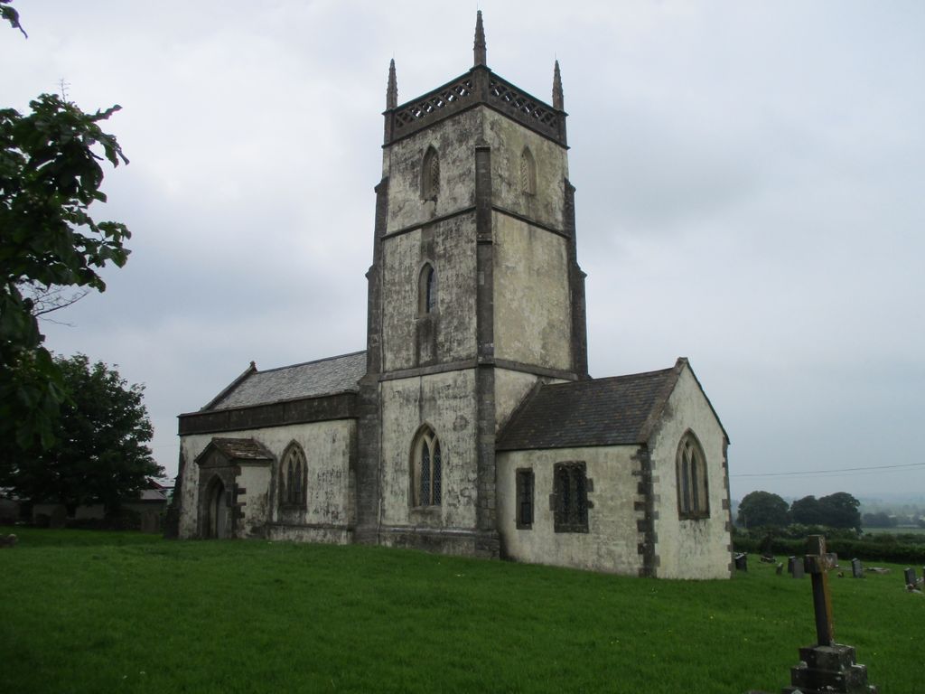
| Location | : | Emborough, Mendip District, England |
| Coordinate | : | 51.2600970, -2.5539150 |
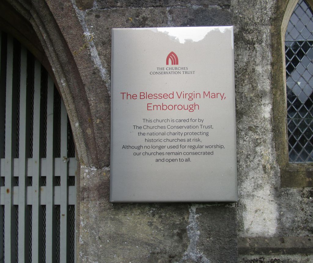
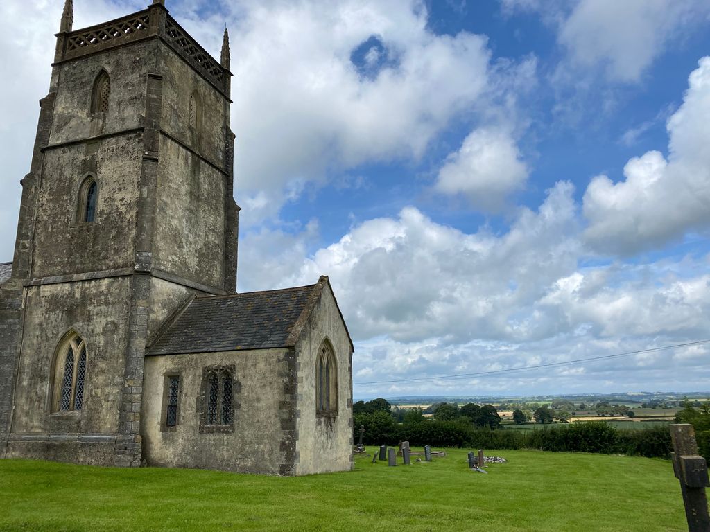
| Description | : | The church is now redundant and is under the care of the Churches Conservation Trust. Emborough is a village about 5 miles from Shepton Mallet. |
frequently asked questions (FAQ):
-
Where is St. Mary the Virgin Churchyard?
St. Mary the Virgin Churchyard is located at Emborough, Mendip District ,Somerset ,England.
-
St. Mary the Virgin Churchyard cemetery's updated grave count on graveviews.com?
8 memorials
-
Where are the coordinates of the St. Mary the Virgin Churchyard?
Latitude: 51.2600970
Longitude: -2.5539150

Nearby Cemetories:
1. Holy Trinity Churchyard
Binegar, Mendip District, England
Coordinate: 51.2425530, -2.5524812
2. St Mary The Virgin Churchyard
Ston Easton, Mendip District, England
Coordinate: 51.2788400, -2.5404390
3. Saint Mary the Virgin Church
Ston Easton, Mendip District, England
Coordinate: 51.2789610, -2.5407720
4. St Mary Magdalene Churchyard
Chewton Mendip, Mendip District, England
Coordinate: 51.2760790, -2.5800490
5. Downside Cemetery
Chilcompton, Mendip District, England
Coordinate: 51.2517300, -2.5152400
6. Christ Church, Downside
Chilcompton, Mendip District, England
Coordinate: 51.2515150, -2.5153030
7. Christ Church Churchyard
Mendip District, England
Coordinate: 51.2514920, -2.5151540
8. St John the Baptist Church Cemetery
Chilcompton, Mendip District, England
Coordinate: 51.2693960, -2.5073780
9. St James Churchyard
Ashwick, Mendip District, England
Coordinate: 51.2320800, -2.5229500
10. Saint Mary the Virgin Churchyard
Litton, Mendip District, England
Coordinate: 51.2899860, -2.5838440
11. Downside Abbey
Stratton-on-the-Fosse, Mendip District, England
Coordinate: 51.2544000, -2.4943000
12. St. Benedict's Churchyard
Stratton-on-the-Fosse, Mendip District, England
Coordinate: 51.2560684, -2.4913545
13. Saint Vigor Churchyard
Stratton-on-the-Fosse, Mendip District, England
Coordinate: 51.2552000, -2.4896000
14. St. John the Baptist Churchyard
Farrington Gurney, Bath and North East Somerset Unitary Authority, England
Coordinate: 51.2993710, -2.5248000
15. St. Andrew's Churchyard
Holcombe, Mendip District, England
Coordinate: 51.2547850, -2.4760280
16. St. John the Baptist Churchyard
Midsomer Norton, Bath and North East Somerset Unitary Authority, England
Coordinate: 51.2870310, -2.4842190
17. Saint John the Evangelist
East Horrington, Mendip District, England
Coordinate: 51.2180000, -2.6006900
18. St Margarets Churchyard
Hinton Blewett, Bath and North East Somerset Unitary Authority, England
Coordinate: 51.3104000, -2.5834000
19. St. James' Churchyard
Cameley, Bath and North East Somerset Unitary Authority, England
Coordinate: 51.3158560, -2.5606190
20. Church of the Holy Trinity
Paulton, Bath and North East Somerset Unitary Authority, England
Coordinate: 51.3074740, -2.5033500
21. St Michael & All Angels
Stoke St Michael, Mendip District, England
Coordinate: 51.2208300, -2.4819900
22. Paulton Cemetery
Paulton, Bath and North East Somerset Unitary Authority, England
Coordinate: 51.3095671, -2.4988841
23. Saint Laurence Churchyard
East Harptree, Bath and North East Somerset Unitary Authority, England
Coordinate: 51.3011730, -2.6245740
24. Harptree Cemetery
East Harptree, Bath and North East Somerset Unitary Authority, England
Coordinate: 51.3056390, -2.6238890