


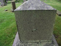
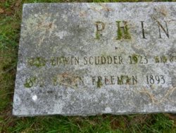
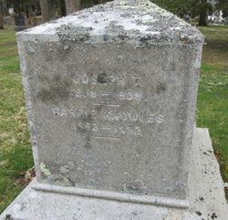
Carolyn Knowles “Carrie” Phinney Sweetser
| Birth | : | 11 Sep 1862 Centerville, Barnstable County, Massachusetts, USA |
| Death | : | 9 Sep 1952 Eugene, Lane County, Oregon, USA |
| Burial | : | Beechwood Cemetery, Centerville, Barnstable County, USA |
| Coordinate | : | 41.6561012, -70.3491974 |
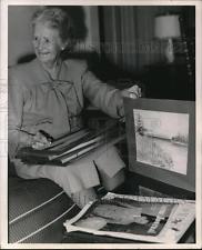
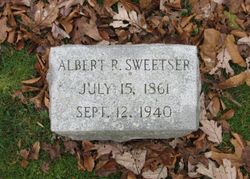
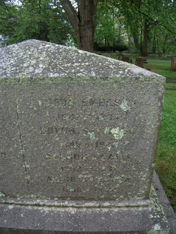
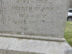
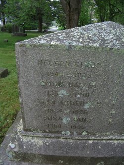
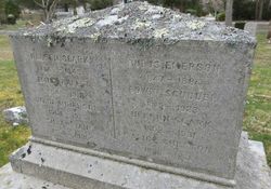
| Description | : | Carrie (Phinney) Sweetser, wife of Albert Raddin Sweetser (1861-1940), was a noted watercolorist and amateur botanist. For most of their married life, the Sweetsers lived in Oregon, where Albert and Carrie collected and documented botanical specimens. Over 300 of Carrie Sweetser's watercolors and her diaries are in the special collections at the University of Oregon Libraries. *** *1870 United States Federal Census Name: John A Phinney Age in 1870: 6 Birth Year: abt 1864 Birthplace: Massachusetts Home in 1870: Barnstable, Barnstable, Massachusetts Race: White Gender: Male Post Office: Barnstable Household Members: Name Age Nelson Phinney 50 Eunice C Phinney 47 Rufus M Phinney 23 Susan J Phinney 19 Nelson C Phinney 18 Emily H Phinney 16 Alice C Phinney... Read More |
frequently asked questions (FAQ):
-
Where is Carolyn Knowles “Carrie” Phinney Sweetser's memorial?
Carolyn Knowles “Carrie” Phinney Sweetser's memorial is located at: Beechwood Cemetery, Centerville, Barnstable County, USA.
-
When did Carolyn Knowles “Carrie” Phinney Sweetser death?
Carolyn Knowles “Carrie” Phinney Sweetser death on 9 Sep 1952 in Eugene, Lane County, Oregon, USA
-
Where are the coordinates of the Carolyn Knowles “Carrie” Phinney Sweetser's memorial?
Latitude: 41.6561012
Longitude: -70.3491974
Family Members:
Parent

Spouse
Siblings


Flowers:


Nearby Cemetories:
1. Beechwood Cemetery
Centerville, Barnstable County, USA
Coordinate: 41.6561012, -70.3491974
2. Centerville Ancient Cemetery
Centerville, Barnstable County, USA
Coordinate: 41.6547012, -70.3429031
3. Congregational Cemetery
Barnstable, Barnstable County, USA
Coordinate: 41.6459007, -70.3461990
4. Saint Francis Xavier Cemetery
Centerville, Barnstable County, USA
Coordinate: 41.6516991, -70.3331985
5. Hillside Cemetery
Osterville, Barnstable County, USA
Coordinate: 41.6316700, -70.3787100
6. Saint Peters Episcopal Church Memorial Garden
Barnstable, Barnstable County, USA
Coordinate: 41.6209700, -70.3735800
7. Saint Andrew's By The Sea Columbarium
Hyannis Port, Barnstable County, USA
Coordinate: 41.6306199, -70.3073859
8. Sandy Street Cemetery
Barnstable, Barnstable County, USA
Coordinate: 41.6968994, -70.3401031
9. South Street Cemetery
Hyannis, Barnstable County, USA
Coordinate: 41.6480300, -70.2920500
10. Marstons Mills Cemetery
Marstons Mills, Barnstable County, USA
Coordinate: 41.6612015, -70.4080963
11. Crocker Park Cemetery
Barnstable, Barnstable County, USA
Coordinate: 41.6959000, -70.3780975
12. Baptist Church Cemetery
Hyannis, Barnstable County, USA
Coordinate: 41.6519699, -70.2873230
13. Oak Grove Cemetery
Hyannis, Barnstable County, USA
Coordinate: 41.6432991, -70.2889023
14. Oak Neck Cemetery
Hyannis, Barnstable County, USA
Coordinate: 41.6431007, -70.2861023
15. Saint Patricks Cemetery
Hyannis, Barnstable County, USA
Coordinate: 41.6562996, -70.2835999
16. West Parish Burial Ground
West Barnstable, Barnstable County, USA
Coordinate: 41.6984200, -70.3842920
17. Universalist Cemetery
Hyannis, Barnstable County, USA
Coordinate: 41.6549100, -70.2822390
18. Lothrop Hill Cemetery
Barnstable, Barnstable County, USA
Coordinate: 41.7028008, -70.3174973
19. West Barnstable Cemetery
West Barnstable, Barnstable County, USA
Coordinate: 41.7080994, -70.3728027
20. Saint Marys Church Memorial Gardens
Barnstable, Barnstable County, USA
Coordinate: 41.7036000, -70.3090000
21. Cobb's Hill Cemetery East and West
Barnstable, Barnstable County, USA
Coordinate: 41.7008018, -70.2994003
22. Cummaquid Cemetery
Cummaquid, Barnstable County, USA
Coordinate: 41.6974700, -70.2804850
23. Mosswood Cemetery
Cotuit, Barnstable County, USA
Coordinate: 41.6279984, -70.4303970
24. Iyanough Gravesite
Cummaquid, Barnstable County, USA
Coordinate: 41.7014900, -70.2754100