
| Birth | : | 22 Dec 1828 Keene, Coshocton County, Ohio, USA |
| Death | : | 9 Apr 1902 Coshocton County, Ohio, USA |
| Burial | : | Keene Old Presbyterian Church Cemetery, Coshocton County, USA |
| Coordinate | : | 40.3480700, -81.8707900 |
| Description | : | Aged 74 years |
frequently asked questions (FAQ):
-
Where is Catherine Hook Adams's memorial?
Catherine Hook Adams's memorial is located at: Keene Old Presbyterian Church Cemetery, Coshocton County, USA.
-
When did Catherine Hook Adams death?
Catherine Hook Adams death on 9 Apr 1902 in Coshocton County, Ohio, USA
-
Where are the coordinates of the Catherine Hook Adams's memorial?
Latitude: 40.3480700
Longitude: -81.8707900
Family Members:
Parent
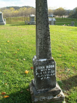
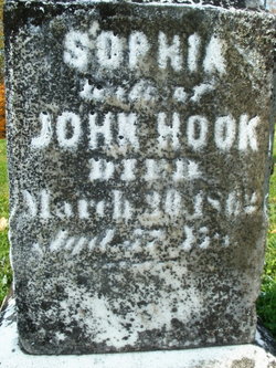
Spouse

Siblings
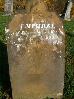
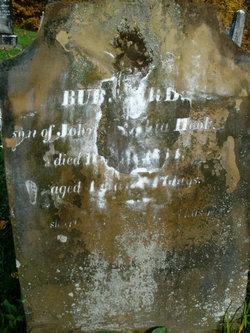
Children
Flowers:


Nearby Cemetories:
1. Keene Old Presbyterian Church Cemetery
Coshocton County, USA
Coordinate: 40.3480700, -81.8707900
2. Keene Methodist Cemetery
Keene, Coshocton County, USA
Coordinate: 40.3431800, -81.8662500
3. Bible Cemetery
Keene, Coshocton County, USA
Coordinate: 40.3330380, -81.8990940
4. Coshocton County Memory Gardens
Coshocton, Coshocton County, USA
Coordinate: 40.3234825, -81.8310089
5. Reamer Cemetery
Coshocton County, USA
Coordinate: 40.3194008, -81.8317032
6. Machpelahs Burial Acres
Keene, Coshocton County, USA
Coordinate: 40.3208950, -81.9126210
7. Amity Cemetery
Keene, Coshocton County, USA
Coordinate: 40.3568993, -81.8167038
8. Knob Cemetery
Keene, Coshocton County, USA
Coordinate: 40.3863983, -81.8358002
9. Casebeer Cemetery
Metham, Coshocton County, USA
Coordinate: 40.3629220, -81.9360840
10. Prairie Chapel Church Cemetery
Coshocton, Coshocton County, USA
Coordinate: 40.3049000, -81.9124000
11. Canal Lewisville Cemetery
Canal Lewisville, Coshocton County, USA
Coordinate: 40.3012500, -81.8357100
12. White Eyes Cemetery
Chili, Coshocton County, USA
Coordinate: 40.3499985, -81.7960968
13. Waring Cemetery
Metham, Coshocton County, USA
Coordinate: 40.3505580, -81.9470740
14. Mount Zion Methodist Church Cemetery
Metham, Coshocton County, USA
Coordinate: 40.3559580, -81.9522140
15. Dutch Meeting House Cemetery
Warsaw, Coshocton County, USA
Coordinate: 40.3796207, -81.9459337
16. Roscoe Cemetery
Coshocton, Coshocton County, USA
Coordinate: 40.2821000, -81.8841000
17. Hill Cemetery
Coshocton County, USA
Coordinate: 40.3208008, -81.7878036
18. Burkhardt Cemetery
Coshocton County, USA
Coordinate: 40.3953800, -81.8049400
19. Oak Grove Cemetery
Coshocton County, USA
Coordinate: 40.3032990, -81.8005981
20. Oak Ridge Cemetery
Coshocton, Coshocton County, USA
Coordinate: 40.2780991, -81.8610992
21. Caldersburg Cemetery
Roscoe, Coshocton County, USA
Coordinate: 40.2755390, -81.8798700
22. Unidentified Cemetery #1
Coshocton, Coshocton County, USA
Coordinate: 40.2753080, -81.8803050
23. Clark Township Baptist Church Cemetery
Clark, Coshocton County, USA
Coordinate: 40.4126680, -81.9229260
24. Fox Cemetery
Blissfield, Coshocton County, USA
Coordinate: 40.4035988, -81.9424973