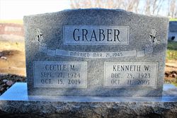
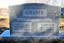
Cecile Marie Ridinger Graber
| Birth | : | 27 Sep 1924 Trenton, Henry County, Iowa, USA |
| Death | : | 15 Oct 2019 Burlington, Des Moines County, Iowa, USA |
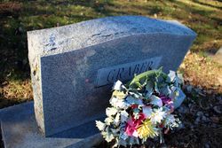
| Burial | : | Green Mound Cemetery, Henry County, USA |
| Coordinate | : | 41.0696983, -91.6652985 |
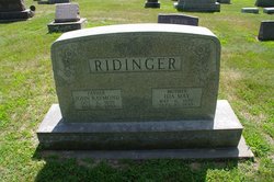
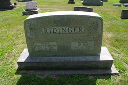
| Description | : | Cecile Marie Graber, 95, of Burlington, died at 10:00 p.m. Tuesday, October 15, 2019 at Burlington Care Center. Born September 27, 1924 in Trenton, IA, she was the daughter of John Raymond and Ida May (Schadt) Ridinger. She married Kenneth Wayne Graber on March 21, 1945 in Trenton, IA. He died October 11, 2005. Cecile was of the Christian faith. She was a homemaker. She loved cooking, sewing, gardening, flowers and enjoyed music. She was preceded in death by her husband, parents, and son-in-law, Stanley Widmer. |
frequently asked questions (FAQ):
-
Where is Cecile Marie Ridinger Graber's memorial?
Cecile Marie Ridinger Graber's memorial is located at: Green Mound Cemetery, Henry County, USA.
-
When did Cecile Marie Ridinger Graber death?
Cecile Marie Ridinger Graber death on 15 Oct 2019 in Burlington, Des Moines County, Iowa, USA
-
Where are the coordinates of the Cecile Marie Ridinger Graber's memorial?
Latitude: 41.0696983
Longitude: -91.6652985
Family Members:
Parent
Spouse
Flowers:
Nearby Cemetories:
1. Green Mound Cemetery
Henry County, USA
Coordinate: 41.0696983, -91.6652985
2. Roth Cemetery
Trenton, Henry County, USA
Coordinate: 41.0515000, -91.6772000
3. Scheffel Family Cemetery
Trenton, Henry County, USA
Coordinate: 41.0539030, -91.6921730
4. Messer Cemetery
Henry County, USA
Coordinate: 41.0419006, -91.6885986
5. Finley Cemetery
Henry County, USA
Coordinate: 41.0913800, -91.6202800
6. White Oak Cemetery
Trenton, Henry County, USA
Coordinate: 41.0293999, -91.6793976
7. Old Baptist Cemetery
Wayland, Henry County, USA
Coordinate: 41.1045000, -91.6209000
8. Alfred Warner Family Burial Ground
Trenton, Henry County, USA
Coordinate: 41.0180520, -91.6909500
9. New Richwoods Cemetery
Trenton, Henry County, USA
Coordinate: 41.0270000, -91.6118000
10. Vorhies Cemetery
Rome, Henry County, USA
Coordinate: 41.0213230, -91.7134810
11. Traxler Cemetery
Mount Pleasant, Henry County, USA
Coordinate: 41.0413500, -91.5922000
12. Richwoods South Cemetery
Henry County, USA
Coordinate: 41.0177000, -91.6115000
13. Nelson Plot
Jefferson County, USA
Coordinate: 41.1243890, -91.7185420
14. Sugar Creek Cemetery
Wayland, Henry County, USA
Coordinate: 41.1347008, -91.6343994
15. Dallner Cemetery
Jefferson County, USA
Coordinate: 41.1047000, -91.7458000
16. Oak Grove Cemetery
Mount Pleasant, Henry County, USA
Coordinate: 41.0323982, -91.5813522
17. Hope Lutheran Cemetery
Germanville, Jefferson County, USA
Coordinate: 41.0943985, -91.7593994
18. Union Free Cemetery
Germanville, Jefferson County, USA
Coordinate: 41.0971000, -91.7585000
19. Pioneer Shively-Neff Cemetery
Wayland, Henry County, USA
Coordinate: 41.1420950, -91.7027100
20. Wayland Methodist Church Cemetery
Wayland, Henry County, USA
Coordinate: 41.1480000, -91.6585000
21. Haynes Cemetery
Wayland, Henry County, USA
Coordinate: 41.1441000, -91.7074000
22. Kurtz Cemetery
Wayland, Henry County, USA
Coordinate: 41.1470000, -91.7071000
23. Cottonwood Cemetery
Coppock, Henry County, USA
Coordinate: 41.1488991, -91.7024994
24. Four Corners German Lutheran Cemetery
Lockridge, Jefferson County, USA
Coordinate: 41.0247002, -91.7605972

