| Birth | : | 19 Oct 1863 Clinton, Clinton County, Iowa, USA |
| Death | : | 28 Jul 1892 Boone County, Iowa, USA |
| Burial | : | Saint Thomas Episcopal Church Cemetery, Glassboro, Gloucester County, USA |
| Coordinate | : | 39.7079200, -75.1101500 |
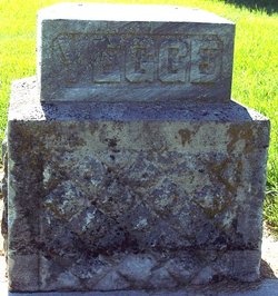
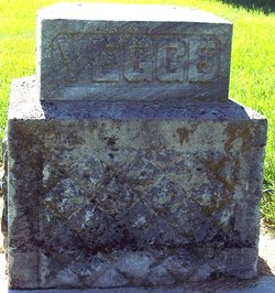
| Description | : | C.A. Yegge, of Boonsboro, died Thursday morning of Typhoid fever. He had been ill for some time but his death was unexpected and came as a surprise to the community. The deceased was a bright, active man of about 30, proprietor of the brick yard. He was born in Clinton, this state, but resided in this county since childhood. Mr. Yegge was universally respected and his early death is greatly regretted. The funeral services were held from the Catholic Church in this city. He was 28. |
frequently asked questions (FAQ):
-
Where is Charles Anthony “Tony” Yegge's memorial?
Charles Anthony “Tony” Yegge's memorial is located at: Saint Thomas Episcopal Church Cemetery, Glassboro, Gloucester County, USA.
-
When did Charles Anthony “Tony” Yegge death?
Charles Anthony “Tony” Yegge death on 28 Jul 1892 in Boone County, Iowa, USA
-
Where are the coordinates of the Charles Anthony “Tony” Yegge's memorial?
Latitude: 39.7079200
Longitude: -75.1101500
Family Members:
Parent
Spouse
Siblings
Children
Flowers:
Nearby Cemetories:
1. Saint Thomas Episcopal Church Cemetery
Glassboro, Gloucester County, USA
Coordinate: 39.7079200, -75.1101500
2. First United Methodist Church Cemetery
Glassboro, Gloucester County, USA
Coordinate: 39.7068900, -75.1081300
3. Saint Bridgets Cemetery
Glassboro, Gloucester County, USA
Coordinate: 39.7023300, -75.1159000
4. Trinity Bible Cemetery
Glassboro, Gloucester County, USA
Coordinate: 39.7003610, -75.1133800
5. Manahath Cemetery
Glassboro, Gloucester County, USA
Coordinate: 39.7154236, -75.1141129
6. Cost Family Cemetery
Pitman, Gloucester County, USA
Coordinate: 39.7307100, -75.1332310
7. Land Of Canaan Cemetery
Glassboro, Gloucester County, USA
Coordinate: 39.6741982, -75.1085968
8. Aura Methodist Cemetery
Aura, Gloucester County, USA
Coordinate: 39.6725006, -75.1374969
9. Hillcrest Memorial Park
Hurffville, Gloucester County, USA
Coordinate: 39.7491989, -75.1110992
10. Bunker Hill Presbyterian Church Cemetery
Gloucester County, USA
Coordinate: 39.7451600, -75.0849200
11. Richwood United Methodist Church Cemetery
Richwood, Gloucester County, USA
Coordinate: 39.7211100, -75.1667700
12. Downer United Methodist Church Cemetery
Williamstown, Gloucester County, USA
Coordinate: 39.6929700, -75.0523200
13. Bethel Methodist Church Cemetery
Hurffville, Gloucester County, USA
Coordinate: 39.7571983, -75.1110992
14. Cedar Green Cemetery
Clayton, Gloucester County, USA
Coordinate: 39.6613998, -75.0852966
15. Gloucester County Veterans Memorial Cemetery
Williamstown, Gloucester County, USA
Coordinate: 39.6521279, -75.1163586
16. Mount Zion Methodist Church Cemetery
Barnsboro, Gloucester County, USA
Coordinate: 39.7547540, -75.1629530
17. Cross Keys Methodist Cemetery
Williamstown, Gloucester County, USA
Coordinate: 39.7124800, -75.0273100
18. Driver Cemetery
Barnsboro, Gloucester County, USA
Coordinate: 39.7631000, -75.1554900
19. Hardingville Cemetery
Hardingville, Gloucester County, USA
Coordinate: 39.6632100, -75.1790400
20. Bunker Hill Presbyterian Church Cemetery
Sewell, Gloucester County, USA
Coordinate: 39.7767514, -75.0931293
21. Saint Johns United Methodist Cemetery
Turnersville, Gloucester County, USA
Coordinate: 39.7598300, -75.0487100
22. Jesse Chew Cemetery
Gloucester County, USA
Coordinate: 39.7736800, -75.1498250
23. Grenloch First Presbyterian Church Memorial Garden
Grenloch Terrace, Gloucester County, USA
Coordinate: 39.7806000, -75.0587000
24. Grenloch First Presbyterian Church Memory Garden
Camden County, USA
Coordinate: 39.7806000, -75.0587000


