
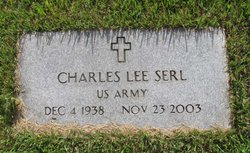
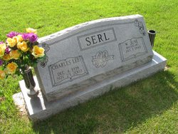
Charles Lee Serl
| Birth | : | 4 Dec 1938 Olean, Miller County, Missouri, USA |
| Death | : | 23 Nov 2003 Plattsburg, Clinton County, Missouri, USA |
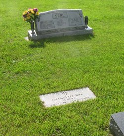
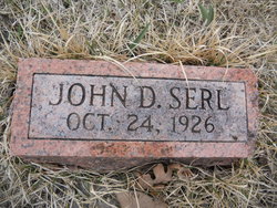
| Burial | : | Little Arlington Cemetery, Elkins, Randolph County, USA |
| Coordinate | : | 38.9482994, -79.8308029 |
| Inscription | : | U. S. Army |
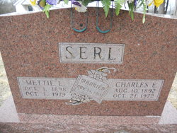
| Description | : | Wednesday, November 26, 2003 SERL Charles Lee Serl, 64, of Stewartsville, MO, died Sunday, November 23, 2003 in Plattsburg, MO. He was born December 4, 1938 in Olean, MO to Charles Earnest and Mettie Lee (Hader) Serl. He was married on January 11, 1959 in Olean, MO to June Breshears. He was a member of the Baptist Church in Blue Springs, MO. He attended Russellville, MO School and graduated from Eldon High School. He served in the United States Army from 1961 to 1963. He was a member of the American Legion Post #25 of Chillicothe,... Read More |
frequently asked questions (FAQ):
-
Where is Charles Lee Serl's memorial?
Charles Lee Serl's memorial is located at: Little Arlington Cemetery, Elkins, Randolph County, USA.
-
When did Charles Lee Serl death?
Charles Lee Serl death on 23 Nov 2003 in Plattsburg, Clinton County, Missouri, USA
-
Where are the coordinates of the Charles Lee Serl's memorial?
Latitude: 38.9482994
Longitude: -79.8308029
Family Members:
Parent

Spouse

Siblings
Flowers:


Nearby Cemetories:
1. Little Arlington Cemetery
Elkins, Randolph County, USA
Coordinate: 38.9482994, -79.8308029
2. Mouse Cemetery
Elkins, Randolph County, USA
Coordinate: 38.9488370, -79.8299000
3. Old Catholic Cemetery
Elkins, Randolph County, USA
Coordinate: 38.9335117, -79.8391259
4. Maplewood Cemetery
Elkins, Randolph County, USA
Coordinate: 38.9417000, -79.8510971
5. Gilman Cemetery
Gilman, Randolph County, USA
Coordinate: 38.9682750, -79.8448670
6. Hinkle Cemetery
Elkins, Randolph County, USA
Coordinate: 38.9317890, -79.8574520
7. Peter Warner Cemetery #19
Cherry Grove, Pendleton County, USA
Coordinate: 38.9745600, -79.8467300
8. Mountain State Memorial Gardens
Elkins, Randolph County, USA
Coordinate: 38.9836006, -79.8360977
9. Coffman Chapel Cemetery
Elkins, Randolph County, USA
Coordinate: 38.9874280, -79.8205900
10. Whitman Ward Family Cemetery
Elkins, Randolph County, USA
Coordinate: 38.9444900, -79.8822330
11. Wilmoth-Isner Cemetery
Elkins, Randolph County, USA
Coordinate: 38.9573970, -79.7767230
12. Baxter Wilmoth Cemetery
Elkins, Randolph County, USA
Coordinate: 38.9573850, -79.7766400
13. Mount Zion Church Cemetery
Elkins, Randolph County, USA
Coordinate: 38.9438400, -79.7733700
14. Saint Brendan Catholic Cemetery
Elkins, Randolph County, USA
Coordinate: 38.9002991, -79.8442001
15. Ward Family Cemetery
Elkins, Randolph County, USA
Coordinate: 38.8956814, -79.8634269
16. Kelly Mountain Cemetery
Elkins, Randolph County, USA
Coordinate: 38.9013930, -79.7789460
17. Elkins Memorial Gardens
Elkins, Randolph County, USA
Coordinate: 38.8838997, -79.8469009
18. Arnolds Hill Baptist Church Cemetery
Elkins, Randolph County, USA
Coordinate: 38.8863000, -79.8635000
19. Bell Family Cemetery
Randolph County, USA
Coordinate: 38.8981480, -79.7708890
20. Chenoweth Hill Cemetery
Elkins, Randolph County, USA
Coordinate: 38.8792590, -79.8357770
21. Hedrick Vandevander Cemetery
Cherry Grove, Pendleton County, USA
Coordinate: 38.9843300, -79.9206700
22. Israel Church Cemetery
Kerens, Randolph County, USA
Coordinate: 39.0266609, -79.8208618
23. Selmon Cemetery #94
Cherry Grove, Pendleton County, USA
Coordinate: 38.9481200, -79.9376800
24. Hammer Cemetery #6
Pendleton County, USA
Coordinate: 38.9277500, -79.7253300