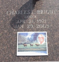
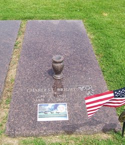
Charles Leon “Chuck” Bright
| Birth | : | 21 Apr 1921 Chanute, Neosho County, Kansas, USA |
| Death | : | 29 Jan 2003 Chanute, Neosho County, Kansas, USA |
| Burial | : | Fort Smith National Cemetery, Fort Smith, Sebastian County, USA |
| Coordinate | : | 35.3838997, -94.4291992 |
| Inscription | : | I'D LIKE THE MEMORY OF ME TO BE A HAPPY ONE. I'D LIKE TO LEAVE AN AFTERGLOW OF SMILES WHEN LIFE IS DONE. I'D LIKE TO LEAVE AN ECHO WHISPERING SOFTLY DOWN THE WAYS, OF HAPPY TIMES AND LAUGHING TIMES, AND B |
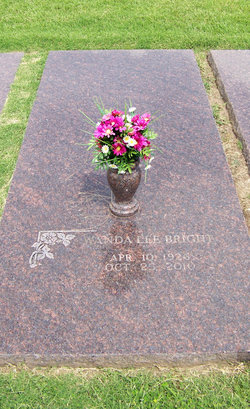
| Description | : | Published Jan. 30, 2003 - Chanute, KS Charles L. "Chuck" Bright, 81, passed away Wednesday, January 29, 2003 at his home in Chanute, Kansas. He was born April 21, 1921 in Chanute, Kansas, the son of Charles Edward Bright and Lula May (Money) Bright. He attended public schools in Chanute and remained a lifetime area resident. He served his country in the United States Army during World War II, in the 10th Infantry, serving in the European Theatres of Normandy, Northern and Southern France, Rhineland, and the Ardennes. Chuck received the Purple Heart with One Bronze Oak Leaf Cluster. On October 18, 1941 he married Wanda... Read More |
frequently asked questions (FAQ):
-
Where is Charles Leon “Chuck” Bright's memorial?
Charles Leon “Chuck” Bright's memorial is located at: Fort Smith National Cemetery, Fort Smith, Sebastian County, USA.
-
When did Charles Leon “Chuck” Bright death?
Charles Leon “Chuck” Bright death on 29 Jan 2003 in Chanute, Neosho County, Kansas, USA
-
Where are the coordinates of the Charles Leon “Chuck” Bright's memorial?
Latitude: 35.3838997
Longitude: -94.4291992
Family Members:
Parent
Spouse
Siblings
Flowers:
Nearby Cemetories:
1. Fort Smith National Cemetery
Fort Smith, Sebastian County, USA
Coordinate: 35.3838997, -94.4291992
2. Saint John Episcopal Church Columbarium
Fort Smith, Sebastian County, USA
Coordinate: 35.3895490, -94.4234350
3. Immaculate Conception Catholic Columbarium
Fort Smith, Sebastian County, USA
Coordinate: 35.3828960, -94.4184930
4. First Presbyterian Church Columbarium
Fort Smith, Sebastian County, USA
Coordinate: 35.3849900, -94.4182700
5. First United Methodist Church Columbarium
Fort Smith, Sebastian County, USA
Coordinate: 35.3834560, -94.4150440
6. Jewish Cemetery
Fort Smith, Sebastian County, USA
Coordinate: 35.3757000, -94.4176000
7. Calvary Cemetery
Fort Smith, Sebastian County, USA
Coordinate: 35.3764000, -94.4167023
8. Goddard United Methodistb Church Columbarium
Fort Smith, Sebastian County, USA
Coordinate: 35.3720830, -94.4129730
9. Oak Cemetery
Fort Smith, Sebastian County, USA
Coordinate: 35.3694000, -94.4017029
10. Christ the King Catholic Church Columbarium
Fort Smith, Sebastian County, USA
Coordinate: 35.3641970, -94.4045960
11. Saint Bartholomew Episcopal Church Garden
Fort Smith, Sebastian County, USA
Coordinate: 35.3571380, -94.3945150
12. Saint Scholastica Cemetery
Fort Smith, Sebastian County, USA
Coordinate: 35.3700890, -94.3842790
13. Woodlawn Memorial Park
Fort Smith, Sebastian County, USA
Coordinate: 35.3443300, -94.4329000
14. Stromberg Family Cemetery
Fort Smith, Sebastian County, USA
Coordinate: 35.3392160, -94.4309880
15. Rose Lawn Park Cemetery
Fort Smith, Sebastian County, USA
Coordinate: 35.3917007, -94.3700027
16. RoseLawn Park Columbarium
Fort Smith, Sebastian County, USA
Coordinate: 35.3917000, -94.3700000
17. Holy Cross Cemetery
Fort Smith, Sebastian County, USA
Coordinate: 35.3978004, -94.3685989
18. Washington Cemetery
Fort Smith, Sebastian County, USA
Coordinate: 35.4095980, -94.3713360
19. Falconer Cemetery
Fort Smith, Sebastian County, USA
Coordinate: 35.3374810, -94.3939300
20. Elmwood Cemetery
Fort Smith, Sebastian County, USA
Coordinate: 35.3276430, -94.4112720
21. Nolon Springs Cemetery
Fort Smith, Sebastian County, USA
Coordinate: 35.4291992, -94.3843994
22. Forest Park Cemetery
Fort Smith, Sebastian County, USA
Coordinate: 35.4261017, -94.3719025
23. Dora Cemetery
Van Buren, Crawford County, USA
Coordinate: 35.4493350, -94.4394630
24. Shady Grove Baptist Church Cemetery
Muldrow, Sequoyah County, USA
Coordinate: 35.3947100, -94.5135400

