
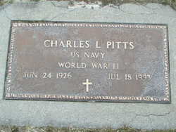
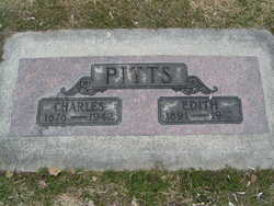
Charles Leroy Pitts
| Birth | : | 24 Jun 1926 Chelan, Chelan County, Washington, USA |
| Death | : | 18 Jul 1993 Chelan, Chelan County, Washington, USA |
| Burial | : | Westfield Township Cemetery, Westfield, Plymouth County, USA |
| Coordinate | : | 42.7510986, -96.5914001 |
| Plot | : | South Fraternal Row24 STBLK21 LS6 |
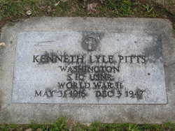
| Inscription | : | US NAVY WW II |
| Description | : | CHARLES LEROY PITTS - Tuesday - July 20, 1993 CHELAN _ Charles Leroy Pitts, 67, a longtime resident of Chelan, died Sunday, July 18, 1993, at his home, following an extended illness. He was born June 24, 1926, on Chelan Butte, the son of Charles and Edith (Fowler) Pitts. He attended schools at Lakeside. Mr. Pitts served with the U.S. Navy during World War II. Following his discharge, he lived in Northern California, where he worked as a truck driver in the logging industry. He married Jean Parrott on May 28, 1967, in Arcata, Calif. They moved to Chelan in 1976,... Read More |
frequently asked questions (FAQ):
-
Where is Charles Leroy Pitts's memorial?
Charles Leroy Pitts's memorial is located at: Westfield Township Cemetery, Westfield, Plymouth County, USA.
-
When did Charles Leroy Pitts death?
Charles Leroy Pitts death on 18 Jul 1993 in Chelan, Chelan County, Washington, USA
-
Where are the coordinates of the Charles Leroy Pitts's memorial?
Latitude: 42.7510986
Longitude: -96.5914001
Family Members:
Parent

Siblings
Flowers:


Nearby Cemetories:
1. Westfield Township Cemetery
Westfield, Plymouth County, USA
Coordinate: 42.7510986, -96.5914001
2. Mills Family Cemetery
Westfield, Plymouth County, USA
Coordinate: 42.7188460, -96.6019280
3. Richland Cemetery
Richland, Union County, USA
Coordinate: 42.7682991, -96.6624985
4. Gores Bluff Cemetery
Union County, USA
Coordinate: 42.8035069, -96.6260468
5. Saint Patricks Cemetery
Akron, Plymouth County, USA
Coordinate: 42.8232300, -96.5374800
6. Saint Paul Cemetery
Elk Point, Union County, USA
Coordinate: 42.7641983, -96.7061005
7. Union County Poor Farm Cemetery
Union County, USA
Coordinate: 42.7649210, -96.7077580
8. Riverside Cemetery
Akron, Plymouth County, USA
Coordinate: 42.8367004, -96.5453033
9. First Brule Creek Cemetery
Elk Point, Union County, USA
Coordinate: 42.7943993, -96.7069016
10. Elk Point Cemetery
Elk Point, Union County, USA
Coordinate: 42.6794586, -96.6794586
11. Saint Joseph Cemetery
Elk Point, Union County, USA
Coordinate: 42.6794014, -96.6797028
12. Brule Creek Cemetery
Spink Township, Union County, USA
Coordinate: 42.8346510, -96.7324350
13. Mount Hope Cemetery
Union County, USA
Coordinate: 42.8885994, -96.5667038
14. Union Creek Cemetery
Union County, USA
Coordinate: 42.8911018, -96.5863037
15. Pleasant Valley Cemetery
Adaville, Plymouth County, USA
Coordinate: 42.7494011, -96.4005966
16. Pleasant Hill Cemetery
Spink, Union County, USA
Coordinate: 42.8741000, -96.6876000
17. Ahlsborg Lutheran Cemetery
Union County, USA
Coordinate: 42.8228000, -96.7612000
18. Pleasant Hill Cemetery Old
Spink, Union County, USA
Coordinate: 42.8588462, -96.7215592
19. Saint Peters Cemetery
Jefferson, Union County, USA
Coordinate: 42.6045799, -96.5594025
20. Hancock Township Cemetery
Millnerville, Plymouth County, USA
Coordinate: 42.6124970, -96.4813510
21. Saint Joseph Cemetery
Johnson Township, Plymouth County, USA
Coordinate: 42.7416992, -96.3707962
22. Dowlin Cemetery
Burbank, Clay County, USA
Coordinate: 42.7789001, -96.8107986
23. Elmwood Cemetery
Elk Point, Union County, USA
Coordinate: 42.6036700, -96.6881900
24. Dewitt Cemetery
Ponca, Dixon County, USA
Coordinate: 42.6248000, -96.7437500