

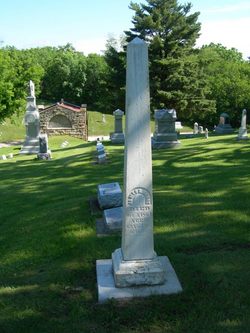
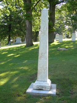
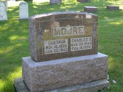
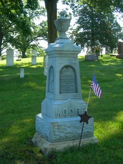
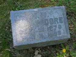
Charles O. Moore
| Birth | : | 30 Mar 1845 Belvidere, Boone County, Illinois, USA |
| Death | : | 16 Feb 1936 Decorah, Winneshiek County, Iowa, USA |
| Burial | : | St. Margaret's Churchyard, Drayton, Broadland District, England |
| Coordinate | : | 52.6773010, 1.2241980 |
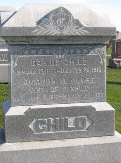
| Description | : | Obituary text from the Decorah Public Opinion, February 20, 1936 (submitted by Norman Hjelmeland): Charles O. Moore, one of Winneshiek County's well known and beloved pioneers passed away on Sunday morning, Feb 16 at 10:15 o'clock at his farm home in Decorah township about two miles N.W. of Decorah. He had been in failing health for the past four weeks. He passed away on the same farm that his father pre-empted from the government in 1850, when he and his wife came from Illinois more than 85 years ago. Mr. Moore was born in Belvidere, Boone County, Illinois March 30 1845... Read More |
frequently asked questions (FAQ):
-
Where is Charles O. Moore's memorial?
Charles O. Moore's memorial is located at: St. Margaret's Churchyard, Drayton, Broadland District, England.
-
When did Charles O. Moore death?
Charles O. Moore death on 16 Feb 1936 in Decorah, Winneshiek County, Iowa, USA
-
Where are the coordinates of the Charles O. Moore's memorial?
Latitude: 52.6773010
Longitude: 1.2241980
Family Members:
Parent
Spouse
Siblings
Children
Flowers:


Nearby Cemetories:
1. St. Margaret's Churchyard
Drayton, Broadland District, England
Coordinate: 52.6773010, 1.2241980
2. St. Edmund's Churchyard
Costessey, South Norfolk District, England
Coordinate: 52.6660400, 1.2183410
3. St. Edmund's Churchyard
Taverham, Broadland District, England
Coordinate: 52.6789990, 1.1949460
4. Costessey Baptist Churchyard
Costessey, South Norfolk District, England
Coordinate: 52.6600122, 1.2116993
5. Our Lady & St. Walstan Churchyard
Costessey, South Norfolk District, England
Coordinate: 52.6583200, 1.2119300
6. All Saints Churchyard
Horsford, Broadland District, England
Coordinate: 52.6913720, 1.2494360
7. Costessey Parish Cemetery
Costessey, South Norfolk District, England
Coordinate: 52.6495927, 1.2040157
8. St. Mary's New Burial Ground
Hellesdon, Broadland District, England
Coordinate: 52.6495480, 1.2520370
9. Horsham St. Faith cemetery
Horsham St Faith, Broadland District, England
Coordinate: 52.6870250, 1.2758110
10. St. Mary's Churchyard
Hellesdon, Broadland District, England
Coordinate: 52.6486720, 1.2515280
11. St Margaret Churchyard
Felthorpe, Broadland District, England
Coordinate: 52.7099700, 1.2105700
12. St. Mary and St. Andrew Churchyard
Horsham St Faith, Broadland District, England
Coordinate: 52.6880970, 1.2771330
13. Horsham St. Faith Priory
Horsham St Faith, Broadland District, England
Coordinate: 52.6888310, 1.2783290
14. St Faith Crematorium
Horsham St Faith, Broadland District, England
Coordinate: 52.6967970, 1.2817680
15. Baptist Chapel Churchyard
Felthorpe, Broadland District, England
Coordinate: 52.7150000, 1.2008950
16. St Michael's Church
Bowthorpe, City of Norwich, England
Coordinate: 52.6359300, 1.2163600
17. St. Peter's Churchyard
Ringland, Broadland District, England
Coordinate: 52.6822900, 1.1552400
18. Old Catton Churchyard
Norwich, City of Norwich, England
Coordinate: 52.6627000, 1.2969770
19. St. Margaret's Churchyard
Catton, Broadland District, England
Coordinate: 52.6626280, 1.2970190
20. St. Bartholomew's Churchyard Heigham
Norwich, City of Norwich, England
Coordinate: 52.6401560, 1.2743680
21. St. Mary's Churchyard
Earlham, City of Norwich, England
Coordinate: 52.6280416, 1.2353034
22. St. Peter's Churchyard
Easton, South Norfolk District, England
Coordinate: 52.6543660, 1.1478070
23. St. Andrew Churchyard
Colney, South Norfolk District, England
Coordinate: 52.6253800, 1.2206100
24. St. Mary and St. Walstan Churchyard
Bawburgh, South Norfolk District, England
Coordinate: 52.6327480, 1.1796530