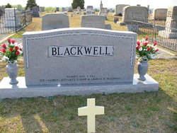
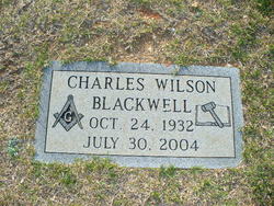
Charles Wilson Blackwell
| Birth | : | 24 Oct 1932 Jonesville, Union County, South Carolina, USA |
| Death | : | 30 Jul 2004 Spartanburg County, South Carolina, USA |
| Burial | : | Riverside Cemetery, Riceville, Mitchell County, USA |
| Coordinate | : | 43.3676834, -92.5576324 |
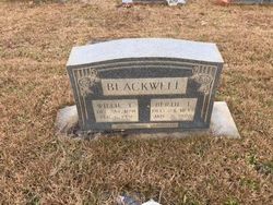
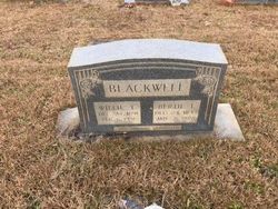
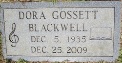
| Description | : | JONESVILLE — Charles Wilson Blackwell, 71, of 440 Pacolet St., Jonesville, husband of Dora Gossett Blackwell, died Friday, July 30, 2004, at 1:58 a.m. in Spartanburg Regional Medical Center after a brief illness. Mr. Blackwell was born in Jonesville on Oct. 24, 1932, a son of the late William Thomas Blackwell and Bertie Ivey Blackwell. He was a 1950 graduate of Jonesville High School and received his associate's degree from USC-Union. He was retired owner and operator of Upstate Timber Co. of Hickory Grove. Since 1995 he had served as Union County Magistrate and was currently serving as chief magistrate of... Read More |
frequently asked questions (FAQ):
-
Where is Charles Wilson Blackwell's memorial?
Charles Wilson Blackwell's memorial is located at: Riverside Cemetery, Riceville, Mitchell County, USA.
-
When did Charles Wilson Blackwell death?
Charles Wilson Blackwell death on 30 Jul 2004 in Spartanburg County, South Carolina, USA
-
Where are the coordinates of the Charles Wilson Blackwell's memorial?
Latitude: 43.3676834
Longitude: -92.5576324
Family Members:
Parent
Spouse
Siblings
Flowers:
Nearby Cemetories:
1. Calvary Cemetery
Riceville, Mitchell County, USA
Coordinate: 43.3497009, -92.5550003
2. Saint Peters Lutheran Cemetery
Riceville, Mitchell County, USA
Coordinate: 43.3163986, -92.5547028
3. Wayne Cemetery
McIntire, Mitchell County, USA
Coordinate: 43.4411011, -92.5744019
4. Beaver Creek Cemetery
Brownville, Mitchell County, USA
Coordinate: 43.3397217, -92.6727829
5. Robbins Cemetery
David (historical), Mitchell County, USA
Coordinate: 43.4150009, -92.6718979
6. Reckner Cemetery
Howard County, USA
Coordinate: 43.2743988, -92.5152969
7. Saint Peters Cemetery
New Haven, Mitchell County, USA
Coordinate: 43.2858315, -92.6427765
8. Saratoga Township Cemetery
Saratoga, Howard County, USA
Coordinate: 43.3710000, -92.4023000
9. Saint Pauls Lutheran Church Cemetery
Maple Leaf, Howard County, USA
Coordinate: 43.3217000, -92.4082000
10. Liberty Cemetery
Little Cedar, Mitchell County, USA
Coordinate: 43.3856010, -92.7230988
11. Saint Patricks Church Cemetery
McIntire, Mitchell County, USA
Coordinate: 43.4771996, -92.6508026
12. Sacred Heart Cemetery
Meyer, Mitchell County, USA
Coordinate: 43.4583282, -92.7011108
13. Calvary Cemetery
Elma, Howard County, USA
Coordinate: 43.2522011, -92.4421997
14. Howard Cemetery
Elma, Howard County, USA
Coordinate: 43.2517014, -92.4372025
15. Saint Patricks Cemetery
Howard County, USA
Coordinate: 43.2200012, -92.5149994
16. Le Roy Cemetery
Le Roy, Mower County, USA
Coordinate: 43.5214005, -92.5227966
17. Saint Patricks Cemetery
Le Roy, Mower County, USA
Coordinate: 43.5217018, -92.5207977
18. Le Roy Lutheran Cemetery
Le Roy, Mower County, USA
Coordinate: 43.5217750, -92.5196340
19. Chester Hill Cemetery
Chester, Howard County, USA
Coordinate: 43.4897003, -92.4072037
20. Stillwater Cemetery
Orchard, Mitchell County, USA
Coordinate: 43.2130585, -92.6780624
21. Visitation Catholic Cemetery
Stacyville, Mitchell County, USA
Coordinate: 43.4430618, -92.7813873
22. Stacyville Cemetery
Stacyville, Mitchell County, USA
Coordinate: 43.4294014, -92.7908020
23. Sacred Heart Cemetery
Osage, Mitchell County, USA
Coordinate: 43.2742004, -92.7917023
24. Calvary Cemetery
Alta Vista, Chickasaw County, USA
Coordinate: 43.1983520, -92.4241590


