| Birth | : | 18 Jan 1873 Leesville, Carroll County, Ohio, USA |
| Death | : | 28 May 1953 Canton, Stark County, Ohio, USA |
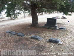
| Burial | : | Leesville Cemetery, Leesville, Carroll County, USA |
| Coordinate | : | 40.4550018, -81.2114029 |
| Description | : | Daughter of Peter Perrine and Nancy Jane May. Married William Baker Thompson on 16 Feb 1890 in Harrison County, Ohio. Clara and William were the parents of four children. |
frequently asked questions (FAQ):
-
Where is Clara Belle Perrine Thompson's memorial?
Clara Belle Perrine Thompson's memorial is located at: Leesville Cemetery, Leesville, Carroll County, USA.
-
When did Clara Belle Perrine Thompson death?
Clara Belle Perrine Thompson death on 28 May 1953 in Canton, Stark County, Ohio, USA
-
Where are the coordinates of the Clara Belle Perrine Thompson's memorial?
Latitude: 40.4550018
Longitude: -81.2114029
Family Members:
Parent
Spouse
Siblings
Children
Flowers:
Nearby Cemetories:
1. Leesville Cemetery
Leesville, Carroll County, USA
Coordinate: 40.4550018, -81.2114029
2. New Hagerstown Cemetery
New Hagerstown, Carroll County, USA
Coordinate: 40.4446983, -81.1893997
3. Longview Cemetery
Bowerston, Harrison County, USA
Coordinate: 40.4324989, -81.1872025
4. Tunnel Hill Cemetery
Bowerston, Harrison County, USA
Coordinate: 40.4213982, -81.2238998
5. Veteran's Grave
Orange Township, Carroll County, USA
Coordinate: 40.4931470, -81.2003677
6. Swinehart Cemetery
Carroll County, USA
Coordinate: 40.4327000, -81.1642170
7. Bethel Cemetery
Leavittsville, Carroll County, USA
Coordinate: 40.4921989, -81.1841965
8. Sherrodsville Cemetery
Sherrodsville, Carroll County, USA
Coordinate: 40.4836006, -81.2544022
9. Saint Francis Catholic Cemetery
Sherrodsville, Carroll County, USA
Coordinate: 40.4951920, -81.2349170
10. Heller Cemetery
Bowerston, Harrison County, USA
Coordinate: 40.4089012, -81.2043991
11. Roby Cemetery
Sherrodsville, Carroll County, USA
Coordinate: 40.5028000, -81.2382965
12. Sherrodsville Memorial Gardens Cemetery
Sherrodsville, Carroll County, USA
Coordinate: 40.4852982, -81.2675018
13. Mount Tabor Cemetery
Carroll County, USA
Coordinate: 40.4817009, -81.1483002
14. Price-Rollins Cemetery
Carroll County, USA
Coordinate: 40.5088997, -81.1956024
15. Mount Olive Cemetery
Carroll County, USA
Coordinate: 40.4488983, -81.1382980
16. Palermo Cemetery
Carroll County, USA
Coordinate: 40.4894444, -81.1522220
17. Leavittsville Cemetery
Leavittsville, Carroll County, USA
Coordinate: 40.5133018, -81.1967010
18. Conotton Cemetery
Harrison County, USA
Coordinate: 40.4103012, -81.1489029
19. Pleasant Valley Cemetery
Dennison, Tuscarawas County, USA
Coordinate: 40.4152800, -81.2858300
20. Zion Cemetery
Sherrodsville, Carroll County, USA
Coordinate: 40.5208015, -81.2518997
21. Boone Family Cemetery
Tuscarawas County, USA
Coordinate: 40.4112100, -81.2899700
22. Plum Run Cemetery
Bowerston, Harrison County, USA
Coordinate: 40.3819008, -81.2294006
23. Plum Run Hill Top Cemetery
Harrison County, USA
Coordinate: 40.3814011, -81.2324982
24. Roxford Church Cemetery
Tuscarawas County, USA
Coordinate: 40.4703400, -81.3087200


