
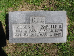
| Birth | : | 1876 Wapello County, Iowa, USA |
| Death | : | 30 Jul 1947 Ottumwa, Wapello County, Iowa, USA |
| Burial | : | Martin Cemetery, Webster County, USA |
| Coordinate | : | 40.0606003, -98.4518967 |
| Plot | : | Prospect Hill-Lot 110 |
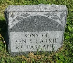
| Inscription | : | McFarland Father Cyrus B. 1869-1960 Mother Carrie M. 1876-1947 |
| Description | : | The following obituary appeared in the Ottumwa newspaper in August, 1947 and was generously researched and provided by findagrave contributor dtruitt. "Mrs. Carrie M. McFarland Mrs. Carrie M. McFarland, 71, wife of C. B. McFarland, Ottumwa route 6, died at 2 p.m. Wednesday at Ottumwa hospital. The daughter of Joseph and Tramanda Gee, she was born on a farm in Green township, where she resided during her entire life. She was married to C. B. McFarland August 2, 1891. Besides her husband, she is survived... Read More |
frequently asked questions (FAQ):
-
Where is Clara Melissa “Carrie” Gee McFarland's memorial?
Clara Melissa “Carrie” Gee McFarland's memorial is located at: Martin Cemetery, Webster County, USA.
-
When did Clara Melissa “Carrie” Gee McFarland death?
Clara Melissa “Carrie” Gee McFarland death on 30 Jul 1947 in Ottumwa, Wapello County, Iowa, USA
-
Where are the coordinates of the Clara Melissa “Carrie” Gee McFarland's memorial?
Latitude: 40.0606003
Longitude: -98.4518967
Family Members:
Parent

Spouse
Siblings
Children
Flowers:


Nearby Cemetories:
1. Wagoner Cemetery
Red Cloud, Webster County, USA
Coordinate: 40.0307999, -98.4488983
2. Amboy Cemetery
Amboy, Webster County, USA
Coordinate: 40.1003150, -98.4297540
3. Pleasant Hill Cemetery
Webster County, USA
Coordinate: 40.1178017, -98.4250031
4. Red Cloud Cemetery
Red Cloud, Webster County, USA
Coordinate: 40.0806961, -98.5270920
5. Sacred Heart Cemetery
Red Cloud, Webster County, USA
Coordinate: 40.0807300, -98.5286700
6. Murphy Cemetery
Red Cloud, Webster County, USA
Coordinate: 40.0744019, -98.5522003
7. Gust Cemetery
Webster County, USA
Coordinate: 40.0172005, -98.5421982
8. Maple Grove Cemetery
Guide Rock, Webster County, USA
Coordinate: 40.0106010, -98.3482971
9. Miner Ranch Cemetery
Red Cloud, Webster County, USA
Coordinate: 40.0774500, -98.5733500
10. Highland Cemetery
Jewell County, USA
Coordinate: 39.9660988, -98.4300003
11. Northbranch Friends Cemetery
Northbranch, Jewell County, USA
Coordinate: 39.9728300, -98.3708300
12. Guide Rock Cemetery
Guide Rock, Webster County, USA
Coordinate: 40.0811005, -98.3125000
13. Cowles Cemetery
Cowles, Webster County, USA
Coordinate: 40.1755000, -98.4425000
14. Webb Hill Cemetery
Lebanon, Smith County, USA
Coordinate: 39.9520200, -98.5045200
15. Old Highland Township Cemetery
Jewell County, USA
Coordinate: 39.9430600, -98.4458900
16. Columbia Cemetery
Guide Rock, Webster County, USA
Coordinate: 40.0499992, -98.2932968
17. Mount Pleasant Cemetery
Webster County, USA
Coordinate: 40.0491982, -98.6125031
18. Thompson Cemetery
Webster County, USA
Coordinate: 40.1761000, -98.3779000
19. Mount Hope Cemetery
Lebanon, Smith County, USA
Coordinate: 39.9721800, -98.5799700
20. Monia Cemetery
Webster County, USA
Coordinate: 40.1605988, -98.3296967
21. Conservative Friends Cemetery
Jewell County, USA
Coordinate: 39.9448800, -98.3527500
22. Amity Cemetery
Jewell County, USA
Coordinate: 39.9153170, -98.4673780
23. Walnut Creek Friends Cemetery
Northbranch, Jewell County, USA
Coordinate: 39.9298800, -98.3436400
24. Emmanuel Lutheran Cemetery
Webster County, USA
Coordinate: 40.2057991, -98.3728027