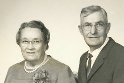
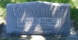
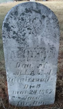
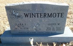
Clarence Everett Wintermote
| Birth | : | 2 Aug 1897 Nebraska, USA |
| Death | : | 24 Jul 1968 Nebraska, USA |
| Burial | : | Fort Bayard National Cemetery, Fort Bayard, Grant County, USA |
| Coordinate | : | 32.7989006, -108.1541977 |
| Plot | : | Block A, Lot 28 |
| Description | : | Chambers: Funeral services for C. E. Wintermote were conducted on Saturday afternoon at 2:00 p.m. on July 27th, 1968 in the Memorial Baptist Church, by the Pastor Rev. Earl F. Schwank, using as his message: "The Uncertainty of Life," James 4:13-15, and John 3:14-21 as accompanying scripture. Music was furnished by Miss Kathy Taylor at the organ and who also accompanied a Young Peoples Quartette comprised of the Misses Judy and Jane Garwood, David and William Schwenk singing two hymns, "When the Roll is Called Up Yonder" and "Beyond the Sunset." Ushers were William Turner and George... Read More |
frequently asked questions (FAQ):
-
Where is Clarence Everett Wintermote's memorial?
Clarence Everett Wintermote's memorial is located at: Fort Bayard National Cemetery, Fort Bayard, Grant County, USA.
-
When did Clarence Everett Wintermote death?
Clarence Everett Wintermote death on 24 Jul 1968 in Nebraska, USA
-
Where are the coordinates of the Clarence Everett Wintermote's memorial?
Latitude: 32.7989006
Longitude: -108.1541977
Family Members:
Parent
Spouse
Siblings
Children
Flowers:
Nearby Cemetories:
1. Fort Bayard Memorial Cemetery
Fort Bayard, Grant County, USA
Coordinate: 32.7907000, -108.1565000
2. Santa Clara Cemetery
Central, Grant County, USA
Coordinate: 32.7701920, -108.1530590
3. Vanadium Cemetery
Vanadium, Grant County, USA
Coordinate: 32.7820000, -108.1100000
4. Hanover Cemetery
Hanover, Grant County, USA
Coordinate: 32.8063000, -108.0893000
5. Bayard Cemetery
Bayard, Grant County, USA
Coordinate: 32.7403620, -108.1326270
6. Fierro Cemetery
Fierro, Grant County, USA
Coordinate: 32.8436012, -108.0755997
7. Santa Rita Cemetery #4
Santa Rita, Grant County, USA
Coordinate: 32.8137200, -108.0576200
8. Santa Rita #4
Santa Rita (Noriega y Anexo), Santa Bárbara Municipality, Mexico
Coordinate: 32.8136425, -108.0571579
9. Pinos Altos Community Cemetery
Pinos Altos, Grant County, USA
Coordinate: 32.8672791, -108.2173004
10. Memory Lane Cemetery
Silver City, Grant County, USA
Coordinate: 32.7830000, -108.2570000
11. Hurley Cemetery
Hurley, Grant County, USA
Coordinate: 32.6885986, -108.1363983
12. Masonic Cemetery
Silver City, Grant County, USA
Coordinate: 32.7572972, -108.2812361
13. Saint Vincent de Paul Catholic Cemetery
Silver City, Grant County, USA
Coordinate: 32.7572861, -108.2812361
14. Georgetown Cemetery
Silver City, Grant County, USA
Coordinate: 32.8405991, -108.0147018
15. Peace of the Wilderness Cemetery
Silver City, Grant County, USA
Coordinate: 32.8682050, -108.2875500
16. Hicks Cemetery
Grant County, USA
Coordinate: 32.9103012, -108.0044022
17. San Lorenzo Cemetery
San Lorenzo, Grant County, USA
Coordinate: 32.7910270, -107.9205040
18. San Juan Catholic Cemetery
Grant County, USA
Coordinate: 32.7647705, -107.9098969
19. Pine Cienega Cemetery
Grant County, USA
Coordinate: 32.6226050, -108.3039090
20. Perrault Ranch Cemetery
Sherman, Grant County, USA
Coordinate: 32.7493770, -107.8935000
21. Savannah Cemetery
Tyrone, Grant County, USA
Coordinate: 32.6443000, -108.3568000
22. Coleson's Crossing Cemetery
Dwyer, Grant County, USA
Coordinate: 32.5682540, -107.9522090
23. Dwyer Cemetery
Dwyer, Grant County, USA
Coordinate: 32.6231600, -107.8792400
24. Foster Cemetery
Luna County, USA
Coordinate: 32.5862410, -107.9062660

