Clark Dillon Dodge
| Birth | : | 13 Mar 1894 Normal, McLean County, Illinois, USA |
| Death | : | 1 Jul 1971 Olympia, Thurston County, Washington, USA |
| Burial | : | West Park Cemetery, Hereford, Deaf Smith County, USA |
| Coordinate | : | 34.8210983, -102.4206009 |
| Plot | : | Section 1 Block 26 Lot 3 Grave 1 |
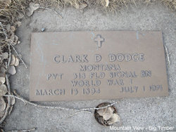
| Inscription | : | Montana PVT 318 FLD SIGNAL BN WWI |
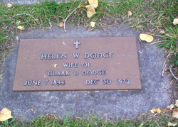
| Description | : | He was the son of James Edward Dodge, Jr. and Mabel A Dillion Big Timber Pioneer, July 8, 1971 Committal serves were held Tuesday, July 6 at Mountain View Cemetery in Big Timber for Clark D. Dodge, 77, who died at his home in Olympia, Washington on July 1. Funeral services were held Saturday in Olympia. The deceased was born March 15, 1894, at Normal, Illinois,. He later moved to Billings, Montana where he married Helen Woolsey on April 29, 1919. He was a veteran of World War I. Mr. Dodge had been employed by the Bell Telephone Company for... Read More |
frequently asked questions (FAQ):
-
Where is Clark Dillon Dodge's memorial?
Clark Dillon Dodge's memorial is located at: West Park Cemetery, Hereford, Deaf Smith County, USA.
-
When did Clark Dillon Dodge death?
Clark Dillon Dodge death on 1 Jul 1971 in Olympia, Thurston County, Washington, USA
-
Where are the coordinates of the Clark Dillon Dodge's memorial?
Latitude: 34.8210983
Longitude: -102.4206009
Family Members:
Nearby Cemetories:
1. West Park Cemetery
Hereford, Deaf Smith County, USA
Coordinate: 34.8210983, -102.4206009
2. Saint Thomas Episcopal Church Columbarium
Hereford, Deaf Smith County, USA
Coordinate: 34.8217660, -102.4133190
3. Saint Anthonys Cemetery
Hereford, Deaf Smith County, USA
Coordinate: 34.8327600, -102.4100700
4. Rest Lawn Cemetery
Hereford, Deaf Smith County, USA
Coordinate: 34.8643990, -102.4049988
5. Hereford Italian POW Camp Chapel Grounds
Hereford, Deaf Smith County, USA
Coordinate: 34.7458000, -102.4250000
6. Old La Plata Cemetery
Hereford, Deaf Smith County, USA
Coordinate: 34.9695880, -102.5980060
7. Westlawn Memorial Park
Dimmitt, Castro County, USA
Coordinate: 34.5380250, -102.3618610
8. Castro Memorial Gardens
Dimmitt, Castro County, USA
Coordinate: 34.5280991, -102.3197021
9. Palo Duro Wildorado
Deaf Smith County, USA
Coordinate: 35.1167700, -102.2047260
10. Holy Family Cemetery
Nazareth, Castro County, USA
Coordinate: 34.5469017, -102.1025009
11. Flagg Cemetery
Castro County, USA
Coordinate: 34.4393997, -102.3681030
12. Hart Cemetery
Hart, Castro County, USA
Coordinate: 34.3926010, -102.1346970
13. Hollene Cemetery
Hollene, Curry County, USA
Coordinate: 34.7774950, -103.0994210
14. Mitchell Cemetery
Bellview, Curry County, USA
Coordinate: 34.9150009, -103.0991974
15. Bailey County Cemetery
Muleshoe, Bailey County, USA
Coordinate: 34.2859600, -102.7661950
16. Pleasant Hill Cemetery
Pleasant Hill, Curry County, USA
Coordinate: 34.5349998, -103.0733032
17. Allen Cemetery
Quay County, USA
Coordinate: 35.0120020, -103.1381030
18. Muleshoe Memorial Park Cemetery
Muleshoe, Bailey County, USA
Coordinate: 34.2634100, -102.7851800
19. Endee Cemetery
Quay County, USA
Coordinate: 35.1453018, -103.1247025
20. Texico Cemetery
Texico, Curry County, USA
Coordinate: 34.3758011, -103.0849991
21. Boot Hill Cemetery
Quay County, USA
Coordinate: 35.0419006, -103.2397003
22. West Camp Cemetery
Bailey County, USA
Coordinate: 34.2811012, -102.9757996
23. Wayside Cemetery
Wayside, Armstrong County, USA
Coordinate: 34.7919998, -101.5466003
24. Running Water Cemetery
Edmonson, Hale County, USA
Coordinate: 34.2602710, -101.8685960


