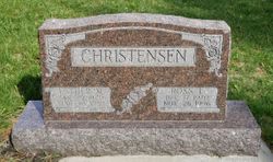
| Birth | : | 29 Sep 1905 Griswold, Cass County, Iowa, USA |
| Death | : | 15 Feb 1982 Omaha, Douglas County, Nebraska, USA |
| Burial | : | Waveland Cemetery, Pottawattamie County, USA |
| Coordinate | : | 41.1738700, -95.1881500 |
| Plot | : | 6 |
| Description | : | Clendora Rachel Scarf, daughter of Herbert Scarf and Edith Ethel Myrtle Russell, was born on September 29, 1905, in Griswold, Cass County, Iowa. She married Roswell Leonard Jim White on March 15, 1934, in Maryville, Missouri. They had nine children during their marriage. She died on February 15, 1982, in Omaha, Nebraska, at the age of 76 |
frequently asked questions (FAQ):
-
Where is Clendora Rachel Scarf White's memorial?
Clendora Rachel Scarf White's memorial is located at: Waveland Cemetery, Pottawattamie County, USA.
-
When did Clendora Rachel Scarf White death?
Clendora Rachel Scarf White death on 15 Feb 1982 in Omaha, Douglas County, Nebraska, USA
-
Where are the coordinates of the Clendora Rachel Scarf White's memorial?
Latitude: 41.1738700
Longitude: -95.1881500
Family Members:
Parent
Spouse
Siblings
Children
Flowers:
Nearby Cemetories:
1. Waveland Cemetery
Pottawattamie County, USA
Coordinate: 41.1738700, -95.1881500
2. Mercer Cemetery
Pottawattamie County, USA
Coordinate: 41.1753006, -95.1650009
3. Hillside Cemetery
Elliott, Montgomery County, USA
Coordinate: 41.1408005, -95.1544037
4. Pleasant Township Cemetery
Griswold, Cass County, USA
Coordinate: 41.2056000, -95.1370000
5. Flint Cemetery
Pottawattamie County, USA
Coordinate: 41.2289009, -95.1841965
6. Griswold Cemetery
Waveland Township, Pottawattamie County, USA
Coordinate: 41.2360992, -95.1735992
7. Center Ridge Cemetery
Montgomery County, USA
Coordinate: 41.1452141, -95.2787018
8. Lowman Cemetery
Griswold, Cass County, USA
Coordinate: 41.1594009, -95.0886002
9. Indian Graveyard
Sherman Township, Montgomery County, USA
Coordinate: 41.0955730, -95.1837580
10. L Laire Property Cemetery (Defunct)
Sherman Township, Montgomery County, USA
Coordinate: 41.0958257, -95.2224927
11. Pilot Grove Center Cemetery
Elliott, Montgomery County, USA
Coordinate: 41.1190600, -95.0993700
12. Smith Cemetery
Griswold, Cass County, USA
Coordinate: 41.2606010, -95.1453018
13. Haefflick Burial Site
Red Oak, Montgomery County, USA
Coordinate: 41.0726300, -95.1561700
14. Gomer Cemetery
Wales, Montgomery County, USA
Coordinate: 41.1171989, -95.3082962
15. Whipple Cemetery
Pottawattamie County, USA
Coordinate: 41.2882996, -95.1983032
16. Saint Clair Cemetery
Red Oak Township, Montgomery County, USA
Coordinate: 41.0598400, -95.2049810
17. Bradway Farm Cemetery
Macedonia, Pottawattamie County, USA
Coordinate: 41.2083300, -95.3336500
18. Buckner Cemetery
Wales, Montgomery County, USA
Coordinate: 41.1595600, -95.3440700
19. Wheeler Grove Cemetery
Macedonia, Pottawattamie County, USA
Coordinate: 41.2131691, -95.3393631
20. Mormon Cemetery
Macedonia, Pottawattamie County, USA
Coordinate: 41.1885986, -95.3557663
21. Pilot Grove Presbyterian Cemetery
Wallin, Montgomery County, USA
Coordinate: 41.0793991, -95.0699997
22. Saint Marys Cemetery
Red Oak, Montgomery County, USA
Coordinate: 41.0447006, -95.2275009
23. Grant Cemetery
Grant, Montgomery County, USA
Coordinate: 41.1405983, -94.9906006
24. Frankfort Cemetery
Montgomery County, USA
Coordinate: 41.0271988, -95.1327972


