COL Stanley Cope “Stan” Wood
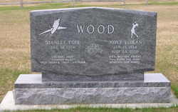
| Birth | : | 14 Dec 1929 Elmdale, Chase County, Kansas, USA |
| Death | : | 14 Sep 2020 Sun Lakes, Maricopa County, Arizona, USA |
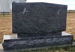
| Burial | : | Elmdale Cemetery, Elmdale, Chase County, USA |
| Coordinate | : | 38.3778000, -96.6628036 |
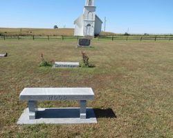
| Plot | : | West Section/East of church |
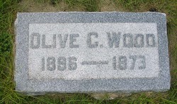
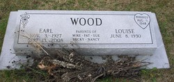
| Description | : | legacy.com Wood, Stanley Stan 12/14/1929 - 9/14/2020 Stanley Cope Wood passed away at the age of 90, on September 14, 2020, with his family by his side at his home in Sun Lakes, AZ. Stanley was born December 14, 1929 at his family home, 2 miles southwest of Elmdale, Kansas to Olive Cope Wood and Paul Bailey Wood, the fifth of six children, 3 boys and 3 girls. After attending Elmdale schools, he graduated from Kansas State College on May 27, 1951, with a Bachelor of Science degree in Agriculture Engineering and commissioned a Second Lieutenant in the... Read More |
frequently asked questions (FAQ):
-
Where is COL Stanley Cope “Stan” Wood's memorial?
COL Stanley Cope “Stan” Wood's memorial is located at: Elmdale Cemetery, Elmdale, Chase County, USA.
-
When did COL Stanley Cope “Stan” Wood death?
COL Stanley Cope “Stan” Wood death on 14 Sep 2020 in Sun Lakes, Maricopa County, Arizona, USA
-
Where are the coordinates of the COL Stanley Cope “Stan” Wood's memorial?
Latitude: 38.3778000
Longitude: -96.6628036
Family Members:
Parent
Spouse
Siblings
Flowers:
Nearby Cemetories:
1. Elmdale Cemetery
Elmdale, Chase County, USA
Coordinate: 38.3778000, -96.6628036
2. McDowall Cemetery
Strong City, Chase County, USA
Coordinate: 38.4059860, -96.6022720
3. Simmons Cemetery
Strong City, Chase County, USA
Coordinate: 38.3988991, -96.5849991
4. Lawless Cemetery
Strong City, Chase County, USA
Coordinate: 38.4496700, -96.6630200
5. Prairie Grove Cemetery
Cottonwood Falls, Chase County, USA
Coordinate: 38.3741989, -96.5639038
6. Saint Anthony Cemetery
Strong City, Chase County, USA
Coordinate: 38.4056015, -96.5547028
7. Clements Cemetery
Clements, Chase County, USA
Coordinate: 38.3040900, -96.7438800
8. Elk Cemetery
Elmdale, Chase County, USA
Coordinate: 38.4138985, -96.7844009
9. Strong Township Cemetery
Strong City, Chase County, USA
Coordinate: 38.3983002, -96.5222015
10. Ice Cemetery
Chase County, USA
Coordinate: 38.2924800, -96.7594600
11. Boenitz Cemetery
Elmdale, Chase County, USA
Coordinate: 38.5052986, -96.7016983
12. Diamond Creek Cemetery
Chase County, USA
Coordinate: 38.5071983, -96.7136002
13. Miller Cemetery
Cottonwood Falls, Chase County, USA
Coordinate: 38.3471985, -96.4916992
14. Bazaar Cemetery
Bazaar, Chase County, USA
Coordinate: 38.2717018, -96.5449982
15. Montgomery Cemetery
Chase County, USA
Coordinate: 38.3196983, -96.8364029
16. Drinkwater Cemetery
Cedar Point, Chase County, USA
Coordinate: 38.2619019, -96.8236008
17. Grant Cemetery
Marion, Marion County, USA
Coordinate: 38.3619003, -96.8843994
18. Sharps Creek Cemetery
Bazaar, Chase County, USA
Coordinate: 38.2481400, -96.5123400
19. Homestead Cemetery
Chase County, USA
Coordinate: 38.2022018, -96.6952972
20. Diamond Springs Cemetery
Diamond Springs, Morris County, USA
Coordinate: 38.5547028, -96.7410507
21. Cedar Point Cemetery
Cedar Point, Chase County, USA
Coordinate: 38.2397003, -96.8253021
22. Peyton Family Cemetery
Toledo Township, Chase County, USA
Coordinate: 38.3819210, -96.4209340
23. Griffith Cemetery
Chase County, USA
Coordinate: 38.1913986, -96.8118973
24. Harter Cemetery
Marion, Marion County, USA
Coordinate: 38.3699989, -96.9483032


