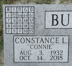
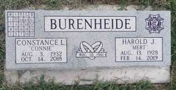
Constance L “Connie” Miller Burenheide
| Birth | : | 3 Aug 1932 Strong City, Chase County, Kansas, USA |
| Death | : | 14 Oct 2018 Emporia, Lyon County, Kansas, USA |
| Burial | : | Strong Township Cemetery, Strong City, Chase County, USA |
| Coordinate | : | 38.3983002, -96.5222015 |
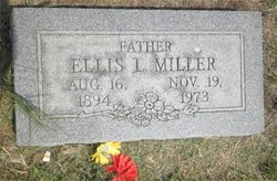
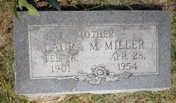
| Description | : | The Emporia Gazette, 19 Oct 2018, EMPORIA - Constance “Connie” Burenheide, 86, passed away Sunday, October 14, 2018 with her loving husband of 57 years Harold (Mert) Burenheide by her side at the Holiday Resort in Emporia. She was born August 3, 1932 in Strong City, Kansas, the daughter of Ellis and Laura Mable (Roberts) Miller. Connie was joined in marriage to Harold John Burenheide on August 8, 1961 in Miami, Oklahoma. She was a homemaker. She was a member of VFW and American Legion Auxillary. She was a member of the 6th Street McDonald’s... Read More |
frequently asked questions (FAQ):
-
Where is Constance L “Connie” Miller Burenheide's memorial?
Constance L “Connie” Miller Burenheide's memorial is located at: Strong Township Cemetery, Strong City, Chase County, USA.
-
When did Constance L “Connie” Miller Burenheide death?
Constance L “Connie” Miller Burenheide death on 14 Oct 2018 in Emporia, Lyon County, Kansas, USA
-
Where are the coordinates of the Constance L “Connie” Miller Burenheide's memorial?
Latitude: 38.3983002
Longitude: -96.5222015
Family Members:
Parent
Spouse
Siblings
Children
Flowers:
Nearby Cemetories:
1. Strong Township Cemetery
Strong City, Chase County, USA
Coordinate: 38.3983002, -96.5222015
2. Saint Anthony Cemetery
Strong City, Chase County, USA
Coordinate: 38.4056015, -96.5547028
3. Prairie Grove Cemetery
Cottonwood Falls, Chase County, USA
Coordinate: 38.3741989, -96.5639038
4. Simmons Cemetery
Strong City, Chase County, USA
Coordinate: 38.3988991, -96.5849991
5. Miller Cemetery
Cottonwood Falls, Chase County, USA
Coordinate: 38.3471985, -96.4916992
6. McDowall Cemetery
Strong City, Chase County, USA
Coordinate: 38.4059860, -96.6022720
7. Peyton Family Cemetery
Toledo Township, Chase County, USA
Coordinate: 38.3819210, -96.4209340
8. Elmdale Cemetery
Elmdale, Chase County, USA
Coordinate: 38.3778000, -96.6628036
9. Hillside Cemetery
Toledo, Chase County, USA
Coordinate: 38.4305992, -96.3741989
10. Lawless Cemetery
Strong City, Chase County, USA
Coordinate: 38.4496700, -96.6630200
11. Old Quaker Cemetery
Toledo, Chase County, USA
Coordinate: 38.4208100, -96.3693200
12. Bazaar Cemetery
Bazaar, Chase County, USA
Coordinate: 38.2717018, -96.5449982
13. Grandview Cemetery
Plymouth, Lyon County, USA
Coordinate: 38.3838997, -96.3542023
14. Sharps Creek Cemetery
Bazaar, Chase County, USA
Coordinate: 38.2481400, -96.5123400
15. Haworth Cemetery
Plymouth, Lyon County, USA
Coordinate: 38.3804207, -96.3178024
16. Boenitz Cemetery
Elmdale, Chase County, USA
Coordinate: 38.5052986, -96.7016983
17. Diamond Creek Cemetery
Chase County, USA
Coordinate: 38.5071983, -96.7136002
18. Fruitland Cemetery
Americus, Lyon County, USA
Coordinate: 38.5078011, -96.3308029
19. Cottonwood Cemetery
Emporia, Lyon County, USA
Coordinate: 38.4130096, -96.2725525
20. Clements Cemetery
Clements, Chase County, USA
Coordinate: 38.3040900, -96.7438800
21. Pleasant View Cemetery
Council Grove, Morris County, USA
Coordinate: 38.5948000, -96.5880700
22. Elk Cemetery
Elmdale, Chase County, USA
Coordinate: 38.4138985, -96.7844009
23. Four Mile Cemetery
Council Grove, Morris County, USA
Coordinate: 38.6086200, -96.5097000
24. Ice Cemetery
Chase County, USA
Coordinate: 38.2924800, -96.7594600


