

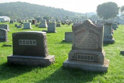
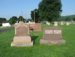
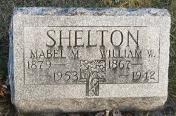
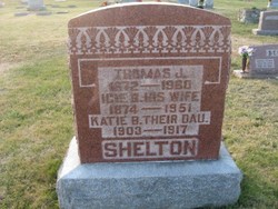
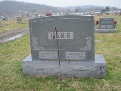
Cora Dove Shelton Roush
| Birth | : | 7 Sep 1868 Ohio, USA |
| Death | : | 2 Feb 1948 Maysville, Mason County, Kentucky, USA |
| Burial | : | Chelan Fraternal Cemetery, Chelan, Chelan County, USA |
| Coordinate | : | 47.8502998, -120.0081024 |
| Plot | : | Section 5 |
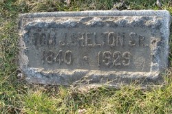
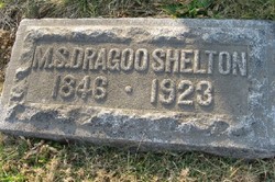
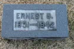
| Description | : | Daughter of Thomas Jefferson Shelton, Sr. and Susan Mary Dragoo. Mother of Harry, Ernest, Grace and Clara. |
frequently asked questions (FAQ):
-
Where is Cora Dove Shelton Roush's memorial?
Cora Dove Shelton Roush's memorial is located at: Chelan Fraternal Cemetery, Chelan, Chelan County, USA.
-
When did Cora Dove Shelton Roush death?
Cora Dove Shelton Roush death on 2 Feb 1948 in Maysville, Mason County, Kentucky, USA
-
Where are the coordinates of the Cora Dove Shelton Roush's memorial?
Latitude: 47.8502998
Longitude: -120.0081024
Family Members:
Parent
Spouse
Siblings
Children

Flowers:


Nearby Cemetories:
1. Chelan Fraternal Cemetery
Chelan, Chelan County, USA
Coordinate: 47.8502998, -120.0081024
2. Mount Olivet Cemetery
Chelan, Chelan County, USA
Coordinate: 47.8451000, -119.9946000
3. Saint Andrews Episcopal Church
Chelan, Chelan County, USA
Coordinate: 47.8397460, -120.0183780
4. Riverview Cemetery
Chelan, Chelan County, USA
Coordinate: 47.8335991, -119.9944000
5. Manson Indian Cemetery
Manson, Chelan County, USA
Coordinate: 47.8800000, -120.1300000
6. Ballard Family Cemetery
Stayman, Chelan County, USA
Coordinate: 47.7811100, -120.1133300
7. Fletcher Cemetery
Douglas County, USA
Coordinate: 47.7430992, -119.9403000
8. Brays Landing Cemetery
Douglas County, USA
Coordinate: 47.7364120, -120.1704660
9. Kummer Cemetery
Waterville, Douglas County, USA
Coordinate: 47.6559000, -120.0332000
10. Packwood Memorial Cemetery
Dyer, Douglas County, USA
Coordinate: 48.0118305, -119.8178880
11. Dick Family Cemetery
Okanogan County, USA
Coordinate: 48.0502700, -119.9241700
12. Miller Family Cemetery
Okanogan County, USA
Coordinate: 48.0530300, -119.9288000
13. Pateros Cemetery
Pateros, Okanogan County, USA
Coordinate: 48.0516600, -119.9097300
14. Waterville Cemetery
Waterville, Douglas County, USA
Coordinate: 47.6418500, -120.0685940
15. Gate of Heaven Catholic Cemetery
Waterville, Douglas County, USA
Coordinate: 47.6382100, -120.0671690
16. Douglas Lutheran Cemetery
Douglas County, USA
Coordinate: 47.6189003, -119.9614029
17. Badger Mountain View Cemetery
Douglas County, USA
Coordinate: 47.6088000, -120.0476000
18. Mansfield Cemetery
Mansfield, Douglas County, USA
Coordinate: 47.8088880, -119.6508330
19. Orondo Community Cemetery
Orondo, Douglas County, USA
Coordinate: 47.6486015, -120.2136002
20. Buckingham Cemetery
Douglas County, USA
Coordinate: 47.8669014, -119.6286011
21. Happy Home Cemetery
Farmer, Douglas County, USA
Coordinate: 47.6268997, -119.8125000
22. Methow Cemetery
Methow, Okanogan County, USA
Coordinate: 48.1102982, -120.0124969
23. Entiat Cemetery
Entiat, Chelan County, USA
Coordinate: 47.6755981, -120.3043976
24. Bridgeport Cemetery
Bridgeport, Douglas County, USA
Coordinate: 48.0050000, -119.6738800