| Birth | : | 16 Jun 1890 Vance, Orangeburg County, South Carolina, USA |
| Death | : | 18 Sep 1976 South Carolina, USA |
| Burial | : | Martin Cemetery, Larue, Benton County, USA |
| Coordinate | : | 36.3465500, -93.9484700 |
| Inscription | : | Together Forever |
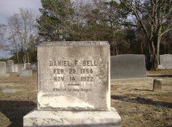
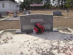
| Description | : | Daniel D. Bell, SR. of Eutawville, SC Born, June 16, 1890 in Vance, SC Died, September 18, 1976 in local hospital Funeral Service, Stuhr’s Downtown Chapel Interment, Carolina Memorial Gardens Arrangements directed by. J. Henry Stuhr’s Downtown Funeral Home Member of, Bethlehem Southern Methodist Church in Eutawville, SC Retired, Conductor Southern Railway Predeceased by; Parents, Daniel F. Bell Mrs. Madeline Smith Bell Survived by, Wife, Mrs. Erma Byrd Bell 1 Daughter, Mrs. Harold B. Nielson 1 Son, Daniel D. Bell 1 Sister, Mrs. E.P. Kellar 1 Brother, L. D. Bell 9 Grandchildren |
frequently asked questions (FAQ):
-
Where is Daniel D. Bell's memorial?
Daniel D. Bell's memorial is located at: Martin Cemetery, Larue, Benton County, USA.
-
When did Daniel D. Bell death?
Daniel D. Bell death on 18 Sep 1976 in South Carolina, USA
-
Where are the coordinates of the Daniel D. Bell's memorial?
Latitude: 36.3465500
Longitude: -93.9484700
Family Members:
Parent
Spouse
Siblings
Children
Flowers:
Nearby Cemetories:
1. Martin Cemetery
Larue, Benton County, USA
Coordinate: 36.3465500, -93.9484700
2. Webb Cemetery (Defunct)
Benton County, USA
Coordinate: 36.3544006, -93.9356003
3. Carter Cemetery (Defunct)
Benton County, USA
Coordinate: 36.3325005, -93.9072037
4. Hatfield Cemetery
Benton County, USA
Coordinate: 36.3244019, -93.9128036
5. Alpine Cemetery (Defunct)
Benton County, USA
Coordinate: 36.3558006, -93.9944000
6. Henson Cemetery (Defunct)
Benton County, USA
Coordinate: 36.3386002, -93.8917007
7. Blaylock Cemetery
Avoca, Benton County, USA
Coordinate: 36.3938700, -93.9799100
8. Ingersoll Cemetery (Defunct)
Benton County, USA
Coordinate: 36.3278008, -94.0119019
9. McReynolds Cemetery (Defunct)
Benton County, USA
Coordinate: 36.3156013, -94.0139008
10. Ozark Cemetery
Benton County, USA
Coordinate: 36.3231010, -94.0252991
11. Walnut Hill Cemetery
Brightwater, Benton County, USA
Coordinate: 36.4082985, -93.9907990
12. Key Cemetery (Defunct)
Benton County, USA
Coordinate: 36.2997017, -94.0192032
13. Rambo Cemetery
Rogers, Benton County, USA
Coordinate: 36.3027992, -93.8741989
14. Williams Cemetery (Defunct)
Prairie Creek, Benton County, USA
Coordinate: 36.3507996, -94.0436020
15. War Eagle Cemetery
Rogers, Benton County, USA
Coordinate: 36.2689018, -93.9522018
16. Williams Cemetery
Benton County, USA
Coordinate: 36.4164009, -94.0002975
17. Snoderly Cemetery
Brightwater, Benton County, USA
Coordinate: 36.4171982, -94.0010986
18. Ruddick Cemetery
Garfield, Benton County, USA
Coordinate: 36.4295000, -93.9512400
19. Union Chapel Cemetery
Garfield, Benton County, USA
Coordinate: 36.4304180, -93.9525340
20. Dean Cemetery
Benton County, USA
Coordinate: 36.4188995, -94.0211029
21. Rock Church Cemetery
War Eagle, Benton County, USA
Coordinate: 36.2750000, -93.8717000
22. Rock Cemetery
Benton County, USA
Coordinate: 36.2743988, -93.8716965
23. Liberty Cemetery
Garfield, Benton County, USA
Coordinate: 36.4389000, -94.0105972
24. Eden Bluff Cemetery
War Eagle, Benton County, USA
Coordinate: 36.2428460, -93.9217150

