
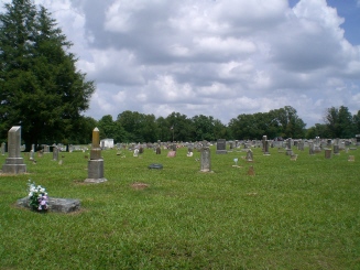
| Memorials | : | 19 |
| Location | : | Garfield, Benton County, USA |
| Coordinate | : | 36.4295000, -93.9512400 |
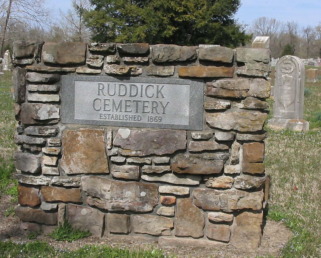
| Description | : | Please verify burials in this cemetery as it has been confused with Union Chapel Cemetery. Ruddick Cemetery is on Hwy 127, at 2.0 miles from Hwy 62, located on the left when traveling from Garfield toward Lost Bridge. |
frequently asked questions (FAQ):
-
Where is Ruddick Cemetery?
Ruddick Cemetery is located at Garfield, Benton County ,Arkansas ,USA.
-
Ruddick Cemetery cemetery's updated grave count on graveviews.com?
19 memorials
-
Where are the coordinates of the Ruddick Cemetery?
Latitude: 36.4295000
Longitude: -93.9512400
Nearby Cemetories:
1. Union Chapel Cemetery
Garfield, Benton County, USA
Coordinate: 36.4304180, -93.9525340
2. Walnut Hill Cemetery
Brightwater, Benton County, USA
Coordinate: 36.4082985, -93.9907990
3. Williams Cemetery
Benton County, USA
Coordinate: 36.4164009, -94.0002975
4. Snoderly Cemetery
Brightwater, Benton County, USA
Coordinate: 36.4171982, -94.0010986
5. Blaylock Cemetery
Avoca, Benton County, USA
Coordinate: 36.3938700, -93.9799100
6. Liberty Cemetery
Garfield, Benton County, USA
Coordinate: 36.4389000, -94.0105972
7. Bayless Cemetery
Gateway, Benton County, USA
Coordinate: 36.4831009, -93.9539032
8. Dean Cemetery
Benton County, USA
Coordinate: 36.4188995, -94.0211029
9. Reed-Trent Cemetery
Gateway, Benton County, USA
Coordinate: 36.4882800, -93.9574800
10. Clantonville Cemetery
Benton County, USA
Coordinate: 36.4813995, -93.9057999
11. Ford Cemetery
Benton County, USA
Coordinate: 36.4557991, -94.0261002
12. Roller Ridge Cemetery
Gateway, Benton County, USA
Coordinate: 36.4932700, -93.9267500
13. Pratt Cemetery
Garfield, Benton County, USA
Coordinate: 36.4375000, -94.0335999
14. Henson Jennings Cemetery
Garfield, Benton County, USA
Coordinate: 36.4373300, -94.0347000
15. Paces Chapel Cemetery
Benton County, USA
Coordinate: 36.4372940, -94.0350770
16. Webb Cemetery (Defunct)
Benton County, USA
Coordinate: 36.3544006, -93.9356003
17. Alpine Cemetery (Defunct)
Benton County, USA
Coordinate: 36.3558006, -93.9944000
18. Potts Cemetery
Garfield, Benton County, USA
Coordinate: 36.4873620, -94.0228990
19. Martin Cemetery
Larue, Benton County, USA
Coordinate: 36.3465500, -93.9484700
20. Scott Cemetery
Garfield, Benton County, USA
Coordinate: 36.4822006, -94.0314026
21. Beaver Cemetery
Seligman, Barry County, USA
Coordinate: 36.5078011, -93.9143982
22. Seligman Cemetery
Seligman, Barry County, USA
Coordinate: 36.5261002, -93.9336014
23. Twelve Corners Cemetery
Pea Ridge, Benton County, USA
Coordinate: 36.4700012, -94.0622025
24. Fuller-McClung Cemetery
Busch, Carroll County, USA
Coordinate: 36.4417000, -93.8292007