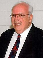
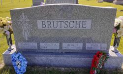
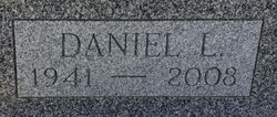
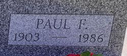
Daniel Leo Brutsche
| Birth | : | 18 Nov 1941 |
| Death | : | 21 Apr 2008 |
| Burial | : | Spring Hill Cemetery, Wellsville, Columbiana County, USA |
| Coordinate | : | 40.6062700, -80.6590000 |
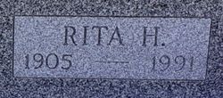
| Description | : | Daniel Leo, son of Paul and Rita (Howe) Brutsche, was born November 18, 1941, at Mercy Hospital in Des Moines, Iowa. He grew up on the family farm in Guthrie County. Dan graduated from Kuemper High School in Carroll in 1959 and continued his education at Iowa State University in Ames. He earned his Agriculture Business degree in 1963. Following graduation, he worked as a loan officer for the Federal Land Bank in eastern Nebraska and western Iowa. During this time he joined the National Guard. In 1966 he started farming in partnership with his father. On June 17, 1967,... Read More |
frequently asked questions (FAQ):
-
Where is Daniel Leo Brutsche's memorial?
Daniel Leo Brutsche's memorial is located at: Spring Hill Cemetery, Wellsville, Columbiana County, USA.
-
When did Daniel Leo Brutsche death?
Daniel Leo Brutsche death on 21 Apr 2008 in
-
Where are the coordinates of the Daniel Leo Brutsche's memorial?
Latitude: 40.6062700
Longitude: -80.6590000
Family Members:
Parent
Flowers:
Nearby Cemetories:
1. Spring Hill Cemetery
Wellsville, Columbiana County, USA
Coordinate: 40.6062700, -80.6590000
2. Saint Elizabeth Cemetery
Wellsville, Columbiana County, USA
Coordinate: 40.6077995, -80.6580963
3. Cuppy Cemetery
Wellsville, Columbiana County, USA
Coordinate: 40.5943985, -80.6766968
4. Scotch Settlement Cemetery
Wellsville, Columbiana County, USA
Coordinate: 40.6399994, -80.6393967
5. Oak Ridge Cemetery
Wellsville, Columbiana County, USA
Coordinate: 40.6119003, -80.7078018
6. Yellow Creek Presbyterian Church Cemetery
Wellsville, Columbiana County, USA
Coordinate: 40.6479988, -80.6796036
7. Shadow Lawn Memory Garden
Newell, Hancock County, USA
Coordinate: 40.6091750, -80.5990870
8. Bnai Jacob Cemetery
East Liverpool, Columbiana County, USA
Coordinate: 40.6321983, -80.6091995
9. Nessly Chapel Cemetery
Hancock County, USA
Coordinate: 40.5583000, -80.6352997
10. McKenzie Cemetery
Yellow Creek Township, Columbiana County, USA
Coordinate: 40.6319008, -80.7182999
11. Saint Aloysius Cemetery
East Liverpool, Columbiana County, USA
Coordinate: 40.6315994, -80.5944977
12. Spring Grove Cemetery
East Liverpool, Columbiana County, USA
Coordinate: 40.6342010, -80.5932999
13. Old Fifth Street Cemetery
East Liverpool, Columbiana County, USA
Coordinate: 40.6218240, -80.5860710
14. Irondale Cemetery
Irondale, Jefferson County, USA
Coordinate: 40.5753650, -80.7290040
15. Old Irondale Cemetery
Irondale, Jefferson County, USA
Coordinate: 40.5752670, -80.7292340
16. Hammondsville Cemetery
Hammondsville, Jefferson County, USA
Coordinate: 40.5530014, -80.7099991
17. Clark Family Cemetery
Wellsville, Columbiana County, USA
Coordinate: 40.6114006, -80.7478027
18. Locust Hill Cemetery
Chester, Hancock County, USA
Coordinate: 40.5914001, -80.5682983
19. Morning View Cemetery
Irondale, Jefferson County, USA
Coordinate: 40.5682983, -80.7382965
20. Riverview Cemetery
East Liverpool, Columbiana County, USA
Coordinate: 40.6389008, -80.5721970
21. Columbiana County Memorial Park
East Liverpool, Columbiana County, USA
Coordinate: 40.6643982, -80.5939026
22. Highlandtown Cemetery
Highlandtown, Columbiana County, USA
Coordinate: 40.6320000, -80.7549973
23. Chestnut Grove Cemetery
Irondale, Jefferson County, USA
Coordinate: 40.5733000, -80.7569600
24. Township Line Cemetery
East Liverpool, Columbiana County, USA
Coordinate: 40.6906013, -80.6333008

