
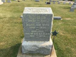


Davis B Clair
| Birth | : | 2 Feb 1839 Pennsylvania, USA |
| Death | : | 27 Dec 1913 Postville, Allamakee County, Iowa, USA |
| Burial | : | Garnavillo Community Cemetery, Garnavillo, Clayton County, USA |
| Coordinate | : | 42.8656000, -91.2422100 |
| Plot | : | Blk 2 |
| Description | : | An Ancestry Family Tree indicates that he was born in Chester, PA, but it is unknown if Chester is the city or the county. Family Members --also from Ancestry Tree Parents Philip Clair 1805 – 1858 Rachel Baum 1804 – 1875 Wife Phoebe Ellen Crosby 1840 – 1906 "U.S., Civil War Soldier Records and Profiles, 1861-1865 about Davis B Clair Name: Davis B Clair Residence: Illinois Enlistment Date: 9 Aug 1862 Rank at enlistment: Private State Served: Illinois Survived the War?: Yes Service Record: Enlisted in Company G, Illinois 92nd Infantry Regiment on 04 Sep 1862.Mustered out on 18 Feb 1863. Sources:... Read More |
frequently asked questions (FAQ):
-
Where is Davis B Clair's memorial?
Davis B Clair's memorial is located at: Garnavillo Community Cemetery, Garnavillo, Clayton County, USA.
-
When did Davis B Clair death?
Davis B Clair death on 27 Dec 1913 in Postville, Allamakee County, Iowa, USA
-
Where are the coordinates of the Davis B Clair's memorial?
Latitude: 42.8656000
Longitude: -91.2422100
Family Members:
Parent
Spouse

Siblings
Children


Flowers:


Nearby Cemetories:
1. Garnavillo Community Cemetery
Garnavillo, Clayton County, USA
Coordinate: 42.8656000, -91.2422100
2. Garnavillo Cemetery
Garnavillo, Clayton County, USA
Coordinate: 42.8660300, -91.2390100
3. Saint Joseph Cemetery
Garnavillo, Clayton County, USA
Coordinate: 42.8628006, -91.2502975
4. McClelland Cemetery
Garnavillo, Clayton County, USA
Coordinate: 42.8249879, -91.2084641
5. Pioneer Rock Cemetery
Ceres, Clayton County, USA
Coordinate: 42.8230591, -91.1863937
6. Clayton Center Cemetery
Clayton Center, Clayton County, USA
Coordinate: 42.8841705, -91.3225021
7. Zion Lutheran Cemetery
Clayton Center, Clayton County, USA
Coordinate: 42.8841705, -91.3249969
8. Clayton Cemetery
Clayton, Clayton County, USA
Coordinate: 42.9043999, -91.1641998
9. Tangeman Family Cemetery
Garnavillo, Clayton County, USA
Coordinate: 42.8580000, -91.1420000
10. Saint Michael Cemetery
Clayton County, USA
Coordinate: 42.8055992, -91.1802979
11. County Home Cemetery
Clayton Center, Clayton County, USA
Coordinate: 42.8916702, -91.3499985
12. Krumm Cemetery
Garber, Clayton County, USA
Coordinate: 42.7913760, -91.3023559
13. Colony Catholic Cemetery (Defunct)
Read Township, Clayton County, USA
Coordinate: 42.8830000, -91.3580000
14. Borcherding Cemetery
Jefferson Township, Clayton County, USA
Coordinate: 42.8182983, -91.1414032
15. National Cemetery
National, Clayton County, USA
Coordinate: 42.9536018, -91.2902985
16. Storck Cemetery
Guttenberg, Clayton County, USA
Coordinate: 42.7694335, -91.1834638
17. Harford Cemetery
Wyalusing, Grant County, USA
Coordinate: 42.9401000, -91.1401800
18. Saint Paula Cemetery
Osterdock, Clayton County, USA
Coordinate: 42.7635994, -91.1992035
19. Meenan Cemetery
Communia, Clayton County, USA
Coordinate: 42.7999862, -91.3584693
20. Norwegian Church Cemetery
McGregor, Clayton County, USA
Coordinate: 42.9644400, -91.1764100
21. Old Garber Cemetery
Garber, Clayton County, USA
Coordinate: 42.7560005, -91.2580032
22. Elkader Cemetery
Elkader, Clayton County, USA
Coordinate: 42.8541718, -91.4000015
23. Bagley Cemetery
Bagley, Grant County, USA
Coordinate: 42.9019012, -91.0907974
24. First Evangelical Lutheran Church Cemetery
McGregor, Clayton County, USA
Coordinate: 42.9718000, -91.1760000