

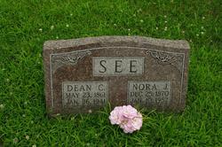
Dean Clay “Henry” See
| Birth | : | 23 May 1861 Henry County, Iowa, USA |
| Death | : | 26 Jan 1941 Gorin, Scotland County, Missouri, USA |
| Burial | : | Graceland Memorial Gardens, Milford, Clermont County, USA |
| Coordinate | : | 39.1963997, -84.1999969 |
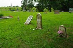
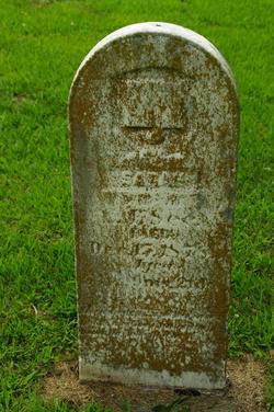
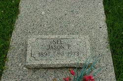
| Description | : | Gorin Man, 79, Died Sunday Dean See Would Have Been 80 Years of Age on May 23rd Henry Clay Dean See was a son of Chas. and Sarah See. He died at his home two miles south of Gorin, on Sunday, January 26, 1941, at twelve o'clock noon. He had been in failing health for a number of years and had been seriously ill the past two weeks. He was born on May 23, 1861, in Henry County, Iowa. He was united in marriage to Nora Powell, September 8, 1887 and to this union was born two children, a son, Jason See, and... Read More |
frequently asked questions (FAQ):
-
Where is Dean Clay “Henry” See's memorial?
Dean Clay “Henry” See's memorial is located at: Graceland Memorial Gardens, Milford, Clermont County, USA.
-
When did Dean Clay “Henry” See death?
Dean Clay “Henry” See death on 26 Jan 1941 in Gorin, Scotland County, Missouri, USA
-
Where are the coordinates of the Dean Clay “Henry” See's memorial?
Latitude: 39.1963997
Longitude: -84.1999969
Family Members:
Parent
Spouse
Siblings

Children
Flowers:


Nearby Cemetories:
1. Graceland Memorial Gardens
Milford, Clermont County, USA
Coordinate: 39.1963997, -84.1999969
2. Myers Cemetery
Goshen, Clermont County, USA
Coordinate: 39.2236900, -84.1836300
3. Mount Zion Cemetery
Craver, Clermont County, USA
Coordinate: 39.1613464, -84.1940231
4. Mulberry Cemetery
Milford, Clermont County, USA
Coordinate: 39.1947784, -84.2469864
5. Hill Family Cemetery
Stonelick, Clermont County, USA
Coordinate: 39.1622490, -84.1826090
6. Union Cemetery
Branch Hill, Clermont County, USA
Coordinate: 39.2152850, -84.2409180
7. Irwin Cemetery
Goshen, Clermont County, USA
Coordinate: 39.2176850, -84.1543670
8. Simpkins Family Cemetery
Williams Corners, Clermont County, USA
Coordinate: 39.1733900, -84.1532700
9. Goshen Cemetery
Goshen, Clermont County, USA
Coordinate: 39.2377300, -84.1579100
10. Olive Cemetery
Stonelick Township, Clermont County, USA
Coordinate: 39.1563988, -84.1552963
11. Brown Family Cemetery
Top-of-the-Ridge, Clermont County, USA
Coordinate: 39.1968980, -84.2695320
12. Ranson Family Cemetery
Top-of-the-Ridge, Clermont County, USA
Coordinate: 39.2077220, -84.2719890
13. Concord Methodist Episcopal Cemetery
Sundale, Clermont County, USA
Coordinate: 39.2318820, -84.2599380
14. Jewish Cemeteries of Greater Cincinnati – Loveland
Loveland, Clermont County, USA
Coordinate: 39.2281970, -84.2641830
15. Stouder Cemetery
Goshen Township, Clermont County, USA
Coordinate: 39.2312700, -84.1335700
16. Greenlawn Cemetery
Milford, Clermont County, USA
Coordinate: 39.1706009, -84.2758026
17. Rapp Cemetery
Belfast, Clermont County, USA
Coordinate: 39.1434900, -84.1529200
18. Perintown United Methodist Church Cemetery
Perintown, Clermont County, USA
Coordinate: 39.1374512, -84.2339783
19. Plainview Cemetery
Newtonsville, Clermont County, USA
Coordinate: 39.1796989, -84.1177979
20. Prickett Cemetery
Newtonsville, Clermont County, USA
Coordinate: 39.1756700, -84.1188800
21. Paxton Cemetery
Loveland, Clermont County, USA
Coordinate: 39.2549000, -84.2433500
22. Shumard Cemetery
Stonelick, Clermont County, USA
Coordinate: 39.1685000, -84.1202500
23. Waldschmidt Cemetery
Camp Dennison, Hamilton County, USA
Coordinate: 39.1944900, -84.2882200
24. Saint Philomena Church Cemetery
Stonelick Township, Clermont County, USA
Coordinate: 39.1277618, -84.1848450