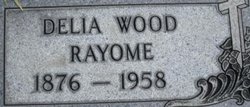
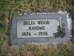
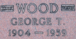
Delia Champagne Rayome
| Birth | : | 10 May 1876 Montreal, Montreal Region, Quebec, Canada |
| Death | : | 6 Mar 1958 Libby, Lincoln County, Montana, USA |
| Burial | : | Gilpin Manor Memorial Park, Elkton, Cecil County, USA |
| Coordinate | : | 39.6264000, -75.8218994 |
| Description | : | Delia was first married to Francis H. Wood and then to Daniel S. Rayome. Montana, Death Index, 1868-2011 Name: Delia W Rayome Birth Year: abt 1875 Death Date: 6 Mar 1958 Death County: Lincoln Age at Death: 83 |
frequently asked questions (FAQ):
-
Where is Delia Champagne Rayome's memorial?
Delia Champagne Rayome's memorial is located at: Gilpin Manor Memorial Park, Elkton, Cecil County, USA.
-
When did Delia Champagne Rayome death?
Delia Champagne Rayome death on 6 Mar 1958 in Libby, Lincoln County, Montana, USA
-
Where are the coordinates of the Delia Champagne Rayome's memorial?
Latitude: 39.6264000
Longitude: -75.8218994
Family Members:
Spouse
Children
Nearby Cemetories:
1. Gilpin Manor Memorial Park
Elkton, Cecil County, USA
Coordinate: 39.6264000, -75.8218994
2. Gilpin Cemetery
Cecil County, USA
Coordinate: 39.6231003, -75.8302994
3. Elkton Presbyterian Cemetery
Elkton, Cecil County, USA
Coordinate: 39.6100800, -75.8254600
4. Elkton Cemetery
Elkton, Cecil County, USA
Coordinate: 39.6074982, -75.8253021
5. Immaculate Conception Parish Cemetery
Elkton, Cecil County, USA
Coordinate: 39.6080500, -75.8338100
6. Sewell Family Vault
Elkton, Cecil County, USA
Coordinate: 39.6022700, -75.8278190
7. Church of Christ Cemetery
Cecil County, USA
Coordinate: 39.6297964, -75.8574304
8. Indian Burial Ground
Elkton, Cecil County, USA
Coordinate: 39.5979150, -75.8360460
9. Otts Chapel Cemetery
Newark, New Castle County, USA
Coordinate: 39.6341667, -75.7786102
10. Oblates of Saint Francis de Sales Cemetery
Childs, Cecil County, USA
Coordinate: 39.6401367, -75.8635483
11. Oblate Sisters of Saint Francis de Sales Cemetery
Childs, Cecil County, USA
Coordinate: 39.6525879, -75.8577881
12. Alms House Potters Field
Cherry Hill, Cecil County, USA
Coordinate: 39.6526000, -75.8587500
13. Immaculate Conception Cemetery
Cherry Hill, Cecil County, USA
Coordinate: 39.6571999, -75.8550034
14. Cherry Hill United Methodist Church Cemetery
Cherry Hill, Cecil County, USA
Coordinate: 39.6633570, -75.8509450
15. Saint Daniels UAME Church Cemetery
Newark, New Castle County, USA
Coordinate: 39.6332893, -75.7614746
16. Saint Thomas AUMP Church Cemetery
Newark, New Castle County, USA
Coordinate: 39.5962486, -75.7704163
17. Leeds Cemetery
Elkton, Cecil County, USA
Coordinate: 39.6549988, -75.8764038
18. Old Welsh Tract Baptist Church Cemetery
Newark, New Castle County, USA
Coordinate: 39.6503868, -75.7520676
19. Boulden Chapel Cemetery
Cecil County, USA
Coordinate: 39.6258011, -75.9011002
20. Glasgow Methodist Episcopal Cemetery
Glasgow, New Castle County, USA
Coordinate: 39.6076393, -75.7457657
21. Pencader Cemetery
Glasgow, New Castle County, USA
Coordinate: 39.6061096, -75.7447205
22. Saint John's Cemetery
Newark, New Castle County, USA
Coordinate: 39.6739006, -75.7658005
23. Saint John's AME-AUMP Cemetery
Newark, New Castle County, USA
Coordinate: 39.6757490, -75.7648940
24. Union Cemetery
Elkton, Cecil County, USA
Coordinate: 39.6472015, -75.9105988

