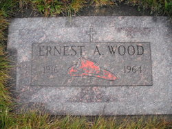
Ernest Alfred Wood Sr.
| Birth | : | 6 Mar 1916 Libby, Lincoln County, Montana, USA |
| Death | : | 12 Nov 1964 Lincoln County, Montana, USA |
| Burial | : | Hematite Cemetery, Amasa, Iron County, USA |
| Coordinate | : | 46.2356520, -88.4636600 |
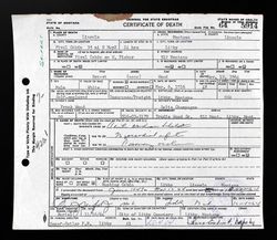
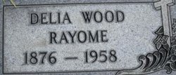
| Description | : | His wife was Gertrude Pival and it says he died in the Pival Cabin, west Fisher , Lincoln County, Montana Montana, County Births and Deaths, 1830-2011 Name: Ernest Wood Gender: Male Death Age: 48 Birth Date: 6 Mar 1916 Birth Place: Libby, Montana, USA Death Date: 12 Nov 1964 Death Place: Pival Cabin, Lincoln, Montana, USA Father: Frank Wood Mother: Delia Wood Social Security Death Index, 1935-2014 Name: Ernest Wood BORN: 6 Mar 1916 Died: Nov 1964 State (Year) SSN issued: Montana (Before 1951) |
frequently asked questions (FAQ):
-
Where is Ernest Alfred Wood Sr.'s memorial?
Ernest Alfred Wood Sr.'s memorial is located at: Hematite Cemetery, Amasa, Iron County, USA.
-
When did Ernest Alfred Wood Sr. death?
Ernest Alfred Wood Sr. death on 12 Nov 1964 in Lincoln County, Montana, USA
-
Where are the coordinates of the Ernest Alfred Wood Sr.'s memorial?
Latitude: 46.2356520
Longitude: -88.4636600
Family Members:
Parent
Spouse
Siblings
Children
Nearby Cemetories:
1. Hematite Cemetery
Amasa, Iron County, USA
Coordinate: 46.2356520, -88.4636600
2. Bates Township Cemetery
Mapleton, Iron County, USA
Coordinate: 46.1201629, -88.5664721
3. Evergreen Memorial Cemetery
Crystal Falls, Iron County, USA
Coordinate: 46.1005620, -88.3124540
4. Iron River Cemetery
Iron River, Iron County, USA
Coordinate: 46.1027985, -88.6358032
5. Stambaugh Cemetery
Iron River, Iron County, USA
Coordinate: 46.0774994, -88.6286011
6. Indian Cemetery
Crystal Falls, Iron County, USA
Coordinate: 46.0389230, -88.5104410
7. Resthaven Cemetery
Iron River, Iron County, USA
Coordinate: 46.0964012, -88.6772003
8. Mansfield Mine Memorial
Mansfield, Iron County, USA
Coordinate: 46.1134700, -88.2178200
9. Rosehill Cemetery
Beechwood, Iron County, USA
Coordinate: 46.1568985, -88.7617035
10. Stambaugh Cemetery
Stambaugh, Iron County, USA
Coordinate: 46.0492670, -88.6409150
11. Channing Cemetery
Channing, Dickinson County, USA
Coordinate: 46.1302986, -88.0839005
12. Rosehill East Cemetery
Mansfield, Iron County, USA
Coordinate: 46.0735589, -88.1243176
13. Martin Cemetery
Tipler, Florence County, USA
Coordinate: 45.9502983, -88.6549988
14. Covington Township Cemetery
Covington, Baraga County, USA
Coordinate: 46.5485990, -88.5419010
15. Sidnaw Cemetery
Sidnaw, Houghton County, USA
Coordinate: 46.5069580, -88.7204361
16. Tipler Cemetery
Tipler, Florence County, USA
Coordinate: 45.9252100, -88.6334000
17. Covington Township Cemetery
Covington, Baraga County, USA
Coordinate: 46.5750000, -88.5322000
18. Woodlawn Cemetery
Florence, Florence County, USA
Coordinate: 45.9235992, -88.2343979
19. Commonwealth Cemetery
Commonwealth, Florence County, USA
Coordinate: 45.9144000, -88.2494000
20. Kitchie Cemetery
Duncan Township, Houghton County, USA
Coordinate: 46.4977989, -88.8167038
21. Lakeview Cemetery
Alvin, Forest County, USA
Coordinate: 45.9831009, -88.8341980
22. Lakeview Cemetery
Michigamme, Marquette County, USA
Coordinate: 46.5307999, -88.1153030
23. Republic Cemetery
Republic, Marquette County, USA
Coordinate: 46.4075000, -87.9675000
24. Kenton Cemetery
Duncan Township, Houghton County, USA
Coordinate: 46.4933014, -88.8897018


