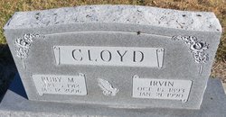
| Birth | : | 6 Oct 1897 Battle Creek, Madison County, Nebraska, USA |
| Death | : | Sep 1982 Meadow Grove, Madison County, Nebraska, USA |
| Burial | : | Golden Grove Cemetery, Golden Grove, Tea Tree Gully City, Australia |
| Coordinate | : | -34.7748502, 138.7318420 |
| Description | : | Funeral services for Donald D. Cloyd were held on Friday, October 1, 1982, from the United Methodist Church in Meadow Grove with the Rev. Stan LaRue officiating. Organist was Mrs James Mills and soloist was Mrs. Dale Horrocks. Pallbearers were Dale Horrocks, Arnold Werner, Wendell Lewis, James Murray, Gordon McIntosh, and George Hamley. Interment was at the Best Cemetery, rural Norfolk. Donald D. Cloyd Cloyd, the son of Wilson Cloyd and Martha (Ransdall) Cloyd, was born at Battle Creek on October 6, 1897. He was educated in Madison County country schools, attended Meadow Grove... Read More |
frequently asked questions (FAQ):
-
Where is Donald D Cloyd's memorial?
Donald D Cloyd's memorial is located at: Golden Grove Cemetery, Golden Grove, Tea Tree Gully City, Australia.
-
When did Donald D Cloyd death?
Donald D Cloyd death on Sep 1982 in Meadow Grove, Madison County, Nebraska, USA
-
Where are the coordinates of the Donald D Cloyd's memorial?
Latitude: -34.7748502
Longitude: 138.7318420
Family Members:
Parent
Spouse
Siblings
Flowers:
Nearby Cemetories:
1. Golden Grove Cemetery
Golden Grove, Tea Tree Gully City, Australia
Coordinate: -34.7748502, 138.7318420
2. Greenwith Uniting Church
Golden Grove, Tea Tree Gully City, Australia
Coordinate: -34.7849500, 138.7187400
3. Golden Grove Uniting Church
Golden Grove, Tea Tree Gully City, Australia
Coordinate: -34.7883129, 138.7091051
4. Little Para Wesleyan Cemetery
Hillbank, Playford City, Australia
Coordinate: -34.7479620, 138.6836570
5. Drumminor Gardens
Ridgehaven, Tea Tree Gully City, Australia
Coordinate: -34.8195240, 138.6968120
6. Houghton Cemetery
Houghton, Adelaide Hills Council, Australia
Coordinate: -34.8280580, 138.7680070
7. One Tree Hill Uniting Church Cemetery
One Tree Hill, Playford City, Australia
Coordinate: -34.7185200, 138.7682710
8. Salisbury Pioneer Catholic Cemetery
Salisbury, Salisbury City, Australia
Coordinate: -34.7627130, 138.6520780
9. St. John's Churchyard
Salisbury, Salisbury City, Australia
Coordinate: -34.7644090, 138.6463600
10. Salisbury Methodist Church Cemetery
Salisbury, Salisbury City, Australia
Coordinate: -34.7616800, 138.6452510
11. Hope Valley Cemetery
Hope Valley, Tea Tree Gully City, Australia
Coordinate: -34.8441550, 138.6954700
12. Salisbury Memorial Park
Salisbury, Salisbury City, Australia
Coordinate: -34.7737160, 138.6382070
13. Holy Cross Anglican Church
Elizabeth, Salisbury City, Australia
Coordinate: -34.7147160, 138.6724910
14. Uley Baptist Church Cemetery
Uleybury, Playford City, Australia
Coordinate: -34.6954070, 138.7575960
15. Athelstone Gorge Primitive Methodist Cemetery
Athelstone, Campbelltown City, Australia
Coordinate: -34.8646690, 138.7133650
16. Sturton Family Cemetery
Penfield, Playford City, Australia
Coordinate: -34.7255460, 138.6375980
17. Chain of Ponds Cemetery
Chain of Ponds, Adelaide Hills Council, Australia
Coordinate: -34.8230300, 138.8316500
18. Kersbrook Wesleyan Methodist Cemetery
Kersbrook, Adelaide Hills Council, Australia
Coordinate: -34.7900482, 138.8482557
19. Kersbrook Cemetery
Kersbrook, Adelaide Hills Council, Australia
Coordinate: -34.8040693, 138.8486109
20. Athelstone Independent Cemetery
Athelstone, Campbelltown City, Australia
Coordinate: -34.8744850, 138.6956870
21. Cudlee Creek Cemetery
Cudlee Creek, Adelaide Hills Council, Australia
Coordinate: -34.8435390, 138.8342770
22. Burton Pioneer Cemetery
Paralowie, Salisbury City, Australia
Coordinate: -34.7532480, 138.6013050
23. St. Martin's Anglican Church Cemetery
Campbelltown, Campbelltown City, Australia
Coordinate: -34.8762440, 138.6662340
24. Montacute Cemetery
Montacute, Adelaide Hills Council, Australia
Coordinate: -34.8911600, 138.7505000


