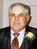
Donna Lorene Tippie West
| Birth | : | 19 Nov 1926 Allen County, Kansas, USA |
| Death | : | 17 Nov 2009 Topeka, Shawnee County, Kansas, USA |
| Burial | : | Workman Cemetery, Danville, Knox County, USA |
| Coordinate | : | 40.4361000, -82.2636032 |
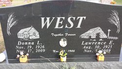
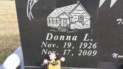
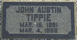
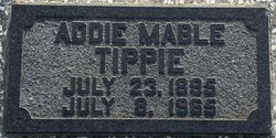
| Description | : | *************************** Published Nov. 17, 2009 - Iola, KS Donna Lorene West, 82, of rural Colony, Kansas, died Tuesday, November 17, 2009, at St. Francis Health Center in Topeka, Kansas. Donna was born November 19, 1926, in Allen County, Kansas, the daughter of John and Addie (Hienlien) Tippie. She grew up in the Geneva and Carlyle areas and graduated from Colony High School. On November 23, 1946, Donna married Lawrence Eldon West in Iola, Kansas. They have always made their home on the farm west of Colony in the Northcott neighborhood. Lawrence preceded her in death on November 5, 2009. Donna worked as... Read More |
frequently asked questions (FAQ):
-
Where is Donna Lorene Tippie West's memorial?
Donna Lorene Tippie West's memorial is located at: Workman Cemetery, Danville, Knox County, USA.
-
When did Donna Lorene Tippie West death?
Donna Lorene Tippie West death on 17 Nov 2009 in Topeka, Shawnee County, Kansas, USA
-
Where are the coordinates of the Donna Lorene Tippie West's memorial?
Latitude: 40.4361000
Longitude: -82.2636032
Family Members:
Parent
Spouse
Children
Flowers:
Nearby Cemetories:
1. Workman Cemetery
Danville, Knox County, USA
Coordinate: 40.4361000, -82.2636032
2. McKee Cemetery
Danville, Knox County, USA
Coordinate: 40.4306204, -82.2443237
3. Saint Luke Cemetery
Danville, Knox County, USA
Coordinate: 40.4468994, -82.2786026
4. Mast Cemetery
Danville, Knox County, USA
Coordinate: 40.4642420, -82.2381500
5. Millwood Cemetery
Millwood, Knox County, USA
Coordinate: 40.4028015, -82.2746964
6. Banbury Cemetery
Danville, Knox County, USA
Coordinate: 40.4774490, -82.2717850
7. Wright Cemetery
Howard, Knox County, USA
Coordinate: 40.4116040, -82.3264590
8. Hollister Cemetery
Knox County, USA
Coordinate: 40.3830986, -82.2485962
9. Brinkhaven Cemetery
Brinkhaven, Knox County, USA
Coordinate: 40.4686012, -82.1988983
10. Old Jelloway Cemetery
Howard, Knox County, USA
Coordinate: 40.4240740, -82.3451150
11. Wesley Chapel Cemetery
Knox, Knox County, USA
Coordinate: 40.5022900, -82.2601600
12. Branstool-Critchfield-Shrimplin Cemetery
Howard, Knox County, USA
Coordinate: 40.4021940, -82.3393400
13. Tiverton Baptist Church Cemetery
Tiverton Center, Coshocton County, USA
Coordinate: 40.4371400, -82.1717900
14. Staats Cemetery
Millwood, Knox County, USA
Coordinate: 40.3711090, -82.2150680
15. Riley Chapel Cemetery
Knox County, USA
Coordinate: 40.3782360, -82.2009740
16. North Bend Church of the Brethren Cemetery
Jelloway, Knox County, USA
Coordinate: 40.5047600, -82.3052700
17. Hardinger Cemetery
Knox County, USA
Coordinate: 40.5078011, -82.2260971
18. Humphrey Family Cemetery
Walhonding, Coshocton County, USA
Coordinate: 40.3969500, -82.1673110
19. Greer Family Cemetery
Greer, Knox County, USA
Coordinate: 40.5117140, -82.2135900
20. Pleasant Valley Cemetery
Howard, Knox County, USA
Coordinate: 40.4021988, -82.3705978
21. Brown Cemetery
Holmes County, USA
Coordinate: 40.4600000, -82.1491660
22. Borden Cemetery
Coshocton County, USA
Coordinate: 40.4383011, -82.1446991
23. Shadley Valley Cemetery
Knox County, USA
Coordinate: 40.5253403, -82.2854390
24. Mount Zion Cemetery
Gambier, Knox County, USA
Coordinate: 40.3750000, -82.3518982

