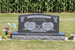
Donna Mae Selma Tena Radloff Olson
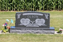
| Birth | : | 1 Sep 1927 Luana, Clayton County, Iowa, USA |
| Death | : | 11 Feb 2010 West Union, Fayette County, Iowa, USA |
| Burial | : | Marion Lutheran Cemetery, Gunder, Clayton County, USA |
| Coordinate | : | 42.9708290, -91.5127792 |
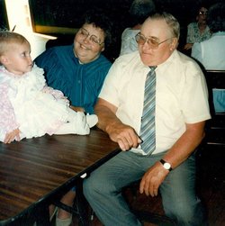
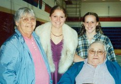
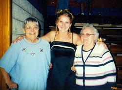
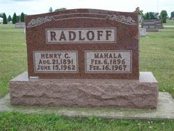
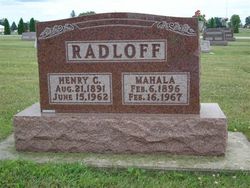
| Description | : | Donna Mae Selma Tena Olson, 82, Gunder, Iowa, died Thursday, February 11, 2010, at Stoney Brook Village in West Union, Iowa, following a brief illness. Donna was born on September 1, 1927, on the family homestead, rural Luana, Iowa, to Henry and Mahala (Hoth) Radloff. She attended Gunder Country School through the eighth grade. Donna was united in marriage to Milton Orville Olson on January 8, 1947, at St. Paul Lutheran Church, Postville, Iowa. Seven children were born to this union. Donna and Milton farmed together for their entire married life in the Gunder, Iowa, area. They celebrated nearly sixty... Read More |
frequently asked questions (FAQ):
-
Where is Donna Mae Selma Tena Radloff Olson's memorial?
Donna Mae Selma Tena Radloff Olson's memorial is located at: Marion Lutheran Cemetery, Gunder, Clayton County, USA.
-
When did Donna Mae Selma Tena Radloff Olson death?
Donna Mae Selma Tena Radloff Olson death on 11 Feb 2010 in West Union, Fayette County, Iowa, USA
-
Where are the coordinates of the Donna Mae Selma Tena Radloff Olson's memorial?
Latitude: 42.9708290
Longitude: -91.5127792
Family Members:
Parent
Spouse
Siblings
Children
Nearby Cemetories:
1. Eno Cemetery
Wagner Township, Clayton County, USA
Coordinate: 42.9930992, -91.4693985
2. Fry Family Cemetery
Farmersburg, Clayton County, USA
Coordinate: 43.0152530, -91.5182350
3. Houg Cemetery
Gunder, Clayton County, USA
Coordinate: 42.9444008, -91.5675964
4. Wagner Township Cemetery
Saint Olaf, Clayton County, USA
Coordinate: 42.9519386, -91.4513931
5. Cook Family Cemetery
Elkader, Clayton County, USA
Coordinate: 42.9209880, -91.5091230
6. Weymouth Cemetery
Saint Olaf, Clayton County, USA
Coordinate: 42.9278799, -91.4583559
7. Clark Family Cemetery
Beulah, Clayton County, USA
Coordinate: 42.9166505, -91.4751415
8. Apostolic Cemetery
Marion Township, Clayton County, USA
Coordinate: 42.9347000, -91.5821991
9. East Clermont Lutheran Church Cemetery
Grand Meadow Township, Clayton County, USA
Coordinate: 42.9969406, -91.5916672
10. Patterson Pioneer Cemetery
Saint Olaf, Clayton County, USA
Coordinate: 42.9216000, -91.4489000
11. Norway Lutheran Church Cemetery
Saint Olaf, Clayton County, USA
Coordinate: 42.9352798, -91.4302826
12. Gooding Cemetery
Wagner Township, Clayton County, USA
Coordinate: 42.9869490, -91.4191570
13. Highland Lutheran Cemetery
Highland Township, Clayton County, USA
Coordinate: 42.8987000, -91.5330000
14. Pioneer Cemetery
Monona, Clayton County, USA
Coordinate: 43.0149994, -91.4274979
15. Grand Meadow Cemetery
Luana, Clayton County, USA
Coordinate: 43.0628014, -91.5081024
16. Elgin City Cemetery
Elgin, Fayette County, USA
Coordinate: 42.9580000, -91.6410000
17. Luana Cemetery
Luana, Clayton County, USA
Coordinate: 43.0602989, -91.4682999
18. Saint Peters Catholic Cemetery
Clermont, Fayette County, USA
Coordinate: 43.0003014, -91.6438980
19. Saint John Lutheran Cemetery
Luana, Clayton County, USA
Coordinate: 43.0628000, -91.4546000
20. Gods Acres Cemetery
Clermont, Fayette County, USA
Coordinate: 42.9925003, -91.6496964
21. Farmersburg-Wagner Cemetery
Farmersburg, Clayton County, USA
Coordinate: 42.9481010, -91.3700027
22. Illyria Cemetery
Wadena, Fayette County, USA
Coordinate: 42.8975983, -91.6363983
23. Postville Cemetery
Clayton County, USA
Coordinate: 43.0811081, -91.5655594
24. Bismark Cemetery
Farmersburg, Clayton County, USA
Coordinate: 42.9790000, -91.3500000

