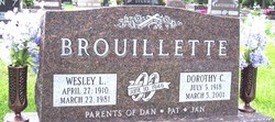
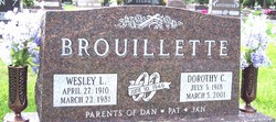
Dorothy C Kain Brouillette
| Birth | : | 5 Jul 1918 Akron, Plymouth County, Iowa, USA |
| Death | : | 5 Mar 2001 Carroll, Carroll County, Iowa, USA |
| Burial | : | Hillsborough Cemetery, Hillsborough, Auckland Council, New Zealand |
| Coordinate | : | -36.9246600, 174.7524030 |
| Plot | : | Block 11 |
| Description | : | March 6, 2001 - Carroll Daily Times - Mass of the Christian burial for Dorothy Brouillette of Carroll will be at 10:30 a.m. Thursday, March 8, 2001, at Holy Spirit Catholic Church in Carroll. Mrs. Brouillette, 82, died Monday, March 5, at St. Anthony Regional Hospital in Carroll. Fathers James McCormick and Craig Collison will concelebrate the Mass. Gift bearers will be Laura Lappe and David Brouillette. Lectors will be Patrick Lappe and Linda Pacsl. Servers will be Jennifer Schultes, Beckie Lappe, Rosie Lappe and Beth Brouillette. Casket bearers will be Joseph Lappe, Patrick Lappe, Matthew Schultes, Kiley Todd, John... Read More |
frequently asked questions (FAQ):
-
Where is Dorothy C Kain Brouillette's memorial?
Dorothy C Kain Brouillette's memorial is located at: Hillsborough Cemetery, Hillsborough, Auckland Council, New Zealand.
-
When did Dorothy C Kain Brouillette death?
Dorothy C Kain Brouillette death on 5 Mar 2001 in Carroll, Carroll County, Iowa, USA
-
Where are the coordinates of the Dorothy C Kain Brouillette's memorial?
Latitude: -36.9246600
Longitude: 174.7524030
Family Members:
Spouse
Flowers:
Nearby Cemetories:
1. St. Peter's Anglican Cemetery
Ōnehunga, Auckland Council, New Zealand
Coordinate: -36.9227113, 174.7847550
2. Onehunga Catholic Cemetery
Ōnehunga, Auckland Council, New Zealand
Coordinate: -36.9224360, 174.7884560
3. Our Lady of the Assumption Catholic Church
Ōnehunga, Auckland Council, New Zealand
Coordinate: -36.9223690, 174.7884530
4. Mangere Piriti Urupā St. James Churchyard
Mangere, Auckland Council, New Zealand
Coordinate: -36.9418970, 174.7835260
5. Saint Andrew's Churchyard
Epsom, Auckland Council, New Zealand
Coordinate: -36.8937200, 174.7654100
6. Waikaraka Cemetery
Ōnehunga, Auckland Council, New Zealand
Coordinate: -36.9297140, 174.7967170
7. Mangere Lawn Cemetery
Mangere, Auckland Council, New Zealand
Coordinate: -36.9626150, 174.7857000
8. St. Luke's Anglican Church Cemetery
Mount Albert, Auckland Council, New Zealand
Coordinate: -36.8785540, 174.7290400
9. Saint Ninians Churchyard
Avondale, Auckland Council, New Zealand
Coordinate: -36.8994510, 174.6966690
10. St Mark's Anglican Church Cemetery
Remuera, Auckland Council, New Zealand
Coordinate: -36.8729300, 174.7801600
11. Mount Eden Stockade Cemetery
Mount Eden, Auckland Council, New Zealand
Coordinate: -36.8678370, 174.7666430
12. Mangere Presbyterian Cemetery
Mangere, Auckland Council, New Zealand
Coordinate: -36.9750197, 174.7924783
13. George Maxwell Memorial Cemetery
Avondale, Auckland Council, New Zealand
Coordinate: -36.8890320, 174.6849320
14. Symonds Street Cemetery
Auckland, Auckland Council, New Zealand
Coordinate: -36.8582828, 174.7636628
15. Otahuhu Public Cemetery
Ōtāhūhū, Auckland Council, New Zealand
Coordinate: -36.9377500, 174.8432390
16. Holy Trinity Memorial Park
Ōtāhūhū, Auckland Council, New Zealand
Coordinate: -36.9374510, 174.8448580
17. Nixon Memorial
Ōtāhūhū, Auckland Council, New Zealand
Coordinate: -36.9499366, 174.8449909
18. St. Joseph and St. Joachim Catholic Cemetery
Ōtāhūhū, Auckland Council, New Zealand
Coordinate: -36.9436100, 174.8490100
19. St. Stephen's Churchyard
Auckland, Auckland Council, New Zealand
Coordinate: -36.8504860, 174.7899970
20. Auckland Provincial Memorial
Glen Eden, Auckland Council, New Zealand
Coordinate: -36.9020700, 174.6548500
21. Waikumete Cemetery & Crematorium
Glen Eden, Auckland Council, New Zealand
Coordinate: -36.9025130, 174.6539610
22. Ōrākei (Rautara St) Urupā
Orakei, Auckland Council, New Zealand
Coordinate: -36.8610770, 174.8188960
23. Purewa Cemetery
Meadowbank, Auckland Council, New Zealand
Coordinate: -36.8674300, 174.8297900
24. St. Patrick's Roman Catholic Church Cemetery
Panmure, Auckland Council, New Zealand
Coordinate: -36.9029680, 174.8564960


