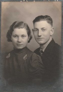
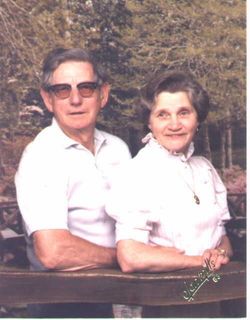
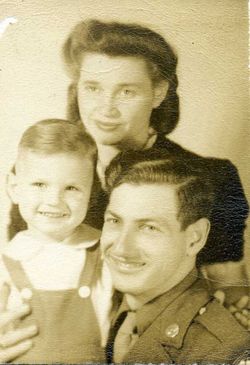
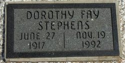
Dorothy Fay DeCow Stephens
| Birth | : | 27 Jun 1917 Bartlett, Labette County, Kansas, USA |
| Death | : | 23 Nov 1992 Opolis, Crawford County, Kansas, USA |
| Burial | : | Knollwood Memorial Park, Canton, Norfolk County, USA |
| Coordinate | : | 42.1478004, -71.1669006 |
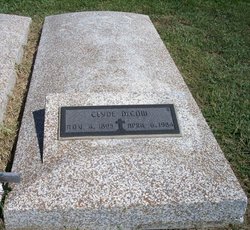
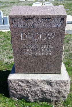
| Description | : | Dorothy F. Stephens ERIE – Dorothy F. Stephens, 75, of Erie died from injuries sustained in a one-car accident around 9 a.m. Thursday, Nov. 19, 1992, between Opolis and Asbury, Mo. She was born June 27, 1917, in Bartlett to Clyde and Edna (Hurd) DeCow. She grew up attended schools in the Bartlett area, graduating from Labette County High School, Altamont, in 1936. She and Wilbur Stephens were married Dec. 24, 1937, in Oswego. After their marriage, they lived in various cities, mostly Wichita and Denver, where Mr. Stephens was employed with the aircraft industry. In 1988,... Read More |
frequently asked questions (FAQ):
-
Where is Dorothy Fay DeCow Stephens's memorial?
Dorothy Fay DeCow Stephens's memorial is located at: Knollwood Memorial Park, Canton, Norfolk County, USA.
-
When did Dorothy Fay DeCow Stephens death?
Dorothy Fay DeCow Stephens death on 23 Nov 1992 in Opolis, Crawford County, Kansas, USA
-
Where are the coordinates of the Dorothy Fay DeCow Stephens's memorial?
Latitude: 42.1478004
Longitude: -71.1669006
Family Members:
Parent
Spouse
Siblings
Children
Flowers:
Nearby Cemetories:
1. Knollwood Memorial Park
Canton, Norfolk County, USA
Coordinate: 42.1478004, -71.1669006
2. Knollwood Cemetery
Canton, Norfolk County, USA
Coordinate: 42.1463670, -71.1635760
3. Sharon Memorial Park
Sharon, Norfolk County, USA
Coordinate: 42.1434200, -71.1742200
4. Chestnut Tree Cemetery
Sharon, Norfolk County, USA
Coordinate: 42.1408005, -71.1753006
5. Gridley Cemetery
Canton, Norfolk County, USA
Coordinate: 42.1444200, -71.1483400
6. Methodist Meeting House Cemetery
Stoughton, Norfolk County, USA
Coordinate: 42.1316110, -71.1319770
7. Moose Hill Cemetery
Sharon, Norfolk County, USA
Coordinate: 42.1410700, -71.2096900
8. Charles Sumner Bird Memorial Cemetery
Norwood, Norfolk County, USA
Coordinate: 42.1639600, -71.2082900
9. Rock Ridge Cemetery
Sharon, Norfolk County, USA
Coordinate: 42.1116982, -71.1663971
10. St. Mary's Cemetery
Canton, Norfolk County, USA
Coordinate: 42.1764000, -71.1290700
11. Canton Corner Cemetery
Canton, Norfolk County, USA
Coordinate: 42.1796989, -71.1314011
12. Holy Sepulchre Cemetery
Stoughton, Norfolk County, USA
Coordinate: 42.1361008, -71.1053009
13. Oliver Lothrop Yard
Sharon, Norfolk County, USA
Coordinate: 42.1090900, -71.2102900
14. Pearl Street Cemetery
Stoughton, Norfolk County, USA
Coordinate: 42.1281013, -71.1044006
15. Dry Pond Cemetery
Stoughton, Norfolk County, USA
Coordinate: 42.1045700, -71.1314900
16. Oldest Burying Ground
Canton, Norfolk County, USA
Coordinate: 42.1875500, -71.1203400
17. Old Parish Cemetery
Norwood, Norfolk County, USA
Coordinate: 42.1963997, -71.1988983
18. Guild Burial Ground
Walpole, Norfolk County, USA
Coordinate: 42.1255989, -71.2339020
19. Maple Grove Cemetery
Walpole, Norfolk County, USA
Coordinate: 42.1493988, -71.2410965
20. Drake Cemetery
Sharon, Norfolk County, USA
Coordinate: 42.0915500, -71.1563900
21. Evergreen Cemetery
Stoughton, Norfolk County, USA
Coordinate: 42.1160088, -71.0987473
22. Old Burial Place
Walpole, Norfolk County, USA
Coordinate: 42.1517780, -71.2486450
23. Highland Cemetery
Norwood, Norfolk County, USA
Coordinate: 42.1955986, -71.2177963
24. Rural Cemetery
Walpole, Norfolk County, USA
Coordinate: 42.1555400, -71.2504400

