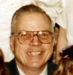
| Birth | : | 8 Nov 1912 Loup County, Nebraska, USA |
| Death | : | 22 Mar 2005 Burwell, Garfield County, Nebraska, USA |
| Burial | : | Saint Deroin Cemetery, Barada, Richardson County, USA |
| Coordinate | : | 40.2543983, -95.5682983 |
| Description | : | BURWELL Dorothy Gertrude VanDiest, 92, of Burwell died Tuesday, March 22, 2005, at Community Memorial Health Center in Burwell. Services will be at 10:30 a.m. Friday at the United Methodist Church in Burwell. Burial will be in the Taylor Cemetery at Taylor. The Rev. Joel Rathbun will officiate. Visitation will be from 5 to 8 p.m. Thursday at Hitchcock Funeral Home in Burwell. Mrs. VanDiest was born Nov. 8, 1912, in Loup County to Fred and Alice (Rittenhouse) Yocum. She was preceded in death by her... Read More |
frequently asked questions (FAQ):
-
Where is Dorothy Gertrude Yocum VanDiest's memorial?
Dorothy Gertrude Yocum VanDiest's memorial is located at: Saint Deroin Cemetery, Barada, Richardson County, USA.
-
When did Dorothy Gertrude Yocum VanDiest death?
Dorothy Gertrude Yocum VanDiest death on 22 Mar 2005 in Burwell, Garfield County, Nebraska, USA
-
Where are the coordinates of the Dorothy Gertrude Yocum VanDiest's memorial?
Latitude: 40.2543983
Longitude: -95.5682983
Family Members:
Parent
Spouse
Children
Flowers:
Nearby Cemetories:
1. Saint Deroin Cemetery
Barada, Richardson County, USA
Coordinate: 40.2543983, -95.5682983
2. Half-Breed Cemetery
Nemaha County, USA
Coordinate: 40.2664900, -95.5604900
3. Saint Johns Catholic Cemetery
Barada, Richardson County, USA
Coordinate: 40.2189000, -95.5683000
4. Harris Cemetery
Barada, Richardson County, USA
Coordinate: 40.2182999, -95.5730972
5. Brick Church Cemetery
Barada, Richardson County, USA
Coordinate: 40.2328000, -95.6155000
6. Hillsdale Cemetery
Nemaha County, USA
Coordinate: 40.2882996, -95.6010971
7. Berg Cemetery
Barada, Richardson County, USA
Coordinate: 40.2257996, -95.6168976
8. Huff Cemetery
Barada, Richardson County, USA
Coordinate: 40.2039000, -95.6248500
9. Saint Peters Evangelical Lutheran Church Cemetery
Richardson County, USA
Coordinate: 40.1752014, -95.5491257
10. Saint Annes Catholic Cemetery
Shubert, Richardson County, USA
Coordinate: 40.2042500, -95.6549500
11. Mount Hope Cemetery
Atchison County, USA
Coordinate: 40.2696991, -95.4503021
12. Penniwell Cemetery
Shubert, Richardson County, USA
Coordinate: 40.2619000, -95.6994500
13. Fricke Cemetery
Richardson County, USA
Coordinate: 40.1516991, -95.5391998
14. Beck Cemetery
Atchison County, USA
Coordinate: 40.3222008, -95.4542007
15. Prairie Union Cemetery
Shubert, Richardson County, USA
Coordinate: 40.2475800, -95.7150200
16. Hunter Cemetery
Rock Port, Atchison County, USA
Coordinate: 40.3636017, -95.5216980
17. Saint Pauls Evangelical Lutheran Cemetery
Falls City, Richardson County, USA
Coordinate: 40.1443800, -95.6150400
18. Nemaha Cemetery
Nemaha, Nemaha County, USA
Coordinate: 40.3469009, -95.6596985
19. Anderson Cemetery
Barada, Richardson County, USA
Coordinate: 40.1612200, -95.4771200
20. Milton Cemetery
Atchison County, USA
Coordinate: 40.2811200, -95.4174400
21. Bush Cemetery
Atchison County, USA
Coordinate: 40.3558006, -95.4858017
22. Saint Johns Cemetery
Richardson County, USA
Coordinate: 40.1375008, -95.5188980
23. Cupola Cemetery
Verdon, Richardson County, USA
Coordinate: 40.1892014, -95.7086029
24. Arago Cemetery
Richardson County, USA
Coordinate: 40.1519012, -95.4728012


