
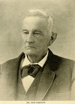
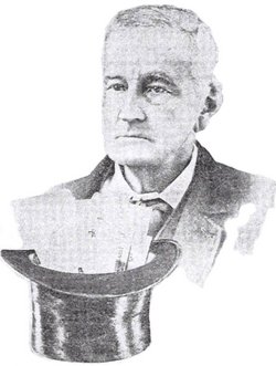

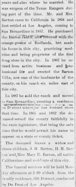
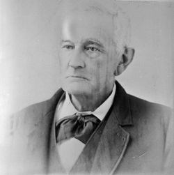

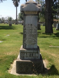
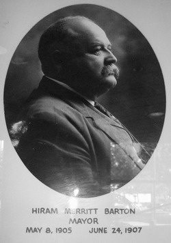
Dr Ben Barton
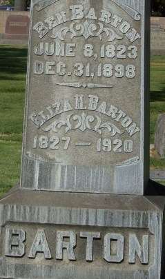
| Birth | : | 8 Jun 1823 Greenville, Greenville County, South Carolina, USA |
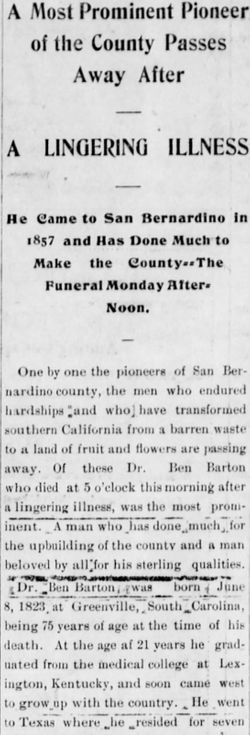
| Death | : | 31 Dec 1898 San Bernardino, San Bernardino County, California, USA |
| Burial | : | Salina Cemetery, Salina, Jefferson County, USA |
| Coordinate | : | 41.0419006, -91.8330994 |
| Description | : | A keen businessman who aquired 3,110 acres of land "part of which is now the city Redlands," for a mere $2,000. Dr. Barton stands as one of the pioneering southern California wine vintners having hosted the original Brookside Winery "run by Teophile Vache." Dr. Barton acquired an additional 640 acres from Mormon elders Amassa Lyman and Charles C. Rich upon their return to Utah. Dr. Barton went on to serve as city postmaster as well as a term in the Assembly before passing away at the age of 76. |
frequently asked questions (FAQ):
-
Where is Dr Ben Barton's memorial?
Dr Ben Barton's memorial is located at: Salina Cemetery, Salina, Jefferson County, USA.
-
When did Dr Ben Barton death?
Dr Ben Barton death on 31 Dec 1898 in San Bernardino, San Bernardino County, California, USA
-
Where are the coordinates of the Dr Ben Barton's memorial?
Latitude: 41.0419006
Longitude: -91.8330994
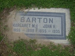
Family Members:
Spouse

Children
Flowers:


Nearby Cemetories:
1. Salina Cemetery
Salina, Jefferson County, USA
Coordinate: 41.0419006, -91.8330994
2. Chillcott Family Cemetery
Jefferson County, USA
Coordinate: 41.0558000, -91.8286300
3. Peterson Cemetery
Lockridge, Jefferson County, USA
Coordinate: 41.0393982, -91.8075027
4. New Sweden Baptist Cemetery
Jefferson County, USA
Coordinate: 41.0242004, -91.7857971
5. Upper Richwoods Cemetery
Salina, Jefferson County, USA
Coordinate: 41.0602989, -91.8807983
6. New Sweden Lutheran Cemetery
Lockridge, Jefferson County, USA
Coordinate: 41.0238991, -91.7797012
7. New Sweden United Methodist Church Cemetery
Lockridge, Jefferson County, USA
Coordinate: 41.0247002, -91.7752991
8. Lower Richwoods Cemetery
Salina, Jefferson County, USA
Coordinate: 41.0882000, -91.8085000
9. Bethesda Cemetery
Fairfield, Jefferson County, USA
Coordinate: 41.0019000, -91.8796000
10. Union Cemetery
Lockridge Township, Jefferson County, USA
Coordinate: 40.9878000, -91.8266000
11. Four Corners German Lutheran Cemetery
Lockridge, Jefferson County, USA
Coordinate: 41.0247002, -91.7605972
12. New Swedish Methodist Church Cemetery
Jefferson County, USA
Coordinate: 41.0037384, -91.7763519
13. Switzer Cemetery
Fairfield, Jefferson County, USA
Coordinate: 41.0368996, -91.9096985
14. Bonnifield Cemetery
Lockridge, Jefferson County, USA
Coordinate: 40.9874992, -91.7966995
15. Perlee Cemetery
Perlee, Jefferson County, USA
Coordinate: 41.0805750, -91.8993380
16. Westenhaver Family Cemetery
Perlee, Jefferson County, USA
Coordinate: 41.0968240, -91.8829110
17. Hopkirk Cemetery
Jefferson County, USA
Coordinate: 41.0029000, -91.7566000
18. Polishville Cemetery
East Pleasant Plain, Jefferson County, USA
Coordinate: 41.1116982, -91.8131027
19. Lockridge Cemetery
Lockridge, Jefferson County, USA
Coordinate: 40.9952000, -91.7558500
20. Wheeler Cemetery
Jefferson County, USA
Coordinate: 41.0797000, -91.9185500
21. Hope Lutheran Cemetery
Germanville, Jefferson County, USA
Coordinate: 41.0943985, -91.7593994
22. Union Free Cemetery
Germanville, Jefferson County, USA
Coordinate: 41.0971000, -91.7585000
23. Saints Peter and Paul Catholic Cemetery
Jefferson County, USA
Coordinate: 41.1088982, -91.7731018
24. Mount Zion Cemetery
Jefferson County, USA
Coordinate: 40.9617004, -91.8082962