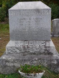
Earle F. Robbins
| Birth | : | 24 Mar 1915 Deerfield, Franklin County, Massachusetts, USA |
| Death | : | 15 Apr 1998 Springfield, Hampden County, Massachusetts, USA |
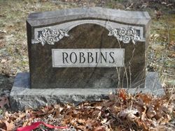
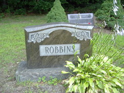
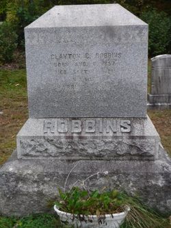
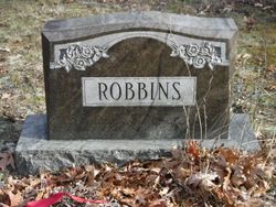
| Burial | : | Baptist Cemetery, Deerfield, Franklin County, USA |
| Coordinate | : | 42.5555992, -72.6258011 |
| Description | : | Earle F. Robbins, ex-WMass banker Earle F. Robbins, 83, of this town, a former Pittsfield banker, died Wednesday at Mercy Hospital in Springfield. After starting his career at Valley Bank & Trust Co. of Springfield, he joined Berkshire Bank in Pittsfield, where he was chief executive officer and president and chairman of the board. He worked for the United Way budget committee, sat on the Visiting Nurse Association board, and was president of the Pittsfield Rotary Club. He retired from Berkshire Bank in October 1976. Born in Deerfield, he was a graduate of Greenfield High School. He served in the Navy in 1934-38, and... Read More |
frequently asked questions (FAQ):
-
Where is Earle F. Robbins's memorial?
Earle F. Robbins's memorial is located at: Baptist Cemetery, Deerfield, Franklin County, USA.
-
When did Earle F. Robbins death?
Earle F. Robbins death on 15 Apr 1998 in Springfield, Hampden County, Massachusetts, USA
-
Where are the coordinates of the Earle F. Robbins's memorial?
Latitude: 42.5555992
Longitude: -72.6258011
Family Members:
Parent
Spouse
Siblings
Flowers:
Nearby Cemetories:
1. Baptist Cemetery
Deerfield, Franklin County, USA
Coordinate: 42.5555992, -72.6258011
2. North Cemetery
Deerfield, Franklin County, USA
Coordinate: 42.5635100, -72.6249200
3. Old Deerfield Burying Ground
Deerfield, Franklin County, USA
Coordinate: 42.5449982, -72.6097031
4. Mater Dolorosa Cemetery
Greenfield, Franklin County, USA
Coordinate: 42.5758000, -72.6165000
5. Savage Farm Cemetery
Deerfield, Franklin County, USA
Coordinate: 42.5336700, -72.6245300
6. Calvary Cemetery
Greenfield, Franklin County, USA
Coordinate: 42.5764008, -72.6138992
7. Hawks Cemetery
Deerfield, Franklin County, USA
Coordinate: 42.5555992, -72.6583023
8. Laurel Hill Cemetery
Deerfield, Franklin County, USA
Coordinate: 42.5416670, -72.5973020
9. Old Catholic Cemetery
Greenfield, Franklin County, USA
Coordinate: 42.5795753, -72.6064215
10. Green River Cemetery
Greenfield, Franklin County, USA
Coordinate: 42.5804400, -72.6052500
11. Cosby Family Cemetery
Shelburne, Franklin County, USA
Coordinate: 42.5566400, -72.6702100
12. Lower Meadow Cemetery
Greenfield, Franklin County, USA
Coordinate: 42.5945600, -72.6200300
13. South Cemetery
Shelburne, Franklin County, USA
Coordinate: 42.5819016, -72.6699982
14. Federal Street Cemetery
Greenfield, Franklin County, USA
Coordinate: 42.5941400, -72.5977300
15. East Deerfield Cemetery
Deerfield, Franklin County, USA
Coordinate: 42.5555992, -72.5642014
16. Burnham Cemetery
Montague, Franklin County, USA
Coordinate: 42.5875300, -72.5720140
17. Mill River Cemetery
Deerfield, Franklin County, USA
Coordinate: 42.5011890, -72.6377770
18. Fairway Avenue Cemetery
Montague, Franklin County, USA
Coordinate: 42.5924270, -72.5646970
19. Pine Grove Cemetery
Conway, Franklin County, USA
Coordinate: 42.5222015, -72.6908035
20. High Street Cemetery
Greenfield, Franklin County, USA
Coordinate: 42.6044840, -72.5806660
21. Shelburne Center Cemetery
Shelburne, Franklin County, USA
Coordinate: 42.5830000, -72.6969600
22. North Meadows Cemetery
Greenfield, Franklin County, USA
Coordinate: 42.6171989, -72.6333008
23. Hill Cemetery
Shelburne, Franklin County, USA
Coordinate: 42.5984344, -72.6878815
24. Springdale Cemetery
Montague, Franklin County, USA
Coordinate: 42.5884700, -72.5530900

