
| Memorials | : | 2 |
| Location | : | Montague, Franklin County, USA |
| Coordinate | : | 42.5924270, -72.5646970 |
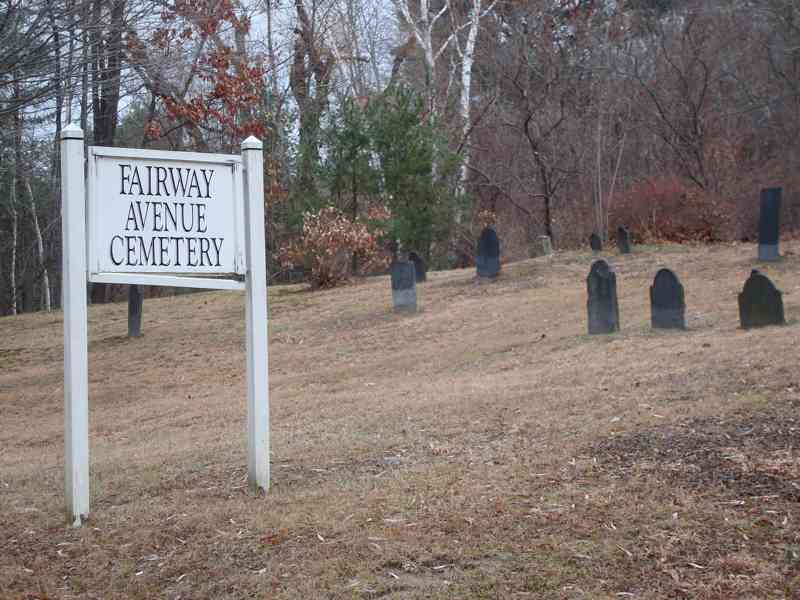
| Description | : | Directions: Take Avenue A south, turn east on Turnpike Rd, left onto Walnut St and east onto Fairway Ave. Alternatively take Avenue A south, turn east on Walnut St past the golf course. Turn east onto Fairway Ave. Cemetery is on left side on the hill. Information: Old Canal (Fairway) Cemetery was established about 1837; oldest stone extant is 1783/1785; In published Montague VRs known as GR 3, Old Cemetery, "formerly Burnhams Pasture, Montague City." The Town of Montague refers to this cemetery in MassGIS as Parcel ID: 13-088. The Massachusetts Historical Commission does not refer to this... Read More |
frequently asked questions (FAQ):
-
Where is Fairway Avenue Cemetery?
Fairway Avenue Cemetery is located at Fairway Ave. Montague, Franklin County ,Massachusetts ,USA.
-
Fairway Avenue Cemetery cemetery's updated grave count on graveviews.com?
2 memorials
-
Where are the coordinates of the Fairway Avenue Cemetery?
Latitude: 42.5924270
Longitude: -72.5646970
Nearby Cemetories:
1. Burnham Cemetery
Montague, Franklin County, USA
Coordinate: 42.5875300, -72.5720140
2. Springdale Cemetery
Montague, Franklin County, USA
Coordinate: 42.5884700, -72.5530900
3. Saint Annes Cemetery
Montague, Franklin County, USA
Coordinate: 42.5861300, -72.5480600
4. Saint Marys Cemetery
Montague, Franklin County, USA
Coordinate: 42.5852200, -72.5475100
5. Our Lady of Czestochowa Cemetery
Montague, Franklin County, USA
Coordinate: 42.5846000, -72.5469400
6. Aaron Clark Memorial Cemetery
Montague, Franklin County, USA
Coordinate: 42.5836200, -72.5471600
7. High Street Cemetery
Greenfield, Franklin County, USA
Coordinate: 42.6044840, -72.5806660
8. Federal Street Cemetery
Greenfield, Franklin County, USA
Coordinate: 42.5941400, -72.5977300
9. Riverside Cemetery
Gill, Franklin County, USA
Coordinate: 42.6156006, -72.5410995
10. Green River Cemetery
Greenfield, Franklin County, USA
Coordinate: 42.5804400, -72.6052500
11. Old Catholic Cemetery
Greenfield, Franklin County, USA
Coordinate: 42.5795753, -72.6064215
12. East Deerfield Cemetery
Deerfield, Franklin County, USA
Coordinate: 42.5555992, -72.5642014
13. Calvary Cemetery
Greenfield, Franklin County, USA
Coordinate: 42.5764008, -72.6138992
14. Lower Meadow Cemetery
Greenfield, Franklin County, USA
Coordinate: 42.5945600, -72.6200300
15. Mater Dolorosa Cemetery
Greenfield, Franklin County, USA
Coordinate: 42.5758000, -72.6165000
16. East Mineral Road Cemetery
Montague, Franklin County, USA
Coordinate: 42.5810500, -72.5086300
17. Highland Cemetery
Montague, Franklin County, USA
Coordinate: 42.5778008, -72.5083008
18. Log Plain Cemetery
Greenfield, Franklin County, USA
Coordinate: 42.6378320, -72.5725800
19. Greenfield Hebrew Congregation Cemetery
Greenfield, Franklin County, USA
Coordinate: 42.6409410, -72.5653360
20. North Cemetery
Deerfield, Franklin County, USA
Coordinate: 42.5635100, -72.6249200
21. Town Cemetery
Montague, Franklin County, USA
Coordinate: 42.5595000, -72.5070200
22. Elm Grove Cemetery
Montague, Franklin County, USA
Coordinate: 42.5418600, -72.5359000
23. Laurel Hill Cemetery
Deerfield, Franklin County, USA
Coordinate: 42.5416670, -72.5973020
24. North Meadows Cemetery
Greenfield, Franklin County, USA
Coordinate: 42.6171989, -72.6333008