

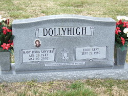
Eddie Gray Dollyhigh
| Birth | : | 22 Sep 1960 Surry County, North Carolina, USA |
| Death | : | 23 Jul 2009 Forsyth County, North Carolina, USA |
| Burial | : | Holy Trinity Churchyard, Loddon, South Norfolk District, England |
| Coordinate | : | 52.5350430, 1.4832560 |
| Description | : | Mr. Eddie Gray Dollyhigh, 48, of Mount Airy, passed away Thursday night, July 23, 2009, at Forsyth Medical Center in Winston-Salem. Mr. Dollyhigh was born September 22, 1960, in Surry County, to Peggy Wall Dollyhigh and the late Chester Lee Dollyhigh. He was of the Baptist faith. Surviving are his daughter and son-in-law, Brandi and John Watts of Pilot Mountain; his mother, Peggy Wall Dollyhigh of Mount Airy; two sisters and brothers-in-law, Sharon and Dean Strickland of Mount Airy and Deborah and Doug Agee of Loveland, OH; a stepdaughter and her spouse, April and Greg Holderfield of King; three stepsons,... Read More |
frequently asked questions (FAQ):
-
Where is Eddie Gray Dollyhigh's memorial?
Eddie Gray Dollyhigh's memorial is located at: Holy Trinity Churchyard, Loddon, South Norfolk District, England.
-
When did Eddie Gray Dollyhigh death?
Eddie Gray Dollyhigh death on 23 Jul 2009 in Forsyth County, North Carolina, USA
-
Where are the coordinates of the Eddie Gray Dollyhigh's memorial?
Latitude: 52.5350430
Longitude: 1.4832560
Family Members:
Spouse
Flowers:


Nearby Cemetories:
1. Holy Trinity Churchyard
Loddon, South Norfolk District, England
Coordinate: 52.5350430, 1.4832560
2. All Saints Churchyard
Chedgrave, South Norfolk District, England
Coordinate: 52.5409130, 1.4831200
3. St Gregory Churchyard
Heckingham, South Norfolk District, England
Coordinate: 52.5350940, 1.5144710
4. St. Michaels's Church Cemetery
Langley with Hardley, South Norfolk District, England
Coordinate: 52.5552220, 1.4727530
5. Hardley Methodist Chapel
Langley with Hardley, South Norfolk District, England
Coordinate: 52.5577290, 1.4957960
6. St Margaret's Churchyard
Hardley Street, South Norfolk District, England
Coordinate: 52.5522980, 1.5170630
7. St Margaret Churchyard
Hales, South Norfolk District, England
Coordinate: 52.5109380, 1.5110840
8. St Peter's Churchyard
Mundham, South Norfolk District, England
Coordinate: 52.5303890, 1.4260120
9. Langley Abbey
Langley with Hardley, South Norfolk District, England
Coordinate: 52.5719000, 1.4875700
10. St Andrews Churchyard
Raveningham, South Norfolk District, England
Coordinate: 52.5126430, 1.5323570
11. St Peter's Churchyard
Carleton St Peter, South Norfolk District, England
Coordinate: 52.5680520, 1.4514100
12. St Margaret and St Remigius Churchyard
Seething, South Norfolk District, England
Coordinate: 52.5303390, 1.4185000
13. Ss Mary and Margaret Churchyard
Norton Subcourse, North Norfolk District, England
Coordinate: 52.5324780, 1.5483860
14. All Saints Churchyard
Kirby Cane, South Norfolk District, England
Coordinate: 52.4937500, 1.4952820
15. St Mary's Parish Churchyard
Ashby St Mary, South Norfolk District, England
Coordinate: 52.5679100, 1.4354760
16. Methodist Churchyard
Norton Subcourse, North Norfolk District, England
Coordinate: 52.5317630, 1.5557020
17. St. Peter and St. Paul Churchyard
Bergh Apton, South Norfolk District, England
Coordinate: 52.5480290, 1.4060870
18. St. Margaret Churchyard
Cantley, Broadland District, England
Coordinate: 52.5826600, 1.5137200
19. St Andrews
Claxton, South Norfolk District, England
Coordinate: 52.5769660, 1.4340060
20. St Michael's Churchyard
Broome, South Norfolk District, England
Coordinate: 52.4860360, 1.4547410
21. St. Botolph's Churchyard
Limpenhoe, Broadland District, England
Coordinate: 52.5811500, 1.5340800
22. St. John the Baptist Churchyard
Hellington, South Norfolk District, England
Coordinate: 52.5761440, 1.4132050
23. St Margaret's Churchyard
Kirstead, South Norfolk District, England
Coordinate: 52.5358860, 1.3840860
24. St Mary's Churchyard
Ellingham, South Norfolk District, England
Coordinate: 52.4739393, 1.4827976