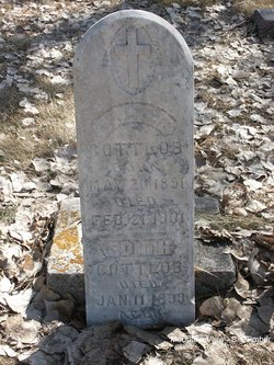
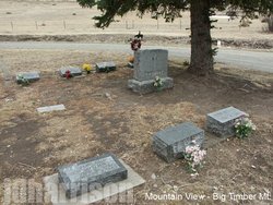
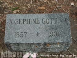
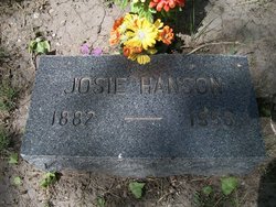
Edith Gottlob
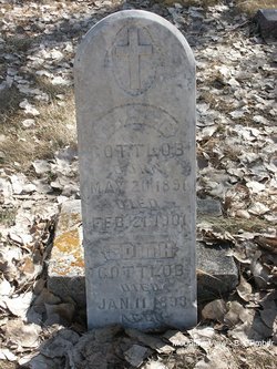
| Birth | : | Jul 1897 |
| Death | : | 11 Jan 1899 Sweet Grass County, Montana, USA |
| Burial | : | Byron Cemetery, Byron, Olmsted County, USA |
| Coordinate | : | 44.0359459, -92.6424713 |
| Plot | : | Section 5 Blk 2 Lot 4 Grave 9 |
| Description | : | The Big Timber Express (MT), Jan 1899 The 18 months old child of Mr. and Mrs. Frank Gottlob of Howie died Wednesday of pneumonia and was buried in the Big Timber cemetery yesterday. Big Timber Pioneer, Jan 19, 1899 Edith Gotlebb (Gottlob), infant daughter of Mr. and Mrs. Frank Gotlebb died last Wednesday morning at the age of one year and two months. Her death was very sudden and caused by pneumonia, although her health had not been good since her birth. The remains were laid to rest in the Big Timber cemetery. The many friends... Read More |
frequently asked questions (FAQ):
-
Where is Edith Gottlob's memorial?
Edith Gottlob's memorial is located at: Byron Cemetery, Byron, Olmsted County, USA.
-
When did Edith Gottlob death?
Edith Gottlob death on 11 Jan 1899 in Sweet Grass County, Montana, USA
-
Where are the coordinates of the Edith Gottlob's memorial?
Latitude: 44.0359459
Longitude: -92.6424713
Family Members:
Parent
Siblings
Nearby Cemetories:
1. Byron Cemetery
Byron, Olmsted County, USA
Coordinate: 44.0359459, -92.6424713
2. Mount Hope Cemetery
Rochester, Olmsted County, USA
Coordinate: 44.0703011, -92.5783005
3. Riverside Cemetery
Salem Corners, Olmsted County, USA
Coordinate: 43.9785995, -92.6074982
4. Evergreen Cemetery
Mantorville, Dodge County, USA
Coordinate: 44.0619011, -92.7418976
5. Saint Margaret Cemetery
Mantorville, Dodge County, USA
Coordinate: 44.0616989, -92.7435989
6. Othello Cemetery
Genoa, Olmsted County, USA
Coordinate: 44.1116982, -92.6641998
7. Maple Grove Cemetery
Kasson, Dodge County, USA
Coordinate: 44.0214005, -92.7553024
8. Center Grove Cemetery
Olmsted County, USA
Coordinate: 44.1082993, -92.5785980
9. South Zumbro Lutheran Church Cemetery
Salem Corners, Olmsted County, USA
Coordinate: 43.9517670, -92.6777878
10. Mayowood Cemetery
Rochester, Olmsted County, USA
Coordinate: 43.9909500, -92.5218800
11. East Saint Olaf Lutheran Church Cemetery
Rock Dell, Olmsted County, USA
Coordinate: 43.9327812, -92.6383286
12. Zion Cemetery
Rock Dell, Olmsted County, USA
Coordinate: 43.9297218, -92.6377792
13. Saint Lukes Episcopal Church Columbarium
Rochester, Olmsted County, USA
Coordinate: 44.0453240, -92.4928450
14. Mount Olive Lutheran Church Columbarium
Rochester, Olmsted County, USA
Coordinate: 44.0540848, -92.4881973
15. Pleasant Prairie Cemetery
Rochester, Olmsted County, USA
Coordinate: 44.1006012, -92.5139008
16. Oakridge Farm Cemetery
Rochester, Olmsted County, USA
Coordinate: 43.9479480, -92.5435090
17. First Unitarian Universalist Memorial Garden
Rochester, Olmsted County, USA
Coordinate: 44.0140700, -92.4876100
18. Congregational Church Columbarium
Rochester, Olmsted County, USA
Coordinate: 44.0122900, -92.4857200
19. Saint Michaels Catholic Cemetery
Olmsted County, USA
Coordinate: 44.1519012, -92.6588974
20. Milton Cemetery
Mantorville, Dodge County, USA
Coordinate: 44.1310997, -92.7463989
21. West Saint Olaf Cemetery
Vernon, Dodge County, USA
Coordinate: 43.9266701, -92.7177811
22. First Presbyterian Church Columbarium
Rochester, Olmsted County, USA
Coordinate: 44.0201416, -92.4704132
23. Calvary Episcopal Church Columbarium
Rochester, Olmsted County, USA
Coordinate: 44.0220450, -92.4676640
24. Zumbro Lutheran Church Columbarium
Rochester, Olmsted County, USA
Coordinate: 44.0165200, -92.4664500

